- Admin
- #1
- Messages
- 2,433
- Reaction score
- 2,273
- Location
- Meridianville, Al
- Special Affiliations
- SKYWARN® Volunteer
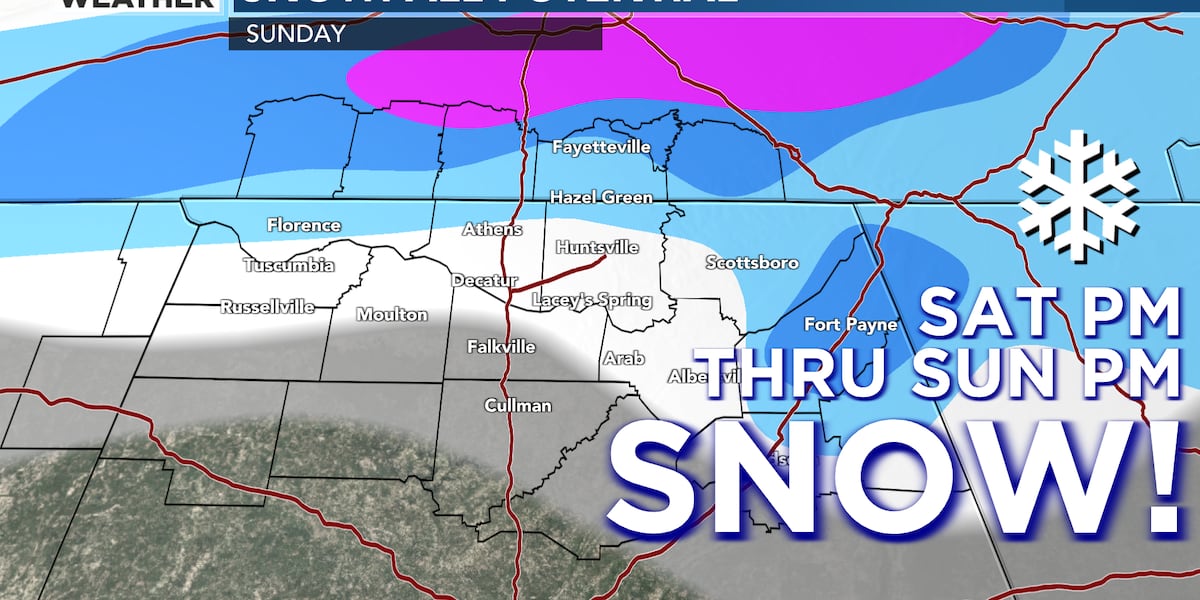
WAFF's Brandon Spinner with a very good write up on possible impacts for North Alabama:
 www.waff.com
FIRST ALERT: A breakdown of our potential for rain changing to snow on Sunday
There is a chance that we could see some winter weather this weekend, but there are a lot of questions still. Brandon has a look at those questions and what we do know about this system, here!
www.waff.com