Hey all, it sure has been a while since I've posted on this server. I have done a lot of reanalysis work while I was away, and would like to share a few things I've come across with you all. Most of the work has to do with tornadoes that occurred in the southern hemisphere.
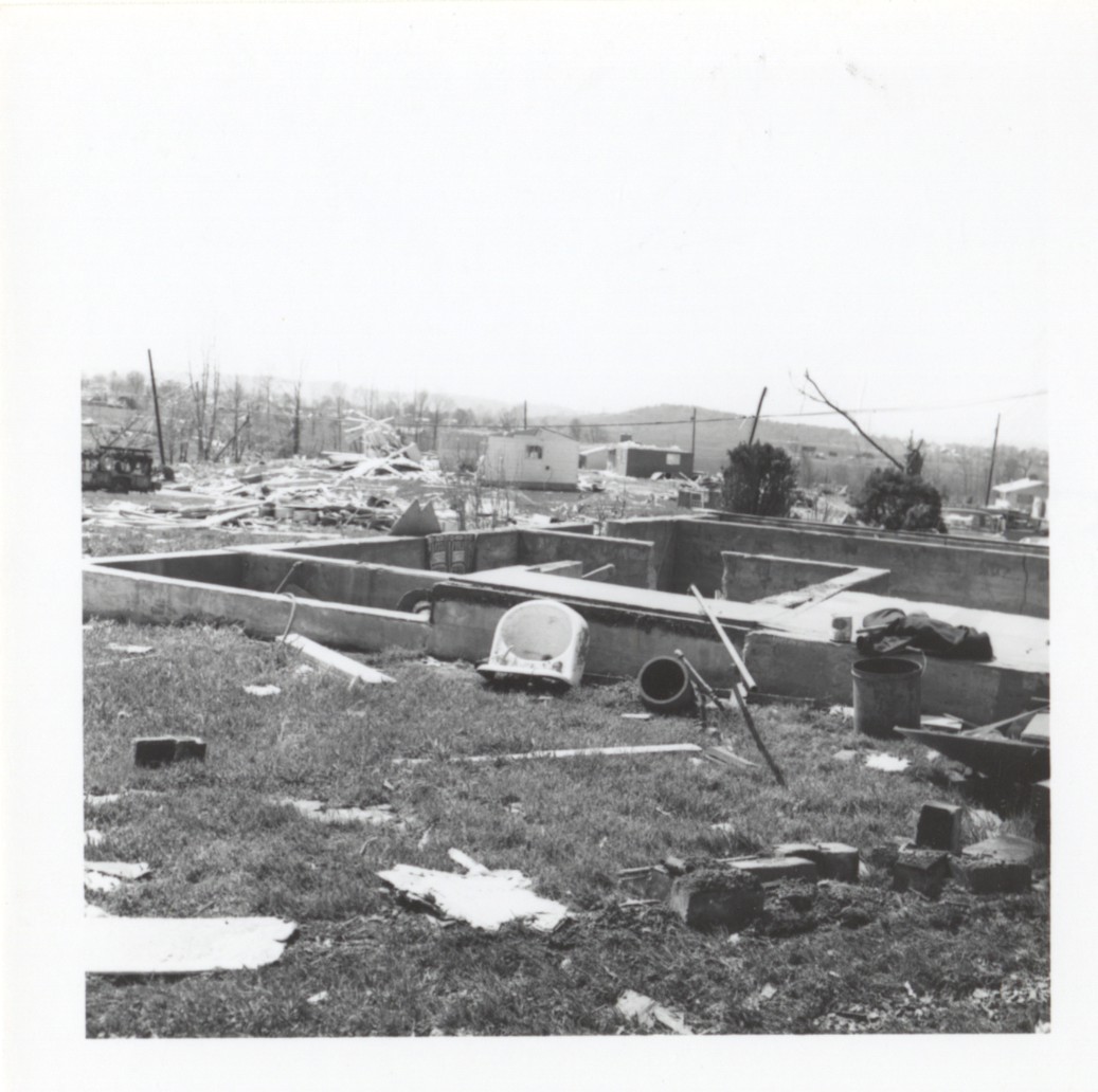
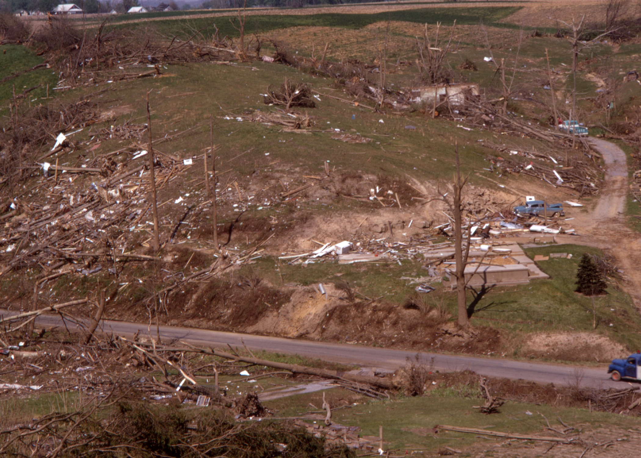
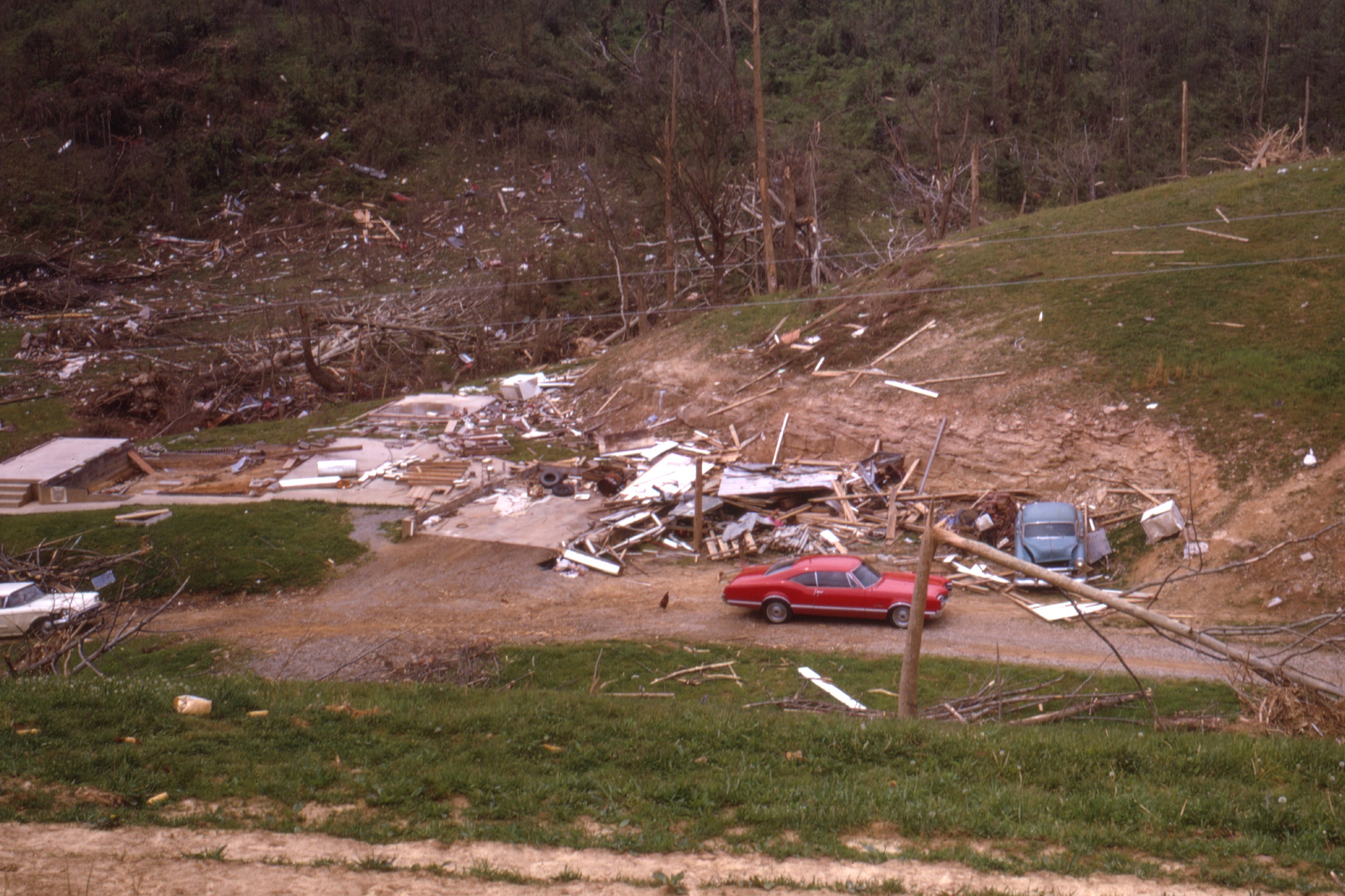
First off, I found a wide-angle shot of the scene at Pinson, Tennessee after it was devastated by a tornado that came after dark on March 11th, 1923. The tornado was spawned during a very widespread and high-end severe weather event. The damaging winds on this day were so widespread that it was referred to as a "hurricane" in newspapers. I believe that the tornado was spawned by a supercell that was able to remain discrete just long enough to produce the tornado. The tornado did not last long, which would fit perfectly with the messy warm sector I had in mind, occluding due to a convective merger.

Next, I came across two very intriguing tornado scars in southern Paraguay, one of which was exceptionally large and unusually violent for that area. I knew that they had appeared not too long before 1965, and reanalysis data indicated that they appeared on August 23rd, 1963, the same day where Dr. King delivered his legendary "I have a Dream" speech.
The two scars

Reanalysis for the exact location of the tornado scar at 4:00 PM on August 23rd, 1963. I don't think the SHARPpy algorithm is used to southern hemisphere profiles, explaining why the possible hazard type says "SVR" instead of "PDS TOR." This sounding would generally be too dry to support convection, but the kinematics matched up perfectly with the occurrence of the tornado. After the big one dissipated, no other tornadoes appeared to be produced by the parent supercell responsible.

Another tornado scar in this region appeared sometime in 1978, which reanalysis data helped me conclude that it likely appeared on July 19th, 1978. This data was supported by GOES-2 Satellite Imagery that was available at that time.
The 1978 scar was the only one I found that did not move due SE, rather taking an ENE path, making this one a big unique. It was also unusually large and had a tree damage swath of nearly a mile wide.

Reanalysis Data for the location where the tornado occurred at 4:00 PM on July 19th, 1978. Once again, ERA5 was too dry for convective initiation but other evidence makes it likely that it occurred on July 19th.

A Brazilian tornado that recently caught my eye occurred on August 29th, 2005 during a very high-end and widespread severe weather outbreak. It was not big in size, but it was big in intensity. Several brick homes in the town of Muitos Capões were simply swept away, and businesses were badly damaged. The tornado scar was detected on LANDSAT imagery in November. It was estimated to have been an F3 but I have some doubts.


Now, we'll take a trip down under with, at least from a meteorological point of view, a very unique tornado event. It occurred not far from Darwin, Australia on the early hours of March 1st, 2007. Yes, the same day that a tornado in the opposite hemisphere visited Enterprise, Alabama with serious but lucky consequences. The tornado passed extremely close to a ranger's station in Kakadu State Park, doing massive tree damage. What's most stunning about the tornado, however, is that IT MOVED WEST-NORTHWEST FOR ITS WHOEL LIFESPAN. This is something I have NOT seen a tornado in any hemisphere do before (save for landspouts and a few tornadoes associated with marginal kinematic support). I'll let this news article below speak for itself:
"Rangers at Kakadu National Park had a lucky escape when a powerful tornado carved a trail of destruction through forest near the Mary River Ranger Station two weeks ago. Two unoccupied caravans were totally destroyed and many trees were snapped and felled around the rangers� houses and office. Park ranger Rob Muller said that the noise of the spinning wind was loud like an industrial machine and could be heard for at least 10 minutes as the tornado approached in the dark, then moved slowly away."
Reanalysis sounding from the event

EF3-level damage from the tornado

The most bizarre tornado of them all touched down in the country you'd least expect, New Zealand in the early morning hours of August 15th, 2004 (local time), north of the city of Waitara. This tornado was associated with a very big and powerful low-pressure system that was located right off the coast of New Zealand. It formed as a waterspout offshore before it made its way ashore, destroying paddocks and snapping power lines. The most jaw-dropping damage occurred next when the tornado cored a farmhouse and an outbuilding. The farmhouse was picked up from its foundation and then thrown to the ground a distance away from the foundation, the impact forces appeared to completely destroy the home. Debris was wind-rowed for an extremely long distance through nearby fields, supposedly over 400 yards but I have doubts that this claim is true. The 4 people inside the home were seriously injured and two of them succumbed to the storm. Unfortunately, I have been unsuccessful in finding images from this event, but it clearly is the strongest tornado to have impacted New Zealand to date. Photos would clear a lot of doubt about this event, and I will update you all if I am successful. For now, the doubts remain.


