Equus
Member
I hope people don't underestimate the QLCS tornado threat, with the wind fields we have parts of the line could be quite prolific in that regard. Embedded, probably, in swaths of straight line damaging wind.
Follow along with the video below to see how to install our site as a web app on your home screen.
Note: This feature may not be available in some browsers.
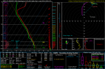
That 75% is either right on DFW or close to it? This is an interesting development considering DFW wasn't much in the equation until the past couple of days. NWS FW bulletin was kinda ominous too. I really hope the forecast changes a bit in the positive (i.e. less scary) direction for the metroplex.Latest SREF tornado ingredients on the SPC website. Got a small area of 75 probs.
View attachment 2308

Hey neighbor! I’m from Warner Robins (although I don’t live there anymore). Y'all are outside the most significant severe threat because the strongest instability will be to your west but the low-level wind fields are still pretty impressive so you could still be looking at a not-insubstantial damaging wind threat. Not the high end damaging wind event they're facing further west in MS/AL but obviously still bears monitoring, especially given that it'll be after dark there.I live in the Middle Georgia area (Lizella) and was wondering if you think we will be experiencing anything other than heavy rain and gusty winds?
The LLJ on Saturday is just gonna be obscene. An 85kt LLJ in Mississippi is mind blowing.
Just a couple of screengrabs here, trying to avoid cherry-picking but this is pretty consistent across the models and has been for some time now. At the very least this has the potential to be a significant straight-line wind event.Please post anything in MS and AL. I have family in Madison for a wedding and other family in NE MS and Central AL.


yea, looking at oz model and considering trends we have seen, this will be a big deal. I want to say the highest strong tornado risk will between Hwy 278 and a line from Demopolis to Montgomery...Birmingham/Tusc could be in the sweet spot for shear and cape...either way this looks like a high impact widespread wind event with lots of power outages and some roof damage along with trees down.
Just a couple of screengrabs here, trying to avoid cherry-picking but this is pretty consistent across the models and has been for some time now. At the very least this has the potential to be a significant straight-line wind event.
I have been burned on UH tracks, especially more than 12 hours out. However, putting that aside, these parameters typically do not look this intense and we have seen model agreement on the overall setup for days now...I just don't see how you can downplay this one...regardless of storm mode.I've heard some crazy things thrown out in the media tonight. Everything from the risk of severe weather will decrease dramatically north of Birmingham, to just coming out and saying there's no indication of any isolated development ahead of the mainline! I just don't see how you can look at the 18Z data, or even as the recent 0Z data rolls in, and make statements like that. Then again, I've seen some really good information come in as well. I guess you take the good with the bad. I understand the idea of not scaring people unnecessarily. Hyping things is one thing, but purposefully downplaying the situation to be the odd person out is another thing! What are your thoughts on those UH tracks above Richard? They seemed pretty accurate last time. Either way, I hope everyone is prepared for power outages, as you alluded too, just from the incredible wind energy in this system.