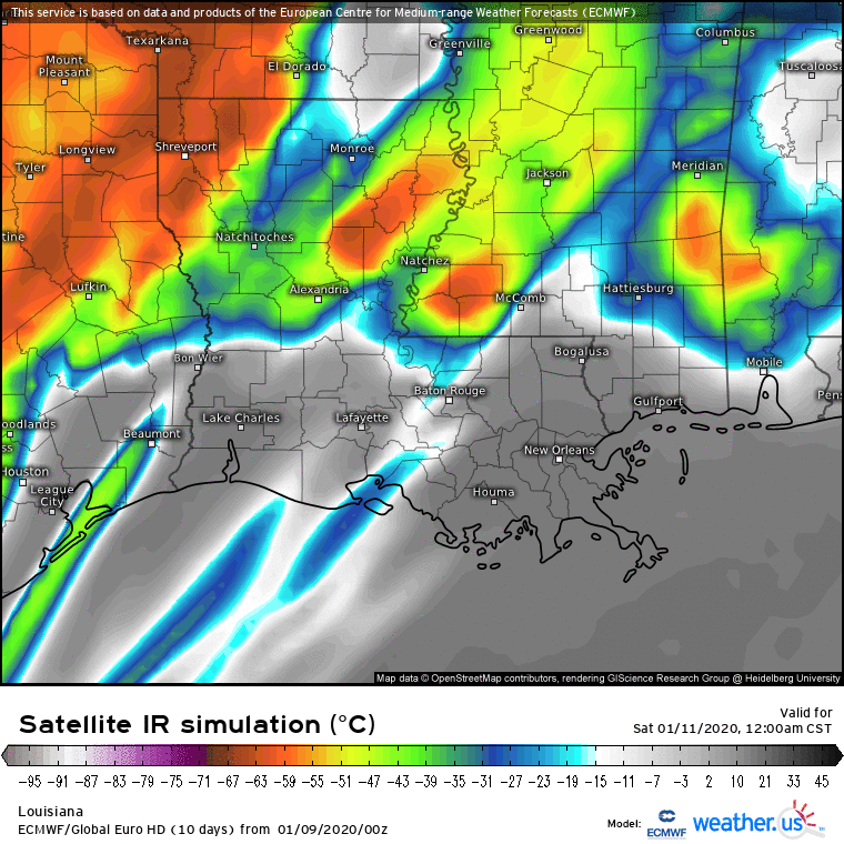
Significant severe weather is likely across our forecast area on
Saturday as a powerful negatively-tilted trough moves from Texas
toward the Ohio Valley. Some model guidance, particularly the NAM,
appears to be underestimating surface temperatures in the warm
sector. Even taking the NAM at face value, forecast soundings now
indicate the potential for deep convection with CAPE up to the 200mb
level. Our forecast is for temperatures to reach the lower to
perhaps mid 70s which is 3-5F higher than the NAM. With MLCAPE of
600-1200 J/kg and strong to extreme low-level shear, the expected
QLCS will be capable of producing widespread damaging winds and
numerous embedded tornadoes. Some of these tornadoes could be
strong. This potential is supported by the SREF, with mean STP
values exceeding 3 across most of our coverage area. The potential
for supercells ahead of the line remains unclear, but if they do
form and maintain good updraft intensity, they could easily become
tornadic. Perhaps the greatest potential for wind damage could
lie in our northwest counties, where height falls and forcing will
be the strongest.


")