• Welcome to TalkWeather!
    We see you lurking around TalkWeather! Take the extra step and join us today to view attachments, see less ads and maybe even join the discussion.
    CLICK TO JOIN TALKWEATHER

Severe all hazards threat for today wed 10/21 and tomorrow thurs 10/22 2026

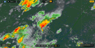
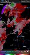
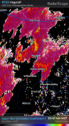
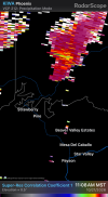
Yeah so, we nearly had an intense+ tornado, but you know what they say. If you want to know how a day will play out, look at the first storm of the day.

We might have a long day ahead in Arizona. Dont know why or how it got so intense. Wouldnt be shocked for a few tornadoes today, with a strong tornado or two not ruled out through mesoscale interactions or topographical enhancement. Im hoping the storm that just went bat**** insane was an outlier.


CONCERNING...SEVERE POTENTIAL...TORNADO WATCH LIKELY

VALID 211635Z - 211830Z


PROBABILITY OF WATCH ISSUANCE...80 PERCENT

SUMMARY...THE RISK FOR SUPERCELLS CAPABLE OF PRODUCING A FEW
TORNADOES, LARGE HAIL, AND SEVERE WIND GUSTS WILL CONTINUE
INCREASING INTO THIS AFTERNOON. A TORNADO WATCH IS LIKELY.

DISCUSSION...WITHIN A BROAD ZONE OF WARM/MOIST ADVECTION EXTENDING
ACROSS AZ, A COUPLE OF STORMS HAVE INTENSIFIED INTO SUPERCELLS,
THOUGH THIS INTENSIFICATION HAS BEEN MOSTLY ASSOCIATED WITH
SMALL-SCALE TERRAIN ENHANCEMENTS THUS FAR. RECENT VISIBLE SATELLITE
AND RADAR DATA NOW SHOW THE GENESIS ZONE FOR DEEP CONVECTION SOUTH
OF THE MOGOLLON RIM, WHERE THE BOUNDARY LAYER IS DIURNALLY
DESTABILIZING. CURRENT THINKING IS THAT THIS ACTIVITY WILL CONTINUE
TRACKING NORTHWARD TOWARD THE AFOREMENTIONED TERRAIN FEATURES AND
RELATED ENHANCEMENT TO LOW-LEVEL SHEAR PROFILES. THIS, COMBINED WITH
A SHELTERED BOUNDARY LAYER WITH CLOCKWISE-CURVED LOW-LEVEL
HODOGRAPHS (PER VWP AND MESOANALYSIS DATA) ALONG/NORTH OF THE RIM,
SHOULD PROMOTE AN INCREASE IN SUPERCELLS THROUGH THE AFTERNOON.
GIVEN GENERALLY WEAK LARGE-SCALE FORCING FOR ASCENT,
DISCRETE/SEMI-DISCRETE SUPERCELLS SHOULD PERSIST, WITH AN ASSOCIATED
RISK FOR A FEW TORNADOES, LARGE HAIL, AND LOCALLY SEVERE GUSTS. A
TORNADO WATCH IS LIKELY FOR PARTS OF CENTRAL AND NORTHERN AZ.

..WEINMAN/MOSIER.. 10/21/2026
 
Steep lapse rates
Upper 50s to low 60s dewpoints good because of higher elevation than ok or Tx
1000 or a little generous amount of instability
terrain influence
lots of lift with the trough left entrance region and also diffluence aloft maybe also with right exit too as that can spill over from left entrance region
some curvature and speed and directional shear in the hodograph
the environment that Trey was talking about in his video
 
Last edited:
Back
Top