

Navigation
Install the app
How to install the app on iOS
Follow along with the video below to see how to install our site as a web app on your home screen.
Note: This feature may not be available in some browsers.
More options
-
Welcome to TalkWeather! We see you lurking around TalkWeather! Take the extra step and join us today to view attachments, see less ads and maybe even join the discussion. CLICK TO JOIN TALKWEATHER
You are using an out of date browser. It may not display this or other websites correctly.
You should upgrade or use an alternative browser.
You should upgrade or use an alternative browser.
Severe Weather 2026
- Thread starter KevinH
- Start date

TornadoFan
Member


He does a very good job ragebaiting us, and click baiting everyone else.
Kds86z
Member
He does a very good job ragebaiting us, and click baiting everyone else.
Nice scenery.

KakashiHatake2000
Member
Surprised he didn’t say dust devil superoutbreak hahaha lol
KakashiHatake2000
Member
Kds86z
Member

WeathermanLeprechaun
Member
Poof. This is some of the more robust model output I've seen from the SW US. Environment favorable for long tracked supercells capable of large hail and a couple tornadoes given high LL instability and strong near surface shear.
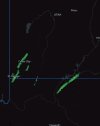
Attached is the 0-2km UH tracks. This is a better indicator of what updrafts could actually do, instead of 2-5km which counts elevated. These tracks are more likely to be surface based simulations more than anything. Impressive for this area. Do not zero in on particular areas, this is just a idea of what cells may do. Specific tracks over towns or cities just like the one in St George aren't to be taken as literal.
Attached is the 0-2km UH tracks. This is a better indicator of what updrafts could actually do, instead of 2-5km which counts elevated. These tracks are more likely to be surface based simulations more than anything. Impressive for this area. Do not zero in on particular areas, this is just a idea of what cells may do. Specific tracks over towns or cities just like the one in St George aren't to be taken as literal.