

Navigation
Install the app
How to install the app on iOS
Follow along with the video below to see how to install our site as a web app on your home screen.
Note: This feature may not be available in some browsers.
More options
-
Welcome to TalkWeather! We see you lurking around TalkWeather! Take the extra step and join us today to view attachments, see less ads and maybe even join the discussion. CLICK TO JOIN TALKWEATHER
You are using an out of date browser. It may not display this or other websites correctly.
You should upgrade or use an alternative browser.
You should upgrade or use an alternative browser.
Significant Tornado Events
- Thread starter locomusic01
- Start date

TH2002
Member
- Messages
- 4,983
- Reaction score
- 11,155
- Location
- California, United States
- Special Affiliations
- SKYWARN® Volunteer
Extreme damage from Chandler 1992.
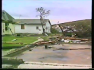
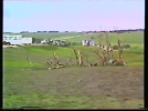
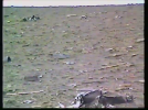
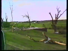
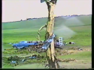
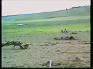
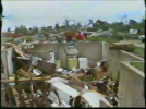
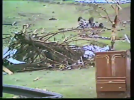
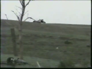
This vehicle was apparently thrown half a mile from where it originated:
Source:
This vehicle was apparently thrown half a mile from where it originated:
Source:

WeathermanLeprechaun
Member

SouthFLwx
Member
EF-5View attachment 54766This is still one of the most insane radar velocity couplets I have ever seen to this day.
WeathermanLeprechaun
Member
In fairness, it isn't exactly your photo. I do agree with crediting likeAlways good to know that they're taking images and passing them off as if they found or geolocated them (without credit, mind you). In reality, we put in all the work and he just came here and yanked it.
"Eoline resurfaced this photo!" but credits to the original uploader must be his rule instead. Ask him if he could edit the post.

Eoline
Member
You are correct that it's not, and neither did I take it, but that entire post would be non-existent if it weren't for sklz, csx, and me.In fairness, it isn't exactly your photo. I do agree with crediting like
WeathermanLeprechaun
Member
I agree and I put a comment regarding how credits goes a long way considering that this poet wouldn't have got its recognition if not for all of you. I understand that completely.You are correct that it's not, and neither did I take it, but that entire post would be non-existent if it weren't for sklz, csx, and me.

Kds86z
Member
Oh noAlways good to know that they're taking images and passing them off as if they found or geolocated them (without credit, mind you). In reality, we put in all the work and he just came here and yanked it.
csx1985
Member
It’s not necessary to repost previous discussed pictures or content on here unless you have a question or any context to add. You can conveniently utilize the “search” feature to help prevent yourself from posting identical information in the future.
Extreme damage from Chandler 1992.
View attachment 54769
View attachment 54770
View attachment 54771
View attachment 54772
View attachment 54773
View attachment 54774View attachment 54775
View attachment 54776
This vehicle was apparently thrown half a mile from where it originated:
View attachment 54777
Source:
Chandler, the Hesston-Goessel family, and Oakfield are pretty overlooked F5s despite all being pretty high-end.
DanLarsen34
Member
Extreme damage from Chandler 1992.
View attachment 54769
View attachment 54770
View attachment 54771
View attachment 54772
View attachment 54773
View attachment 54774View attachment 54775
View attachment 54776
This vehicle was apparently thrown half a mile from where it originated:
View attachment 54777
Source:
I was watching some of those old tornado documentaries like Tornado Videos on YouTube over the weekend. This video of the Chandler tornado reminds me a lot of the infamous Phil Campbell video where the tornado passes by at a very similar distance to this home video.

Tornado_Man_40
Member
Does anyone have a photo of the well-built house completely destroyed by the Hopewell, Kansas EF3+ of May 4, 2007?

Western_KS_Wx
Member
These are the only up close photos I’ve found of the “well-built” home referenced in the storm data publication on the tornado.Does anyone have a photo of the well-built house completely destroyed by the Hopewell, Kansas EF3+ of May 4, 2007?
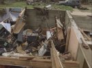
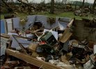
Here’s some photos of the farmstead.
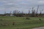
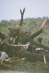
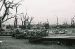
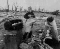
Whats impressive about this location specifically is that the most intense winds of the tornado appeared to have missed the home to the east. A few shelter belts caught in the centerline of the vortex to the southeast were essentially stripped bare by almost certainly EF4+ winds, whereas at this location the vegetation damage appeared noticeably less intense.
This has been discussed before, but most interesting of all is a separate farmstead that was obliterated 5 miles south of the aforementioned area. In the damage survey file I downloaded from the event by NWS DDC the farm is labeled as having been rated as EF4, despite the tornado offically being an EF3.
What isn’t talked about though is that the same location pictured above and nearby farmsteads already destroyed on the night of May 4th were narrowly missed (as in less than a 1/2 mile or even grazed in some spots) by another strong, likely EF3+ tornado less than 24 hours later on May 5th. In fact, the Hopewell EF3 on May 4th and the long-tracked tornado on the 5th actually crossed paths a mile north of the farm pictured.

Ivanthetornadoenthusiast
Member
Are there any structural damage from the Macksville EF3?These are the only up close photos I’ve found of the “well-built” home referenced in the storm data publication on the tornado.
View attachment 54858View attachment 54859
Here’s some photos of the farmstead.
View attachment 54860
View attachment 54861
View attachment 54862View attachment 54863
Whats impressive about this location specifically is that the most intense winds of the tornado appeared to have missed the home to the east. A few shelter belts caught in the centerline of the vortex to the southeast were essentially stripped bare by almost certainly EF4+ winds, whereas at this location the vegetation damage appeared noticeably less intense.
This has been discussed before, but most interesting of all is a separate farmstead that was obliterated 5 miles south of the aforementioned area. In the damage survey file I downloaded from the event by NWS DDC the farm is labeled as having been rated as EF4, despite the tornado offically being an EF3.
What isn’t talked about though is that the same location pictured above and nearby farmsteads already destroyed on the night of May 4th were narrowly missed (as in less than a 1/2 mile or even grazed in some spots) by another strong, likely EF3+ tornado less than 24 hours later on May 5th. In fact, the Hopewell EF3 on May 4th and the long-tracked tornado on the 5th actually crossed paths a mile north of the farm pictured.