
Navigation
Install the app
How to install the app on iOS
Follow along with the video below to see how to install our site as a web app on your home screen.
Note: This feature may not be available in some browsers.
More options
-
Welcome to TalkWeather! We see you lurking around TalkWeather! Take the extra step and join us today to view attachments, see less ads and maybe even join the discussion. CLICK TO JOIN TALKWEATHER
You are using an out of date browser. It may not display this or other websites correctly.
You should upgrade or use an alternative browser.
You should upgrade or use an alternative browser.
Severe WX Severe Weather 4/24-4/26
- Thread starter Sharpy
- Start date
Kds86z
Member
There’s one video from Runaway bay showing stripped, stubbed trees and what looks like a debris field from a leveled home.
At least two dead, injuries reported and families displaced after severe storms slam North Texas, officials say
Authorities in Wise and Parker counties confirmed two storm‑related deaths Saturday as rescue crews responded to major damage.
Where did you see that video?There’s one video from Runaway bay showing stripped, stubbed trees and what looks like a debris field from a leveled home.
Sorry for the double post but is this the video?
Yes, the very last clip.
N0mz
Member
Pretty noticeable uptrend from ASTORP for tomorrow. Has a sizable area of tor driven enhanced versus the tiny area it had a day ago.
Sawmaster
Member
Doing a YouTube vid search I found Runaway Bay had a tornado hit 10 years ago 
Somewhat curious about the kind of scenario the 06z HRRR depicts, with multiple nocturnal supercells developing in a classic after dark LLJ maxed out environment.
While soundings look slightly elevated, hypothetically these would have an intense tornado risk if they could become surface based owing to the strength of the low level mesocylone.
HREF depicts what appears to be a shortwave trough or some sort of disturbance moving into KS/OK in the 00z-06z period. I could see a scenario where storms develop as a result of this, probably along the northern periphery of the LLJ. The problem is not only is there an element of uncertainty in whether storms would develop, but also an element of uncertainty as to whether they actually would root to the surface and become tornadic. There is current a wide range among CAMS.
Certainly going to be something that needs watching through the course of the day. As we have seen multiple times in the past (including as recent as last year), it only takes one supercell in this sort of setting to produce multiple intense tornadoes.
Note: I can't seem to upload any photos right now, but hopefully will be able to try again later.
WeathermanLeprechaun
Member
I don't know if i trust initiation that late. I feel like this threat could be way earlier across 00z-03z and on through the night, gradually weakening. Intense to violent tornadoes at 1am in the morning would be a very dangerous scenario.Somewhat curious about the kind of scenario the 06z HRRR depicts, with multiple nocturnal supercells developing in a classic after dark LLJ maxed out environment.
While soundings look slightly elevated, hypothetically these would have an intense tornado risk if they could become surface based owing to the strength of the low level mesocylone.
HREF depicts what appears to be a shortwave trough or some sort of disturbance moving into KS/OK in the 00z-06z period. I could see a scenario where storms develop as a result of this, probably along the northern periphery of the LLJ. The problem is not only is there an element of uncertainty in whether storms would develop, but also an element of uncertainty as to whether they actually would root to the surface and become tornadic. There is current a wide range among CAMS.
Certainly going to be something that needs watching through the course of the day. As we have seen multiple times in the past (including as recent as last year), it only takes one supercell in this sort of setting to produce multiple intense tornadoes.
Note: I can't seem to upload any photos right now, but hopefully will be able to try again later.
WeathermanLeprechaun
Member
@Maxis_s probably best to stop criticising the NWS in a immature manner. That post you made regarding the PDS in Arkansas caught a lot of flack last night...
Kds86z
Member
WeathermanLeprechaun
Member
Strong to intense tornado threat verified, maybe not in the area intended. Hope residents recover..
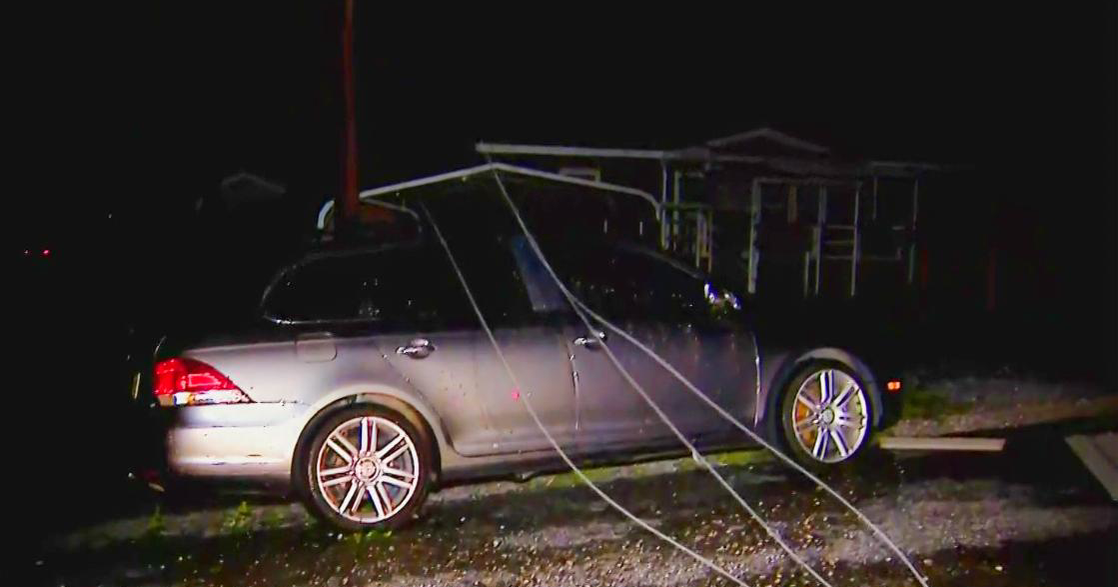
The mobile home, frame home, and tree damage here (the stripping and stubbing especially) technically supports low-end EF3, but I kinda doubt we’ll see that based on the typically conservative nature of NWS Dallas/Fort Worth. I’d expect an EF2 rating, but there is still a small chance we could see EF3 here.
WeathermanLeprechaun
Member
Didn't Dallas/Fort Worth rate a potentially significant tornado as SLW winds back in 2017? I might be quoting whoever brought this up a while ago in a different thread wrong, but that was quite the survey if I remember correctly here.The mobile home and tree damage in the first pic (stripping and stubbing is visible) technically supports low-end EF3, but I kinda doubt we’ll see that based on the typically conservative nature of NWS Dallas/Fort Worth. I’d expect an EF2 rating, but there is still a small chance we could see EF3 here.
I do recall an extremely violent house destroying “downburst” somewhere in Texas a few years ago that is strongly suspected of being a tornado by some, but I don’t remember where it was specifically, or if it was in 2017.Didn't Dallas/Fort Worth rate a potentially significant tornado as SLW winds back in 2017? I might be quoting whoever brought this up a while ago in a different thread wrong, but that was quite the survey if I remember correctly here.
But I definitely recall a very recent weak tornado in the Dallas/FortWorth metro that had a clear CC drop and couplet, but was officially recorded as “straight line winds”, which caused quite a bit of backlash.
Last edited:
WeathermanLeprechaun
Member
Yeah, that one was in October. Regardless of it being weak, the office should've done better.I do recall an extremely violent house destroying “downburst” somewhere in Texas a few years ago that is strongly suspected of being a tornado by some, but I don’t remember where it was specifically, or if it was in 2017.
But I definitely recall a very recent weak tornado in the Dallas Fort/Worth metro that had a clear CC drop and couplet, but was officially recorded as “straight line winds”, which caused quite a bit of backlash.
Yeah, that is what i remember. A destroyed house that was rated SLW winds or alongside that lines and it was suspected to be a significant tornado. I do know of a downburst from Utrecht, Netherlands that caused the cathedral to collapse partially, so downbursts can be particularly strong at times. The pattern of that Texas one would probably determine if it was tornadic or not though.
WeathermanLeprechaun
Member
Genuinely impressive by ASTORP. No models caught up to it whatsoever with the 10 hatch and now it's proven right by the 12z HRRR which depicts a conditional significant to intense tornado threat from a isolated supercell RIGHT in the 10 hatch it has around this time of 00z-03z. Central Kansas doesn't even advect at all. So those runs mightve been outliers or we see the 18z flip flop again with the Kansas portion.
Eoline
Member
Unless I'm missing something, was the 10# removed at the latest update? It's not appearing on the SPC page anymore.Genuinely impressive by ASTORP. No models caught up to it whatsoever with the 10 hatch and now it's proven right by the 12z HRRR which depicts a conditional significant to intense tornado threat from a isolated supercell RIGHT in the 10 hatch it has around this time of 00z-03z. Central Kansas doesn't even advect at all. So those runs mightve been outliers or we see the 18z flip flop again with the Kansas portion.
It wasUnless I'm missing something, was the 10# removed at the latest update? It's not appearing on the SPC page anymore.