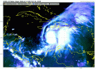
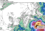
Yeah I don't know either @tornado examiner, but then again, what do I know about a storm in high oceanic heat content in an area completely untouched this season. LOL!
Navigation
Install the app
How to install the app on iOS
Follow along with the video below to see how to install our site as a web app on your home screen.
Note: This feature may not be available in some browsers.
More options
-
Welcome to TalkWeather! We see you lurking around TalkWeather! Take the extra step and join us today to view attachments, see less ads and maybe even join the discussion. CLICK TO JOIN TALKWEATHER
You are using an out of date browser. It may not display this or other websites correctly.
You should upgrade or use an alternative browser.
You should upgrade or use an alternative browser.
Tropical Storm Melissa
- Thread starter Jacob Aden
- Start date
tornado examiner
Member
One of those storms where we could go to sleep on a category 1 hurricane and wake up to a category 3 on its way to a category 5.
Just like Milton
Just like Milton
Kds86z
Member
Lake Martin EF4
Member
Good news: Jamaica won't get an intensifying C4-C5 rolling up the entire southern coast
Bad news: This means Melissa may indeed reach C5
Ugly news: Jamaica looks like it's gonna get smashed flat as a pancake by Melissa in about 96 hours presuming the turn remains as far east as it is forecast to
Melissa Retirement Potential: >90%
Bad news: This means Melissa may indeed reach C5
Ugly news: Jamaica looks like it's gonna get smashed flat as a pancake by Melissa in about 96 hours presuming the turn remains as far east as it is forecast to
Melissa Retirement Potential: >90%
Lake Martin EF4
Member
joshoctober16
Member
tornado examiner
Member
My peak intensity prediction. 180mph cat 5 less than 910MB pinhole eye that cycles right before completing the north turn into Jamaica. Weakening as it does so.
Lake Martin EF4
Member
My prediction, as of now:My peak intensity prediction. 180mph cat 5 less than 910MB pinhole eye that cycles right before completing the north turn into Jamaica. Weakening as it does so.
160 mph, 920-915 mbar. Liabke to go far higher.
joshoctober16
Member
Lake Martin EF4
Member
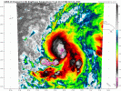
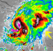
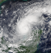
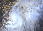
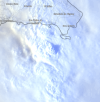
There was literally a shockwave from Melissa's core earlier btw. Basically an "oh SH#T" visual right then.here is a normal color of the soon to be hurricane with its blob.
View attachment 47667
View attachment 47669
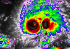
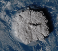
the blob has 2 super high overshooting top peaks , its similar to the giant 2022 Hunga Tonga volcano eruption overshooting top , pretty much some super strong explosive convective growth right now.
View attachment 47668
joshoctober16
Member
Lake Martin EF4
Member
Also no props to the GFS who forecast a Haiti landfall scenario long after reality had basically rendered it into horseshit. They really need to do that GFS upgrade lmao
WeathermanLeprechaun
Member
Really beginning to think Melissa has more in store for us with the current satellite. Just that look to it concerns me alone.
tornado examiner
Member
Yo that radiating pulse of citrus on the northeast side of it. Intense.View attachment 47670
oh you are correct at around 15:00z to 17:00z
WeathermanLeprechaun
Member
And also that Melissa would be just a C1 LOLAlso no props to the GFS who forecast a Haiti landfall scenario long after reality had basically rendered it into horseshit. They really need to do that GFS upgrade lmao
joshoctober16
Member
tornado examiner
Member
Wilma and Patricia’s intensification rates may soon be rivaled by Melissa.
joshoctober16
Member
N0mz
Member
Crazy that a direct hit at c4-c5 intensity is certainly the better of two evils in this scenarioGood news: Jamaica won't get an intensifying C4-C5 rolling up the entire southern coast
Bad news: This means Melissa may indeed reach C5
Ugly news: Jamaica looks like it's gonna get smashed flat as a pancake by Melissa in about 96 hours presuming the turn remains as far east as it is forecast to
Melissa Retirement Potential: >90%

