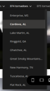
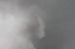
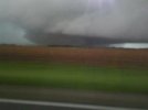
I'd heard Brian Peters and Tim Coleman describe two tornadoes in progress as the storm approached Cordova during their live play-by-play for 33/40, but as far as I can tell no separate tornado was ever confirmed by survey in this area.
Just from this image, the tornadoes look too far apart and too similar in size to be a "main/satellite" pair, and it also doesn't look like an anticyclonic companion. Visually, it bears the strongest resemblance to a simple handoff/cycle, with the left tornado occluded and soon to dissipate (Peters/Coleman did report one of the tornadoes lifting not long after their observations began) and the right tornado recently formed and will intensify and continue through Cordova, Sumiton, Blountsville, etc.
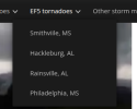
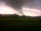
If confirmed this would have split the track into separate EF3 and EF4 tornadoes; although per radar signatures the first tornado was extremely intense and likely violent during much of its track from just northeast of Reform to somewhere just south or southeast of Berry.
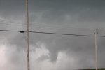
Speaking of, I think the
Wikipedia article photo for this tornado must be captioned wrong; since, officially, it wasn't at EF4 intensity until past Cordova.