• Welcome to TalkWeather!
    We see you lurking around TalkWeather! Take the extra step and join us today to view attachments, see less ads and maybe even join the discussion.
    CLICK TO JOIN TALKWEATHER
  • TalkWeather Tropical Weather Widget
    Active Tropical Systems
    Loading...
    Fetching latest NHC data...

Significant Tornado Events

Was one of his best case study videos IMO.

Really went into just how rare this set up was and the numerous ingredients that had to align just right to produce the result. Really explains why this event is so anomalous in (reliable) tornadic record history.

It’s extremely hard to get an undiluted EML into that region. A paper he referenced shows that area of the northeast may not get a single day with an EML in an entire year. For reference, the plains get up to 15 days a year per their definition. It required a confluence of factors like a specific, compatible jet geometry, trough location, and high pressure placement in the southeast to do it. Time of year also helped, with plentiful moisture already sitting in place. Then add a slow moving cold front (due to small temperature gradient behind vs in front of the boundary) and you got more subtle forcing for discrete cells.

I’d definitely recommend watching it.
I agree, well worth the long wait for it. I recall him stating he would have the video up on May 31 this year, but I vastly prefer him taking his time on complex past events to really take a deep dive into these outbreaks. This video was absolutely phenomenal.

After watching the video, the event was a straight-up monster plains setup that just so happened to build itself around the Great Lakes in a perfect confluence of ingredients. One thing I found particularly interesting was the lack of southerly surface winds in many of the pulled soundings he had, and the strong veering/strengthening of the winds with height was the thing that mattered much more when it actually came to tornadic production. It makes sense that a setup in the northeast is far less reliant on there being a southerly component to the surface winds due to the geography, but still, there were some soundings in the video that had surface winds out of the WSW. That’s pretty insane to me. I fully expected those hodographs to be much more potent looking and the thermos to be less impressive than they were for this event.
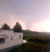
I wonder if my state of PA will ever see this type of event again? Hmm
 
  • Like
Reactions: AJS
Was one of his best case study videos IMO.

Really went into just how rare this set up was and the numerous ingredients that had to align just right to produce the result. Really explains why this event is so anomalous in (reliable) tornadic record history.

It’s extremely hard to get an undiluted EML into that region. A paper he referenced shows that area of the northeast may not get a single day with an EML in an entire year. For reference, the plains get up to 15 days a year per their definition. It required a confluence of factors like a specific, compatible jet geometry, trough location, and high pressure placement in the southeast to do it. Time of year also helped, with plentiful moisture already sitting in place. Then add a slow moving cold front (due to small temperature gradient behind vs in front of the boundary) and you got more subtle forcing for discrete cells.

I’d definitely recommend watching it.
That EML made it as far northeast as Maine! Man, what a crazy setup!
 
I agree, well worth the long wait for it. I recall him stating he would have the video up on May 31 this year, but I vastly prefer him taking his time on complex past events to really take a deep dive into these outbreaks. This video was absolutely phenomenal.

After watching the video, the event was a straight-up monster plains setup that just so happened to build itself around the Great Lakes in a perfect confluence of ingredients. One thing I found particularly interesting was the lack of southerly surface winds in many of the pulled soundings he had, and the strong veering/strengthening of the winds with height was the thing that mattered much more when it actually came to tornadic production. It makes sense that a setup in the northeast is far less reliant on there being a southerly component to the surface winds due to the geography, but still, there were some soundings in the video that had surface winds out of the WSW. That’s pretty insane to me. I fully expected those hodographs to be much more potent looking and the thermos to be less impressive than they were for this event.
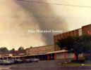
The surface winds and the jet translation speed both really made me go “huh.??.”. When he was calculating the jet speed I was expecting it to be way over 40 knots. Just really such a unique set up.
 
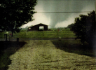
images (4).jpeg
Mesopotamia, OH (what a town name) F3 from that day that injured thirty.
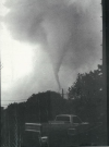
1756132100186.png
Niles, OH F5 that killed 18.
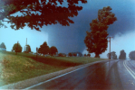
1756132171961.png
Jamestown to Cochranton, PA tornado that killed 16.
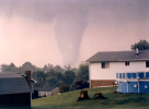
1756132255780.png
Albion, PA tornado that killed 12.
1756132412501.png
Corry, PA tornado that injured 16 (my personal favorite tornado photo from that day)
1756132514689.png
Sarver, PA F3 that killed nine
 
Last edited:
View attachment 46324
Mesopotamia, OH (what a town name) F3 from that day that injured thirty.
View attachment 46325
Niles, OH F5 that killed 18.
View attachment 46326
Jamestown to Cochranton, PA tornado that killed 16.
View attachment 46327
Albion, PA tornado that killed 12.
View attachment 46328
Corry, PA tornado that injured 16 (my personal favorite tornado photo from that day)
View attachment 46329
Sarver, PA F3 that killed nine

Of course as we know visual appearance isn't everything with tornadoes, but Corry looks the most menacing out of all of these. Reminds me of Tuscaloosa as it was coming into town.

In nearly all the photos I've seen of it (including this one), Niles looks like a Pampa '95-esque debris-filled drillbit. Unquestionably capable of violent damage, but not your "quintessential" F5. Not sure if it maybe had a larger stage that just isn't as well-documented, since it's not uncommon for long-track tornadoes to change size and shape, sometimes frequently, throughout their path.
 
Last edited:
Of course as we know visual appearance isn't everything with tornadoes, but Albion looks the most menacing out of all of these. Reminds me of Tuscaloosa as it was coming into town.

In nearly all the photos I've seen of it (including this one), Niles looks like a Pampa '95-esque debris-filled drillbit. Unquestionably capable of violent damage, but not your "quintessential" F5. Not sure if it maybe had a larger stage that just isn't as well-documented, since it's not uncommon for long-track tornadoes to change size and shape, sometimes frequently, throughout their path.
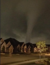
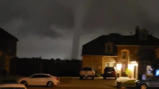
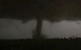
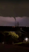
Of any tornado event in history, the 2019 Dallas-Richardson EF3 is 100% the most menacing tornado I've ever seen photographed. Sure, Tuscaloosa was hellish, but there's something about a giant nocturnal stovepipe over a populated area that does it for me.
1756134103887.png1756134188362.png1756134231805.png1756134257602.png

As for Niles wedging out, it has a max width of ~450 yards according to Highways and Hailstones, so there's a chance it remained as a drillbit for most, if not all, of its life.
 
Of course as we know visual appearance isn't everything with tornadoes, but Albion looks the most menacing out of all of these. Reminds me of Tuscaloosa as it was coming into town.

In nearly all the photos I've seen of it (including this one), Niles looks like a Pampa '95-esque debris-filled drillbit. Unquestionably capable of violent damage, but not your "quintessential" F5. Not sure if it maybe had a larger stage that just isn't as well-documented, since it's not uncommon for long-track tornadoes to change size and shape, sometimes frequently, throughout their path.
You said it best in a previous comment on here. Tornados on high end days seem to be adept and chaotic shapeshifters. Going from stovepipes and cones with horizontal vortices, to wedges, to completely rain wrapped and back and forth.
 
The surface winds and the jet translation speed both really made me go “huh.??.”. When he was calculating the jet speed I was expecting it to be way over 40 knots. Just really such a unique set up.
right same but it had to do with the nose of the 500 mb jet and also it moving right over the target area
 
You said it best in a previous comment on here. Tornados on high end days seem to be adept and chaotic shapeshifters. Going from stovepipes and cones with horizontal vortices, to wedges, to completely rain wrapped and back and forth.
Cullman is a great example of that.
 
right same but it had to do with the nose of the 500 mb jet and also it moving right over the target area

One of the reasons I was skeptical of 4/2 was that the left exit region of the jet seemed to be whiffing off to the northwest of the unstable warm sector...I do believe that the outbreak area ended up in the right entrance region though, which is also a favored quadrant for lift.

The really big outbreaks seem to be the ones that have (among other things):

- A fast jet translation speed
- Both the left exit AND right entrance regions of the jet ejecting out over the unstable warm sector

This is how you get outbreaks with a very broad areal distribution such as 3/31/23.
oh i see gotcha very interesting yeah that too as well and good to know
 
One of the reasons I was skeptical of 4/2 was that the left exit region of the jet seemed to be whiffing off to the northwest of the unstable warm sector...I do believe that the outbreak area ended up in the right entrance region though, which is also a favored quadrant for lift.

The really big outbreaks seem to be the ones that have (among other things):

- A fast jet translation speed
- Both the left exit AND right entrance regions of the jet ejecting out over the unstable warm sector

This is how you get outbreaks with a very broad areal distribution such as 3/31/23.
Good point. That glancing blow by the jet of the warm sector when it’s in the right exit region (thinking the southern modes of 4/3/74 and 3/31/23) can kick up some discrete storms. However, the trough ejecting and then those storms being placed in the right entrance region helps their maintenance.
 
Back
Top