Sidenote: I really wish RadarScope and RadarOmega would give you the option to customize the warning colors like on GR.
Navigation
Install the app
How to install the app on iOS
Follow along with the video below to see how to install our site as a web app on your home screen.
Note: This feature may not be available in some browsers.
More options
-
Welcome to TalkWeather! We see you lurking around TalkWeather! Take the extra step and join us today to view attachments, see less ads and maybe even join the discussion. CLICK TO JOIN TALKWEATHER
You are using an out of date browser. It may not display this or other websites correctly.
You should upgrade or use an alternative browser.
You should upgrade or use an alternative browser.
Severe Weather 2025
- Thread starter KevinH
- Start date
- Moderator
- #4,342
I know a good ole guy named Kevin who would have a phrase for these type of occurrences.
What happened with Kevin? Anyone talk to him? Is he ok?
Kds86z
Member
What happened with Kevin? Anyone talk to him? Is he ok?
We don’t know @MichelleH . Hasn’t been on since April 22. Kinda concerned
SVR now for this blob that dropped a tornado a few minutes ago. TOR possible tag is attached.

BULLETIN - IMMEDIATE BROADCAST REQUESTED
Severe Thunderstorm Warning
National Weather Service Huntsville AL
850 PM CDT Tue May 27 2025
The National Weather Service in Huntsville Alabama has issued a
* Severe Thunderstorm Warning for...
West central Jackson County in northeastern Alabama...
Central Madison County in north central Alabama...
* Until 930 PM CDT.
* At 850 PM CDT, a severe thunderstorm was located near Owens Cross
Roads, or near Redstone Arsenal, moving northeast at 20 mph.
HAZARD...60 mph wind gusts.
SOURCE...Radar indicated.
IMPACT...Expect damage to roofs, siding, and trees.
* Locations impacted include...
Paint Rock, Maysville, Hampton Cove, Brownsboro, Gurley, Farley,
Pleasant Groves, Trenton, Garth, and Ryland.
PRECAUTIONARY/PREPAREDNESS ACTIONS...
Remain alert for a possible tornado! Tornadoes can develop quickly
from severe thunderstorms. If you spot a tornado go at once into the
basement or small central room in a sturdy structure.
For your protection move to an interior room on the lowest floor of a
building.
&&
LAT...LON 3453 8648 3464 8665 3491 8646 3471 8614
TIME...MOT...LOC 0150Z 220DEG 18KT 3463 8653
TORNADO...POSSIBLE
HAIL THREAT...RADAR INDICATED
MAX HAIL SIZE...<.75 IN
WIND THREAT...RADAR INDICATED
MAX WIND GUST...60 MPH
$$
AMP

- Moderator
- #4,345

Let's not do that again :[
There's been a lot of activity here the past week.
Edit: Lot of obstructions but I was able to grab a photo of the inflow region from a video I took before going to the safe place. Speeding it up shows rotating winds consistent with a broad & low wall cloud, rain wrapped. Don't think it was producing anything at this point in time.

Last edited:
TornadoFan
Member
I see the Arnett, OK tornado has been upped to an EF-3.
Brandon
Member
Absolutely nothing, I just found it ironic that the typical rumble from testing now includes tornadoes. Both are a part of life around these parts...What does that have to do with tornadoes?
Kolle
Member
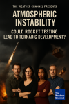
I can see it now. Weather Channel: Could Rocket Testing Lead To Tornadic Development?
Brandon
Member
LOL, I was not implying that at all, but it wouldn't surprise me if that became the latest conspiracy theory.I can see it now. Weather Channel: Could Rocket Testing Lead To Tornadic Development?
O I know, but it gave me that idea. As soon as I saw that, I was like O boy this is gonna give the chemtrail theory a run for it's money. LOL!LOL, I was not implying that at all, but it wouldn't surprise me if that became the latest conspiracy theory.
- Moderator
- #4,352
LOL, I was not implying that at all, but it wouldn't surprise me if that became the latest conspiracy theory.
No crazier than some of those wack-a-doodles who say NEXRAD causes tornadoes.
And don't forget the roundabouts causing tornadoes too. Some think if you drive as fast as you can through a roundabout, it leads to a tornado. Anyways, back to regularly scheduled programmingNo crazier than some of those wack-a-doodles who say NEXRAD causes tornadoes.
Kds86z
Member
And don't forget the roundabouts causing tornadoes too. Some think if you drive as fast as you can through a roundabout, it leads to a tornado. Anyways, back to regularly scheduled programming
Don’t forget tornadoes being caused by HAARP.
- Moderator
- #4,355
tornado examiner
Member
The blanco Oklahoma tornado was definitely a mega wedge with an EF3 rating now.
Nearly 3000 yards wide.
Nearly 3000 yards wide.
Kds86z
Member
jiharris0220
Member
CheeselandSkies
Member
Kds86z
Member
May now has 13 EF3s beating March at 11.


