.LONG TERM...
(Tuesday night through next Sunday)
Issued at 349 AM CDT MON MAY 19 2025
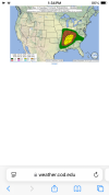
A cold
front will approach Central Alabama on Tuesday evening, with
a threat of severe thunderstorms across the region. Storms will form
initially over Tennessee and northern Mississippi during the
afternoon hours, supported by
SBCAPE values
likely to be approaching
or exceeding 1800
J/kg. Activity is expected to grow upscale into a
more linear storm mode by the evening hours, which will move
southeastward into Central Alabama by late evening into the
overnight. New 06z CAMs suggest bulk
shear values 50-60
kts, with 0-
1 and 0-3
SRH of 300-400
m2/s2. A strong mid-level
jet that will
initially be supportive of supercells will contribute to favorable
conditions for tornadoes, especially further north across Tennessee.
There will be some question as to how storm mode may affect the
hail
and
tornado threat as the cells become line segments and ultimately
a line moving southeast across Central Alabama. Forecast LCLs of 500-
800 m are also generally favorable for tornadoes. The HRRR and 3 km
NAM depict little in the way of
reflectivity with the line, with may
indicate the hesitancy of upscale growth. More cellular activity
making into Central Alabama, as opposed to linear, would greatly
increase the
tornado and
hail threat, especially across areas
northwest of the Interstate 59/20 corridor. Severity should
gradually decrease later overnight as the line sinks further
southeast toward the Interstate 85 corridor.