
Navigation
Install the app
How to install the app on iOS
Follow along with the video below to see how to install our site as a web app on your home screen.
Note: This feature may not be available in some browsers.
More options
-
Welcome to TalkWeather! We see you lurking around TalkWeather! Take the extra step and join us today to view attachments, see less ads and maybe even join the discussion. CLICK TO JOIN TALKWEATHER
You are using an out of date browser. It may not display this or other websites correctly.
You should upgrade or use an alternative browser.
You should upgrade or use an alternative browser.
Severe Weather Threat May 17-19, 2025
- Thread starter Brice W
- Start date

AJS
Member
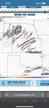
2025 continues to be full of surprises!Huh, neat. 2 MCS's, taking the same general path, several hundred miles apart.
View attachment 42185
- Moderator
- #323
Bentley was not awake when he wrote this. Day 3 is Tuesday, not Monday.
Day 3 Convective Outlook
NWS Storm Prediction Center Norman OK
0230 AM CDT Sun May 18 2025
Valid 201200Z - 211200Z
...THERE IS AN ENHANCED RISK OF SEVERE THUNDERSTORMS FOR PORTIONS OF
THE MID-MISSISSIPPI VALLEY...OHIO VALLEY...AND TENNESSEE VALLEY...
...SUMMARY...
Severe thunderstorms are likely across portions of the Ohio Valley,
Mid-Mississippi Valley, and Tennessee Valley on Monday.
...Synopsis...
A mid-level low will stall and perhaps start to retrograde across
parts of the Upper Midwest on Monday. A surface low in the MO/IL
region will start to occlude during the day. A cold front will move
east through the period with a warm front across the Ohio Valley.
...Mid-Mississippi Valley into the Ohio Valley and Tennessee
Valley...
Thunderstorms will likely be ongoing amid broad isentropic ascent
and moderate elevated instability along the warm front in southern
Illinois and Indiana and vicinity on Monday morning. South of this
morning activity, where upper 60s to low 70s dewpoints are
anticipated, moderate to strong instability is forecast to develop
amid daytime heating. As 55 to 65 knots of mid-level flow
overspreads the warm sector, strong shear will be present for
supercells. Large to very large hail will be the primary threat
initially, as low-level flow will likely be veered. However,
low-level shear should be strong enough to support some tornado
threat during the afternoon/evening. As storms grow upscale, one or
more bowing segments may develop with an increased damaging wind
threat during the evening and perhaps persisting into the overnight
period.
US_Highway15
Member
Honestly pretty surprised that they didn't pull a moderate risk due to how high the parameters specifically, CAPE, helicity values and shear rates. My guess is it's due to the strength of the jet(s). However, that's why I'm sitting here posting on a weather forum, while they're working in Norman OK, or at a NWS office in general getting paid lots of money to do this stuff.
TornadoFan
Member
We got a small MDT.
Central Ohio Wx
Member

Website bugged

TornadoFan
Member
Schoeppeya
Member
AJS
Member
I think we may see a moderate come the afternoon update. The cape and shear rates are pretty insane.
joshoctober16
Member
except for 2 things this would be a sounding of a super outbreak to be honest.View attachment 42174
Took this in southern Kansas. I would say an upgrade to a moderate is pretty warranted for tomorrow.
the 2 issues are
1:hodo shape , might suggest it could become a mess (slinky is also a bit too northwards)
2:SRH1 isn't at 420+
if these 2 things change then i would honestly be saying a super outbreak would be very likely.
there are no issues at all except for these 2 things.
tennessee storm chaser
Member
- Messages
- 1,877
- Reaction score
- 4,283
- Location
- jackson tennessee
- Special Affiliations
- SKYWARN® Volunteer
We are looking at quite possible at least 2 dangerous threats out of the next 3 days coming up …. What a Buisy next 3 days so coming …
US_Highway15
Member
Can I ask what model this is from?Really shocked they didn’t go mod last night for today and pretty underwhelming discussion to go with it. Definitely looking ugly based on the cams.
joshoctober16
Member

everything on the left side is perfect for a superoutbreak , however hodo shape is trash , the higher levels stick down , shoving all the rain into the updraft, slinky is too north , this is going to make all the storms pile up into a line.
SRH1 could be a bit better as well.
however note this...
if any supercells start to move more east then north .... watch out ... that's going to be a violent tornado maker
and this sounding is near a cell that does this movement

only storm i see to worry about at least model wise ... for now .....

zath
Member
Today is definitely looking volatile with some great thermodynamics and wind profiles - definitely supportive for strong to intense tornadoes and huge hail across southern KS and north-central OK. The only main concern I have is storm mode. A lot of the models are hinting at storms quickly growing upscale. But those initial discrete supercells and any that develop south of the main cluster in KS (should that happen) could be monsters. Yesterday I was worried that some of the mid-level winds may hinder things a little today, but overnight and morning models seem to have allayed those concerns. Great placement of the moderate risk IMHO.
Now begins the waiting game on how the day evolves. For sure a potential high-end day if storm mode stays discrete longer!
Just for funsies: a sounding from the latest 12Z NAM model coming in have an analog to May 3, 1999 (OKC). Slight eye brow raiser haha
Now begins the waiting game on how the day evolves. For sure a potential high-end day if storm mode stays discrete longer!
Just for funsies: a sounding from the latest 12Z NAM model coming in have an analog to May 3, 1999 (OKC). Slight eye brow raiser haha
Schoeppeya
Member
12z HRRRCan I ask what model this is from?
US_Highway15
Member
I know it's easy to look at high numbers and think "super outbreak" but need I remind you, these are two soundings pulled from Huntsville on 4/27/11. The sounding you provided is not even close to being on the same level as these two from April 27th (see SRH, shear rates and hodographs).View attachment 42190
everything on the left side is perfect for a superoutbreak , however hodo shape is trash , the higher levels stick down , shoving all the rain into the updraft, slinky is too north , this is going to make all the storms pile up into a line.
SRH1 could be a bit better as well.
however note this...
if any supercells start to move more east then north .... watch out ... that's going to be a violent tornado maker
and this sounding is near a cell that does this movement
View attachment 42191
only storm i see to worry about at least model wise ... for now .....
View attachment 42192


There are a ton of factors that go into something being a super outbreak, and a good deal of them aren’t something you can ascertain from a sounding.everything on the left side is perfect for a superoutbreak , however hodo shape is trash , the higher levels stick down , shoving all the rain into the updraft, slinky is too north , this is going to make all the storms pile up into a line.
SRH1 could be a bit better as well.
however note this...
if any supercells start to move more east then north .... watch out ... that's going to be a violent tornado maker
and this sounding is near a cell that does this movement
only storm i see to worry about at least model wise ... for now .....
US_Highway15
Member
Also, latest 12z HRRR run has a lot more messy of a storm mode, actually more cluster-linear esque like mode for Monday. I would not be shocked to see SPC stick with ENH specifically for that reason alone.
SmokeEater
Member
Multiple chasers I'm seeing or talking to worried about this same thing for Monday, storm more looks like trash. Saying today is the make or break day possibly.Also, latest 12z HRRR run has a lot more messy of a storm mode, actually more cluster-linear esque like mode for Monday. I would not be shocked to see SPC stick with ENH specifically for that reason alone.
AJS
Member
I just hope we can avoid death and destruction like what we saw two days ago.