• Welcome to TalkWeather!
    We see you lurking around TalkWeather! Take the extra step and join us today to view attachments, see less ads and maybe even join the discussion.
    CLICK TO JOIN TALKWEATHER

Severe Weather 2025

I could see tommorow being a 5% tornado risk for portions of North and central Alabama. Depending on storm mode.With how this year is going i

Both 18Z NAM and HRRR are a bit concerning, each showing discrete supercell activity over the northern portions of Alabama, Georgia and Mississippi on Thursday afternoon into the evening. Again, wouldn't necessarily foresee tornadoes as a substantial risk, but from an overall perspective, tomorrow certainly has the opportunity to be sneakily impressive for some of us.
View attachment 39547View attachment 39548
As they say, dixie alley will dixie alley.
 
Both 18Z NAM and HRRR are a bit concerning, each showing discrete supercell activity over the northern portions of Alabama, Georgia and Mississippi on Thursday afternoon into the evening. Again, wouldn't necessarily foresee tornadoes as a substantial risk, but from an overall perspective, tomorrow certainly has the opportunity to be sneakily impressive for some of us.
View attachment 39547View attachment 39548
STP has come up on the 18z run compared to the 12z. HRRR favors the i20 corridor if we possibly see a tornado or two. Classic low end tornado watch day tommorow if I had to guess. Might be some good views of supercells depending on storm mode.
 
Both 18Z NAM and HRRR are a bit concerning, each showing discrete supercell activity over the northern portions of Alabama, Georgia and Mississippi on Thursday afternoon into the evening. Again, wouldn't necessarily foresee tornadoes as a substantial risk, but from an overall perspective, tomorrow certainly has the opportunity to be sneakily impressive for some of us.
View attachment 39547View attachment 39548
It looks like it should be an interesting afternoon. Some mammatus clouds would be nice to see.
 
Not sure if this is the correct thread, but a question that I wanna ask people's opinion on, is should the NWS eliminate the "TORNADO: POSSIBLE" tag on Severe T-Storm Warnings and instead just go ahead and issue Tornado Warnings instead for storms that could produce a brief spin-up tornado?

Had the local TV news station (WSBT 22) run a story at the local NWS office in Northern Indiana (IWX) on NWS budget cuts (that specific office hasn't been affected), and the Warning Coordinator for IWX, said that he's gotten a number of phone calls about people who have been hit by brief spin-up tornadoes in the past couple weeks from the two lines of storms that came through (3/30 and 4/2) and never were warned of that possibility. Now to be fair, the storm that produced those brief tornadoes had "TORNADO: POSSIBLE" tags on them, which the guy said gets put on storms that could produce a tornado.

My question then is, if that's the case, why not just go ahead and issue a Tornado Warning? Aren't those supposed to be issued on storms that have the possibility of producing a tornado? I understand why you wouldn't, but why not just air on the side of caution?
My opinion is that the "TORNADO POSSIBLE" tag is actually completely fine and should be kept - in fact, I prefer them to radar-based tornado warnings if the tornado warning is for some broad-ish or weak-ish looking rotation. This is because issuing a tornado warning instead for a storm where it would be better described by a "TP" tag would lead to less of the cry-wolf effect that we already see in a significant portion of the population, especially in the Midwest. I have grown up around the mentality my whole life and I am definitely a bit biased when it comes to this though.

However, I do also believe that the "TP" section should be easier to see and read for laymen, or should be better communicated, as most people simply don't read into severe thunderstorm warnings. All they read is the headline, and that's it. Many people don't take severe thunderstorm warnings very seriously, and honestly I can understand why after living in central Ohio my whole life. They really aren't that bad up here 95% of the time (this number is not based in reality, it's just my guess). Tornado warnings should be reserved for strong rotation and a very strong indication that something will drop IMO. Also, atmospheric context should be considered. If the atmosphere is loaded on a particular day, like a particularly dangerous MOD or a HIGH risk day, then they should more readily issue a TORR for sure.

EDIT: What in the world is that replacement for a colon followed by a P? That's really weird
 
Last edited:
Looks like the 18z models are more in line with my WRF-ARW run earlier showcasing some spin-ups and discrete activity. Could be a tricky day to forecast! I still think a 5% is definitely possible.
These are the kinds of days that are tricky to forecast, because they can really overproduce or be a gust of hot air. The threat could also get mitigated by more early-day convection than forecast, and of course vice versa, if light convection aids in the formation of boundaries. Definitely one of those days when I don't envy being in the forecaster's chair.

My opinion is that the "TORNADO POSSIBLE" tag is actually completely fine and should be kept - in fact, I prefer them to radar-based tornado warnings if the tornado warning is for some broad-ish or weak-ish looking rotation. This is because issuing a tornado warning instead for a storm where it would be better described by a "TP" tag would lead to less of the cry-wolf effect that we already see in a significant portion of the population, especially in the Midwest. I have grown up around the mentality my whole life and I am definitely a bit biased when it comes to this though.

However, I do also believe that the "TP" section should be easier to see and read for laymen, or should be better communicated, as most people simply don't read into severe thunderstorm warnings. All they read is the headline, and that's it. Many people don't take severe thunderstorm warnings very seriously, and honestly I can understand why after living in central Ohio my whole life. They really aren't that bad up here 95% of the time (this number is not based in reality, it's just my guess). Tornado warnings should be reserved for strong rotation and a very strong indication that something will drop IMO. Also, atmospheric context should be considered. If the atmosphere is loaded on a particular day, like a particularly dangerous MOD or a HIGH risk day, then they should more readily issue a TORR for sure.

EDIT: What in the world is that replacement for a colon followed by a P? That's really weird
Spann had, at one point, said that the most beneficial likely solution to this problem would to have a separate warning item between a Tornado Warning and Severe Thunderstorm Warning, because the average joe is (my experience included) not likely to give the slightest notice to the Tornado Possible tag on an SVR. Of course, introducing a new warning type has all kinds of its own headaches, so I dunno if we're gonna get an answer to this issue any time soon. And I mean, shoot, while we talk about this, people are still sheltering under overpasses during tornadoes, so we might have bigger fish to fry in the meantime.
 
Who’s betting $$ on a 5% tornado tonight.


John Locke Lost Show GIF
 
One factor worth mentioning is that a tornadic vortex is obviously orders of magnitude larger in cross-sectional area than a wire or anything used in welding would be, so I feel like it’s still not completely outlandish when you look at it from that perspective. But a lot of the other numbers are still wonky to me and it just seems like a very strange idea in general.

I did some digging and found a couple studies that calculate the kinetic energy of tornadoes. Thought you might be interested? For reference, the Hiroshima bomb had a blast yield of 63 Trillion Joules (TJ).

Empirical estimates of kinetic energy from some recent U.S. tornadoes


This study concluded the average kinetic energy of an EF5 tornado is 50.4 TJ. Funnily enough, the 2011 Sawyerville-Eoline EF3 released the most energy out of all the tornadoes they calculated with a whopping 125 TJ. The Hackleburg-Phil Campbell EF5 was #2 with 100 TJ of energy.

Kinetic Energy of Tornadoes in the United States


This study is much more conservative and says only 1% of tornadoes exceed 31.9 TJ. However, their top 10 tornadoes released WAY more energy than the first study's top 10. They calculated the 2010 Yazoo City EF4 released over 516 TJ of energy (8.19 X the Hiroshima blast)! As long as we're entertaining the electro-magnet theory, this list is really bizarre because their top 5 tornadoes all did some uniquely incredible damage to steel objects/structures.

1744272518310.png

The biggest issue with both these studies is they used EF scale wind speeds in their calculations instead of DOW or NEXRAD measurements, which are significantly higher. Considering the exponential relationship between wind speed and kinetic energy release, these studies are likely both underestimating the kinetic energy of tornadoes by orders of magnitude.

For anyone interested, here's a graph showing the relationship between wind speeds and kinetic energy. The kinetic energy of a 1 KG object moving at 200 mph (EF5 threshold) is 4050 J, and 260 mph (F5 threshold) is 6845 J. That's a 70% increase in energy with only a 30% increase in wind speed.

1744270930275.png

Does this help give some clarity on your energy questions @slenker?
 
Last edited:
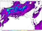
Overall helicity has increased and SPC has a 15% wind and hail risk out. Surprised there isn't even a 2% tornado risk because, despite mostly straight hodographs, I'd reckon there's definitely still a risk for at least a brief tornado in any storm that takes advantage of localized higher shear or boundary interactions.
1744290006072.png1744291601988.png
 
One factor worth mentioning is that a tornadic vortex is obviously orders of magnitude larger in cross-sectional area than a wire or anything used in welding would be, so I feel like it’s still not completely outlandish when you look at it from that perspective. But a lot of the other numbers are still wonky to me and it just seems like a very strange idea in general.
Next tornado I see; ill plug up my welder to it and manufacture a shelter mid tornado
 
I did some digging and found a couple studies that calculate the kinetic energy of tornadoes. Thought you might be interested? For reference, the Hiroshima bomb had a blast yield of 63 Trillion Joules (TJ).

Empirical estimates of kinetic energy from some recent U.S. tornadoes


This study concluded the average kinetic energy of an EF5 tornado is 50.4 TJ. Funnily enough, the 2011 Sawyerville-Eoline EF3 released the most energy out of all the tornadoes they calculated with a whopping 125 TJ. The Hackleburg-Phil Campbell EF5 was #2 with 100 TJ of energy.

Kinetic Energy of Tornadoes in the United States


This study is much more conservative and says only 1% of tornadoes exceed 31.9 TJ. However, their top 10 tornadoes released WAY more energy than the first study's top 10. They calculated the 2010 Yazoo City EF4 released over 516 TJ of energy (8.19 X the Hiroshima blast)! As long as we're entertaining the electro-magnet theory, this list is really bizarre because their top 5 tornadoes all did some uniquely incredible damage to steel objects/structures.

View attachment 39554

The biggest issue with both these studies is they used EF scale wind speeds in their calculations instead of DOW or NEXRAD measurements, which are significantly higher. Considering the exponential relationship between wind speed and kinetic energy release, these studies are likely both underestimating the kinetic energy of tornadoes by orders of magnitude.

For anyone interested, here's a graph showing the relationship between wind speeds and kinetic energy. The kinetic energy of a 1 KG object moving at 200 mph (EF5 threshold) is 4050 J, and 260 mph (F5 threshold) is 6845 J. That's a 70% increase in energy with only a 30% increase in wind speed.

View attachment 39553

Does this help give some clarity on your energy questions @slenker?
Seeing PICHER OKLAHOMA of all tornadoes on here is insane. Like that tornado over Piedmont, Jarrell, Harper, Smithville, or like multiple other extremely violent tornadoes is truly a crazy thing.
I did not think of Picher as a kinetic energy monster but here we are
 
Overall helicity has increased and SPC has a 15% wind and hail risk out. Surprised there isn't even a 2% tornado risk because, despite mostly straight hodographs, I'd reckon there's definitely still a risk for at least a brief tornado in any storm that takes advantage of localized higher shear or boundary interactions.
View attachment 39567View attachment 39568
Watch midday update bring in 5% hahah.
 
Back
Top