
NorthBamaWX
Member
Tornado Warning including Corinth MS, Farmington MS, Walnut MS until 10:15 PM CST
Follow along with the video below to see how to install our site as a web app on your home screen.
Note: This feature may not be available in some browsers.
I'm more than a bit angry about the way this event was handled, by both the NWS and TWC. Two key warning outlets were not on top of their game today, and it cost lives. Two different NWS missed key warnings on tornadoes. Shameful that this could've been prevented, yet warnings weren't issued on tornadoes that were on the ground until they'd already lifted. I don't know if it's complacency, laziness, or poor attention to detail, but when lives are cost at the hands of a professional dropping the ball, you can't expect anybody to be happy.
000
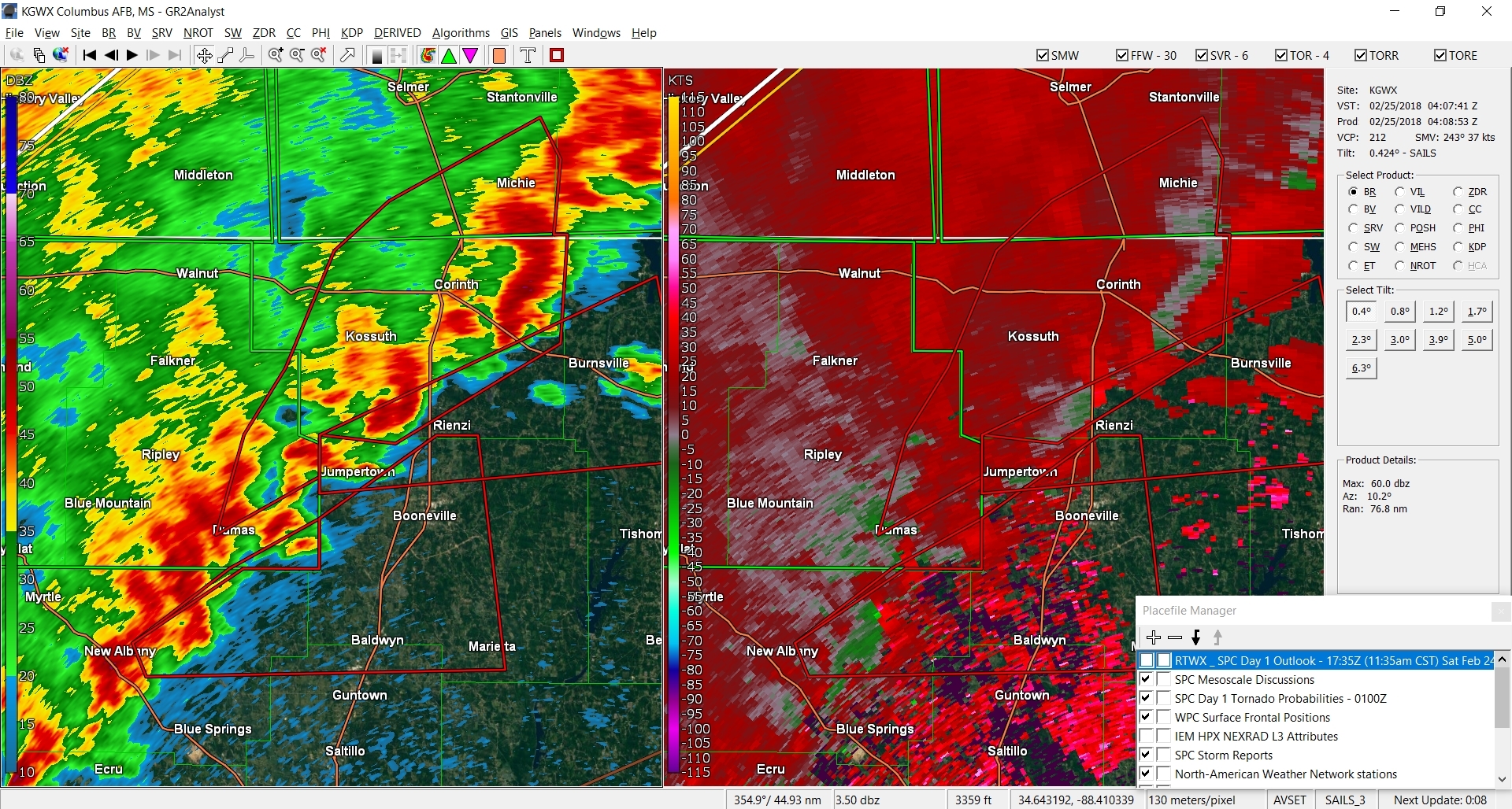
WFUS54 KMEG 250400
TORMEG
MSC003-117-141-250445-
/O.NEW.KMEG.TO.W.0014.180225T0400Z-180225T0445Z/
BULLETIN - EAS ACTIVATION REQUESTED
Tornado Warning
National Weather Service Memphis TN
1000 PM CST SAT FEB 24 2018
The National Weather Service in Memphis has issued a
* Tornado Warning for...
Northwestern Tishomingo County in northeastern Mississippi...
Northern Prentiss County in northeastern Mississippi...
Southeastern Alcorn County in northeastern Mississippi...
* Until 1045 PM CST
* At 1000 PM CST, a severe thunderstorm producing a tornado was
located over Jumpertown, or 8 miles northwest of Booneville, moving
northeast at 45 mph.
HAZARD...Tornado and quarter size hail.
SOURCE...Radar indicated rotation.
IMPACT...Flying debris will be dangerous to those caught without
shelter. Mobile homes will be damaged or destroyed.
Damage to roofs, windows, and vehicles will occur. Tree
damage is likely.
* Locations impacted include...
Booneville, Iuka, Burnsville, Jumpertown, Glen, Hinkle, Midway,
Leedy, Rienzi, Doskie, Gaston, Hazard Switch, Walker Siding, Holcut
and Holts Spur.
PRECAUTIONARY/PREPAREDNESS ACTIONS...
TAKE COVER NOW! Move to a storm shelter or an interior room on the
lowest floor of a sturdy building. Avoid windows. If you are
outdoors, in a mobile home, or in a vehicle, move to the closest
substantial shelter and protect yourself from flying debris.
&&
LAT...LON 3473 8818 3469 8872 3476 8872 3495 8823
TIME...MOT...LOC 0400Z 243DEG 37KT 3473 8869
TORNADO...RADAR INDICATED
HAIL...1.00IN
$$
Make that 3 warnings over northern MS that say that.Both of the tornado warnings over north MS say that the warned storm was/is producing a tornado.
Looking at that storm I'm not even seeing much of a hook. I'm not sure where the confidence is coming from.Both of the tornado warnings over north MS say that the warned storm was/is producing a tornado.
When I was at NWS Jax they had templates for each kind of tornado warning, so either their "capable of producing" template is messed up or their just overcompensating for the known issues earlier today. The latter seems somewhat likely, actually.Yeah, they don't look that impressive. I wonder if NWS Memphis is just forgetting to add "capable of" in front of "producing"?
"radar confirmed tornadoes", yet the signature i previously posted didn't even get warned until 15 minutes later. What is going on with the NWS????
on another note, the southernmost storm is starting to wrap up quite a bit.