- Thread starter
- #101
KevinH
Member
Me….Anyone else not quite in agreement with the Day 2?
Follow along with the video below to see how to install our site as a web app on your home screen.
Note: This feature may not be available in some browsers.
Me….Anyone else not quite in agreement with the Day 2?
Why? Please elaborateMe….
The Day 2 just FEELS…… offWhy? Please elaborate
Very bearish on the northern threat area (i.e. north of the Ohio River) even though some of the models are showing a decent sigtor threat there (more dangerous than the actual ENH areas on a lot of them).Why? Please elaborate

Yeah that's plausible. The 3km NAM run I pulled that STP plot from doesn't generate a ton of crapvection over KY/TN earlier in the day while some of the other models show a more substantial MCS. I guess it's possible that higher threat further north is based on unrealistic assumptions about warm/moist advection and/or insolation.IMO, it has a complex of big showers and storms over Kentucky early, I would think that would stabilize the risk, and have the greatest risk over Central Tennessee, anyone else agree or am I just wrong here?
This has gotta be the first time Broyles has ever been criticized for being too conservative lolJust my opinion, but based on what I've seen that's been shared here, Broyles isn't giving enough thought to North MS and AL. Again, just my opinion.
D2 High incomingThis has gotta be the first time Broyles has ever been criticized for being too conservative lol
I can see were moderate risk will go next day2 update around lunch time , central tennessee up through Ohio valleyD2 High incoming


If the rest of the 12z models follow suite of the latest HRRR, we are in for a real ride.
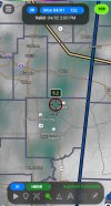
View attachment 24566
This is an area averaged sounding through a fairly large section of the warm sector in IN/OH tomorrow afternoon. Not only is the thermodynamic profile nearly ideal - wind profiles have only trended stronger with a more consolidated surface low leading to more backing of the winds - I would say (in this particular run), this is the highest end environment we have seen since 3/31 of last year. Put a discrete supercell in this environment and violent tornadoes are easily a possibility.
Whats more... the HRRR does simulate a line of discrete and semi-discrete supercells through IN/OH with the rest of the WS clearer than previous runs.
View attachment 24567
The thing is that the upper air pattern in my opinion is highly supportive of discrete convection, especially considering the warm sector looks unstable and mostly uncapped. Therefore I would expect more CAMs to follow suite with this and also think the HRRR is not being a 'supercell printer' without good reason. At risk of sounding dramatic - if (and ONLY IF) this HRRR run verified exactly as shown above, we would be seeing an upper-echelon with multiple intense tornadoes, similar to some of the analogs I mentioned previously. I will be really watching the next CAM few runs very closely, as this last HRRR run was downright worrying. Really hoping we see trends away from this solution otherwise tomorrow could be properly bad. Interested to see the next D2 Update.


Look at those CIPS tornado probs! NCAR's CAM-based machine learning probabilities, which has generally performed well, shows a substantial risk for tornadoes across the OH valley during the afternoon, and a localized maximum for tornado threats in AL Tuesday evening. SREF also aggressive on the tornado threat tomorrow. CSU's ML-probs are a good bit more conservative, on the other hand. 12Z HRRR shows some of those more curved hodos that caught my attention on the 06Z CAM runs.
View attachment 24570
Keep those eyes peeled and stay safe out there tomorrow.this is flat out sinister with the local maxima right on top of cincinnati