SmokeEater
Member
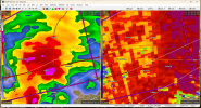
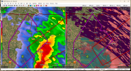
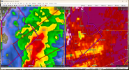
Strong tornado on the ground near Strong City, debris over 10k.
Sent from my SM-S901U using Tapatalk
Sent from my SM-S901U using Tapatalk
Follow along with the video below to see how to install our site as a web app on your home screen.
Note: This feature may not be available in some browsers.
It is 65/58 in Altus right now. It is 58/55 in my area. I wouldn't consider it unfavorable but probably a fair chance because those temperatures are fairly warm and moist for this time of year.This system reminds me a little bit of the February 21-22, 1975 event that Gary England wrote about in his book, Weathering the Storm: Tornadoes, Televsion & Turmoil. Several strong tornadoes hit southwestern Oklahoma that night including an F2 that killed two in Altus despite seemingly unfavorable surface thermodynamics.
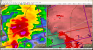
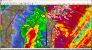
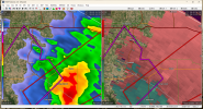
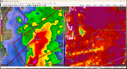
Yup. Small but noticeable TDSSure looks like a tornado approaching Hobart:


For reference, it also snowed in Altus that night…This system reminds me a little bit of the February 21-22, 1975 event that Gary England wrote about in his book, Weathering the Storm: Tornadoes, Televsion & Turmoil. Several strong tornadoes hit southwestern Oklahoma that night including an F2 that killed two in Altus despite seemingly unfavorable surface thermodynamics.
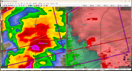
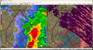
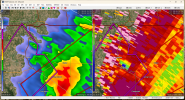
Looks like a new one spinning up west of Gotebo, OK.


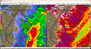
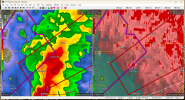
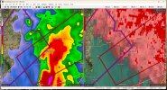
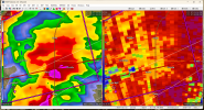
Maybe a hail core?Is it me or did Binger just get hit with a strong tornado without velocity showing much of anything?