warneagle
Member
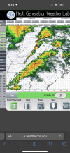
New watch is up further east
Follow along with the video below to see how to install our site as a web app on your home screen.
Note: This feature may not be available in some browsers.
Yeah, I do too, and that event reloaded to become much worse than the 1st day event..The term that I keep hearing that worries me for tomorrow is reloading. They keep talking about the atmosphere reloading from the upper Midwest down through the Kentucky-Tennessee area. I remember another system that reloaded during the day like that about 14 years ago.
15z rap is impressive parameter space for Ohio. Waiting on that 21z run
The term that I keep hearing that worries me for tomorrow is reloading. They keep talking about the atmosphere reloading from the upper Midwest down through the Kentucky-Tennessee area. I remember another system that reloaded during the day like that about 14 years ago.
21z RAP maintains a gnarly environment and a little more backing of winds in the lowest levels, but the overall area is much thinner than we've seen so far. additionally, it suggests nonstop precip over much of the moderate risk area with very little time for destabilizing. something to watch.

I really hope you're right. That's a large area.I interpret that a bit differently.
Yes. They expect the Atmosphere to destabilize after the early morning convection passes through the Ohio Valley. However, it's also possible that the early morning convection and cloud cover stabilizes portions of the higher risk area in Ohio.
That's what sort of shocked me with the sudden major upgrade for Ohio. A lot of rain is going to fall over the next 18 hours in the MDT area. I figured they wanted to see some more updates before pulling the trigger on the MDT. SPC seems convinced we will get enough destabilization, however, so we shall see.
James Spann does not seemed to concerned about the tornado threat for North alabamaYeah. To be honest, I'm more concerned for North MS into Alabama than Ohio tomorrow. As Justin pointed out, you're gonna have a lot of rainfall plus training of storms over the warm front positioned in the area. Not to discount the tornado risk there, but it's gonna have trouble producing discrete supercells IF that rain mass pans out. We'll see.
It's not like there isn't a significant threat of tornadic activity over Ohio. Given what the models are showing over a relatively populated area, I think they had to pull the trigger in order to warn the public. They could always downgrade the threat level tomorrow morning.
Yeah that too. Great point. I was gonna mention that but didn't want to go there.I think people are putting a bit too much stock with the pre set up rainfall. That doesn’t always mean a bust, the 2011 super outbreak had an entire MCS run through the entire risk area and look what still happened.
most of the severe threats we get up here tend to come down to this, and most of the time, the atmosphere does not destabilize fast enough and things ultimately end up pretty tame. however, the march 14th outbreak in IN/OH was thanks to destabilization at a pace far more rapid than i can recall seeing up this way in a long time. as such, uncertainty lingers. i hope that crapvection bails us out as per usual, but its important to be aware that there's a scenario where that is not the case and be prepared just in case.That's what sort of shocked me with the sudden major upgrade for Ohio. A lot of rain is going to fall over the next 18 hours in the MDT area. I figured they wanted to see some more updates before pulling the trigger on the MDT. SPC seems convinced we will get enough destabilization, however, so we shall see.
I think people are putting a bit too much stock with the pre set up rainfall. That doesn’t always mean a bust, the 2011 super outbreak had an entire MCS run through the entire risk area and look what still happened.
Yes but just keep in mind .. That was so unique in that we were looking at "July DP's" with dynamics we usually see with Dec/Jan systems. Just insane for both to be present.I think people are putting a bit too much stock with the pre set up rainfall. That doesn’t always mean a bust, the 2011 super outbreak had an entire MCS run through the entire risk area and look what still happened.