• Welcome to TalkWeather!
    We see you lurking around TalkWeather! Take the extra step and join us today to view attachments, see less ads and maybe even join the discussion.
    CLICK TO JOIN TALKWEATHER
Logo 468x120

Severe WX Southern Severe Weather Threat: 3/9-3/10

Bama Ravens

Member
Messages
1,207
Reaction score
648
Location
Morris, AL (Northern Jefferson County)
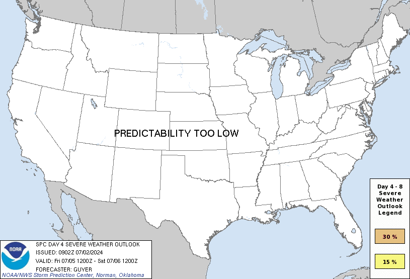
Day 5, a surface cold front is progged to sweep across the central
and southern Plains and into Missouri/Arkansas through the day, and
then quickly eastward across the Mississippi River into the Ohio and
Tennessee Valleys overnight. While the strongest large-scale ascent
is progged at this time to sweep across the Ozarks vicinity during
the day, as the trough takes on a negative tilt, substantial
questions remain as to the degree of moistening/destabilization that
will be able to occur this far north. Greater severe risk may
therefore remain farther south, from east Texas/Louisiana across the
Lower Mississippi Valley region, and possibly into the central Gulf
Coast states late.

Aside from questions regarding instability, this appears likely to
be a strongly dynamic system with strong flow/shear covering a broad
area. As such, damaging winds, and potential for tornadoes, is
evident at this time. At this time, a large 15% probability area
will be issued centered on a north-south zone from Missouri to the
Lower Mississippi Valley, with additional areal, and risk-level,
refinements to be made in subsequent outlooks.
 
Last edited:
X

Xenesthis

Guest
Just looking at some of the models... Don’t be shocked to see this area get shunted way south. I don’t see the warm sector making it that far north first of all. I could also see junk convection along the gulf being an issue as well
 

andyhb

Member
Messages
1,033
Reaction score
2,689
Location
Norman, OK
Wind fields on the 12z GFS over MS and AL are pretty incredible. Add a couple of degrees to the surface temperatures/dewpoints and there could be a big problem there.
 

Kory

Member
Messages
4,928
Reaction score
2,119
Location
Tuscaloosa, Alabama
Just looking at some of the models... Don’t be shocked to see this area get shunted way south. I don’t see the warm sector making it that far north first of all. I could also see junk convection along the gulf being an issue as well
Most guidance shows significant capping out ahead of the main forcing. What would make you think that there would be a convective mess along the Gulf Coast? Now, some of the forcing looks like it may allow things to become linear but I’m not completely convinced on that either.
 

Taylor Campbell

Moderator
Moderator
PerryW Project Supporter
Messages
2,102
Reaction score
2,189
Location
Wedowee, AL
Special Affiliations
  1. SKYWARN® Volunteer
The low level wind field strength on the GFS, and EURO are insane. Also is the nearly 1000 m2s2 SFC-3KM SRH on GFS point soundings with long looping hodographs literally off the charts. Where we do get this wind shear to coincide with the instability, and 567-573 height falls watch out! It looks like eastern TX, LA, MS are the favored spots right now with potential to extend further east.
 

Jimruns

Member
Messages
16
Reaction score
8
Location
Ft. Worth
PW.png

OK..so while admittedly an amateur at best, I guess this is as good a time as any to ask the real simple questions re: reading models.

What version of the model should I be looking at and what parameters? Nothing I've toggled through, i.e. SB Cape, Supercell Composite even Lapse Rate suggests Severe Weather...

What am I doing wrong and more importantly, what SHOULD I be doing?

Thanks in advance.....
 
Messages
2,753
Reaction score
4,291
Location
Madison, WI
Well the good news for those pulling for a non-event is the GFS has backed off the huge >1500 j/kg warm sector it had on the ~180 hour plots over last weekend. The bad news is, judging from the outbreak that was occurring at the time, that doesn't necessarily mean much.
 
Messages
2,753
Reaction score
4,291
Location
Madison, WI
View attachment 1137

OK..so while admittedly an amateur at best, I guess this is as good a time as any to ask the real simple questions re: reading models.

What version of the model should I be looking at and what parameters? Nothing I've toggled through, i.e. SB Cape, Supercell Composite even Lapse Rate suggests Severe Weather...

What am I doing wrong and more importantly, what SHOULD I be doing?

Thanks in advance.....

For one thing, you're looking at the forecast valid for 12Z (6 AM CST, or the typical diurnal minimum of instability).

However, as I mentioned above, the GFS has backed off quite a bit on instability for next weekend, at least for the time being.
 

KoD

Moderator
Staff member
Moderator
PerryW Project Supporter
Messages
1,380
Reaction score
697
Location
Huntsville, AL
View attachment 1137

OK..so while admittedly an amateur at best, I guess this is as good a time as any to ask the real simple questions re: reading models.

What version of the model should I be looking at and what parameters? Nothing I've toggled through, i.e. SB Cape, Supercell Composite even Lapse Rate suggests Severe Weather...

What am I doing wrong and more importantly, what SHOULD I be doing?

Thanks in advance.....
Products like supercell composite or significant tornado are designed to take a whole lot of parameters (such as the CAPE and lapse rates, wind fields, etc) and try to spit out regions of enhanced probabilities for severe weather. They're far from perfect and IMO should only be used as a guide to further investigate simulated sounding data and other parameters. I think the best thing to do first on any model run is go from the top down, review 250mb wind speeds, 500mb, 700mb, 850mb and then your SLP and surface data before moving on to the convective products. From there you'll want to know how to read skew-t diagrams, hodographs and other sounding data and what all the various parameters mean. There's great info online and YouTube videos, just search "skew t diagram tutorial" and go down the rabbit hole. It's a lot to take in so don't expect to get it all in one day. Once you've got a good understanding of all the products you'll be able to conceptualize how all these layers on the models translate to three dimensions.
Note: I'm an amateur too so others may have better recommendations for analysis.
 

Richardjacks

Member
Meteorologist
Messages
1,155
Reaction score
1,308
Location
Atop Red Mountain Birmingham, Al
Products like supercell composite or significant tornado are designed to take a whole lot of parameters (such as the CAPE and lapse rates, wind fields, etc) and try to spit out regions of enhanced probabilities for severe weather. They're far from perfect and IMO should only be used as a guide to further investigate simulated sounding data and other parameters. I think the best thing to do first on any model run is go from the top down, review 250mb wind speeds, 500mb, 700mb, 850mb and then your SLP and surface data before moving on to the convective products. From there you'll want to know how to read skew-t diagrams, hodographs and other sounding data and what all the various parameters mean. There's great info online and YouTube videos, just search "skew t diagram tutorial" and go down the rabbit hole. It's a lot to take in so don't expect to get it all in one day. Once you've got a good understanding of all the products you'll be able to conceptualize how all these layers on the models translate to three dimensions.
Note: I'm an amateur too so others may have better recommendations for analysis.
To add to this, you can have the knowledge of these general forecasting rules and tools, but each area is different, every day is different. For example, a warm sector is more likely to advance northward during the later months of spring vs. early months. Cool air is heavier and is more difficult to be moved when a warm front is pushing north...these items add another layer to forecasting skills, some of these take time to understand. Yes, it is physics, but you need a good understand of climatology, topography to connect the dots and know what to look for just before an event.

I would not put too much stock into the GFS instability parameters 5 days out...there are just too many variables that can change things. What I look for is the overall upper and mid pattern, surface features before an event, time of year, historic events/climatology, gulf of mexico water temps...all of these items will play a part into what happens.
 

warneagle

Member
Messages
3,729
Reaction score
3,208
Location
Arlington, VA
Special Affiliations
  1. SKYWARN® Volunteer
You should check out Rich Thompson’s forecasting workshop videos on the OU SCAMS YouTube channel. They’re a very good, methodical breakdown of the process of forecasting tornadoes, starting with the basics and then working through some of the more advanced concepts. They were really helpful for me when I was trying to learn some of this stuff as someone who was a pretty unspectacular physics and calculus student.
 

jmills

Member
Messages
134
Reaction score
99
Location
Troy, AL/Montevallo, AL
Also, I highly recommend Tim Vaquez's books. In particular, "Weather Analysis and Forecasting". It's a great book on meteorology in general, but with an emphasis on actual application.
 

Jimruns

Member
Messages
16
Reaction score
8
Location
Ft. Worth
You should check out Rich Thompson’s forecasting workshop videos on the OU SCAMS YouTube channel. They’re a very good, methodical breakdown of the process of forecasting tornadoes, starting with the basics and then working through some of the more advanced concepts. They were really helpful for me when I was trying to learn some of this stuff as someone who was a pretty unspectacular physics and calculus student.

I actually watched those early last year and yes, found them to be quite insightful.

Perhaps it's time for a refresher....
 

Austin Dawg

Member
Sustaining Member
Messages
852
Reaction score
1,299
Location
Leander, Texas
Products like supercell composite or significant tornado are designed to take a whole lot of parameters (such as the CAPE and lapse rates, wind fields, etc) and try to spit out regions of enhanced probabilities for severe weather. They're far from perfect and IMO should only be used as a guide to further investigate simulated sounding data and other parameters. I think the best thing to do first on any model run is go from the top down, review 250mb wind speeds, 500mb, 700mb, 850mb and then your SLP and surface data before moving on to the convective products. From there you'll want to know how to read skew-t diagrams, hodographs and other sounding data and what all the various parameters mean. There's great info online and YouTube videos, just search "skew t diagram tutorial" and go down the rabbit hole. It's a lot to take in so don't expect to get it all in one day. Once you've got a good understanding of all the products you'll be able to conceptualize how all these layers on the models translate to three dimensions.
Note: I'm an amateur too so others may have better recommendations for analysis.

Thanks for that. I am a newbie to this and wish to learn how to read the reports and measurements like the wind fields. Can you recommend any more websites that would help me learn how to read and interpret some of these things, along with the definitions of some of the terminology? I know that's a lot to ask for but if you can just point me in the right direction it would be greatly appreciated. I just want to understand better.

P.S. I always sucked at math.
 

Fred

Member
Messages
21
Reaction score
16
Location
Madison, Alabama
Thanks for that. I am a newbie to this and wish to learn how to read the reports and measurements like the wind fields. Can you recommend any more websites that would help me learn how to read and interpret some of these things, along with the definitions of some of the terminology? I know that's a lot to ask for but if you can just point me in the right direction it would be greatly appreciated. I just want to understand better.

P.S. I always sucked at math.


I learned a lot from watching Meteorology Lab / Tim Vasquez on Youtube. Most nights during active weather season he will walk through the current weather patterns before focusing on a single location or reading models. You can find him here:

Meteorology Lab

He hasn't gotten back yet this year but all of his previous videos are available.
 

Equus

Member
Messages
3,290
Reaction score
3,368
Location
Jasper, AL
Special Affiliations
  1. SKYWARN® Volunteer
My education led to rather poor math understanding so that really set me back from many career paths without extensive tutoring... nevertheless, Rich Thompson's video series was phenomenal in helping my understanding of a lot of things. It took a while to learn to read soundings and hodographs but it's certainly possible with time. YouTube is a better resource than one might think.
 
Last edited:

Austin Dawg

Member
Sustaining Member
Messages
852
Reaction score
1,299
Location
Leander, Texas
I learned a lot from watching Meteorology Lab / Tim Vasquez on Youtube. Most nights during active weather season he will walk through the current weather patterns before focusing on a single location or reading models. You can find him here:

Meteorology Lab

He hasn't gotten back yet this year but all of his previous videos are available.

GREATLY appreciated folks. I was able to follow last weekend's event closely by bouncing between this site and Discord. It might be a cool idea to pool some reference websites under a pinned or labeled page to prevent someone like my partially derailing a thread's subject.

Now back to your thread subject.
 

Daryl

Member
Messages
316
Reaction score
99
Location
Boaz,AL
day4prob.gif
 
Back
Top