
- Admin
- #1,001
Navigation
Install the app
How to install the app on iOS
Follow along with the video below to see how to install our site as a web app on your home screen.
Note: This feature may not be available in some browsers.
More options
-
Welcome to TalkWeather! We see you lurking around TalkWeather! Take the extra step and join us today to view attachments, see less ads and maybe even join the discussion. CLICK TO JOIN TALKWEATHER
You are using an out of date browser. It may not display this or other websites correctly.
You should upgrade or use an alternative browser.
You should upgrade or use an alternative browser.
Severe WX Severe Wx Outbreak March 1st- 3rd, 2023 - Southern States, MS/OH/TN Valley
- Thread starter KevinH
- Start date
- Thread starter
- #1,002
KevinH
Member
I think the Thunderstorm Warning is in the wrong place
They aren’t BMX sooooo lol jk jk
- Moderator
- #1,003
I think Winston County may be next
akt1985
Member
Flash Flooding reports starting to occur in north Alabama.
- Moderator
- #1,005

Last edited by a moderator:
According to the Digital Storm Total off RadarScope, north of Belmont, MS has had nearly 4 inches of rain.
Austin Dawg
Member
Yeah I'm afraid we might have some mega haiiers here in South Central Texas.

- Thread starter
- #1,009
KevinH
Member
Surprised the red Severe Wx tag isn’t on this thread.
I’m headed to bed… g’night and be safe!
I’m headed to bed… g’night and be safe!
MattPetrulli
Member
Northeast Alabama tornado enhancement is hilarious at this point
Kolle
Member
From HPD: Much of the Parkway in Huntsville is impassable due to standing water.
There were also some local storm reports of snapped trees and power poles in northern Madison County, along with one report of a "truck was thrown."
There were also some local storm reports of snapped trees and power poles in northern Madison County, along with one report of a "truck was thrown."
- Moderator
- #1,012
| 0441 | 400 | 3 NW DILLEY | FRIO | TX | 2871 | 9921 | REPORTED SOFTBALL SIZED HAIL OFF OF HWY 117 WEST OF DILLEY. HAIL CAME THROUGH ROOFS OF MOBILE HOMES AND TRUCK WINDSHIELDS. (EWX) |
TornadoFan
Member
Day 1 outlook update:
Day 1 Convective Outlook
NWS Storm Prediction Center Norman OK
1200 AM CST Thu Mar 02 2023
Valid 021200Z - 031200Z
...THERE IS A MODERATE RISK OF SEVERE THUNDERSTORMS FOR PORTIONS OF
THE ARKLATEX...
...SUMMARY...
A regional severe-thunderstorm outbreak appears likely across parts
of the southern Plains into the ArkLaTex and ArkLaMiss regions today
into tonight. Widespread damaging winds, large hail, and tornadoes
are all expected. A few long-lived, intense tornadoes are possible.
...Synopsis...
A potent mid-level shortwave trough will traverse the southern
Plains today and approach the lower MS Valley tonight while a
surface low rapidly intensifies over the Arklatex. Multiple rounds
of severe thunderstorms are expected through the period, with an
initial round of storms moving across the Arklatex during the late
afternoon and a second round moving across the Arklatex into the
Lower MS Valley during the night. Ahead of the surface low, an
intensifying low-level jet beneath unseasonably strong mid-level
flow will promote very strong deep-layer ascent/shear atop rich
low-level moisture, encouraging significant severe weather in
association with both rounds of storms. A regional severe
thunderstorm outbreak is expected, including the potential for
damaging tornadoes.
...Central Texas into the Mid-South - Daytime...
Showers and thunderstorms should be ongoing at the start of the
period across eastern TX into southern AR, toward northern AL along
a diffuse effective warm front, delineating the northward extent of
the warm sector. As the mid-level trough traverses the southern
Rockies, rapid surface cyclogenesis should ensue across TX,
supporting the vigorous northward advection of rich low-level
moisture into eastern OK/AR. 7-8 C/km mid-level lapse rates will
overspread upper 60s F surface dewpoints, contributing to 1500-2000
J/kg MLCAPE across the warm sector. During the day, a 30+ kt
low-level jet will be situated across the southern Plains,
overspread by 50+ kt southwesterly mid-level flow, resulting in
widespread 50-75 kt effective bulk shear across the warm sector.
Appreciable low-level shear will also be present, with hodographs
gradually elongating/curving throughout the day. With the mid-level
trough/300 mb jet streak still lagging to the west, some questions
remain in terms of how widespread diurnal warm-sector coverage will
be. Nonetheless, the eastward advance of a merging dryline/pacific
front will encourage at least isolated supercell storms during the
afternoon into early evening, with supercells initiating across
central TX into southeast OK, progressing eastward into the
Arklatex. Severe gusts, large hail (including 2+ inch stones) and
tornadoes are all possible. Any supercell that can become sustained
within the warm sector may produce strong tornadoes.
...Arklatex into the Mid-South - Nightime...
By evening, the mid-level trough will become negatively tilted and
will accelerate toward the Lower MS Valley, with the surface low
also expected to undergo rapid intensification. Impressive vertical
wind profiles will develop as a result of the deep-layer mass
response to the approaching trough, with a regional but volatile
severe weather setup taking place. As the Pacific front rapidly
advances eastward into a buoyant airmass (500-1500 J/kg MLCAPE,
driven primarily by upper 60s F surface dewpoints), several strong
to severe storms should initiate along the front. An intense QLCS
may develop, comprised of a mix of embedded supercells and
potentially long-lived meso-gamma scale vortices. A 50-60 kt
low-level jet overspread by 100+ kts of 500 mb flow will support
very large/curved hodographs amid residual surface-based
instability. In addition to widespread severe gusts, several
QLCS/possible embedded supercell tornadoes appear likely with this
main round of storms. Given the high magnitudes of shear, at least a
few sustained, strong tornadoes are likely and an intense (EF3+)
tornado or two cannot be ruled out. One caveat which precludes the
issuance of higher tornado-driven probabilities this outlook is the
advection of warm 700 mb temperatures into the low-level jet axis
during the evening, which may temper low-level updraft stretching
and in turn, dampen tornado potential with a subset of storms that
do occur.
The QLCS may undergo gradual weakening after crossing the MS river
around 09Z. Nonetheless, impressive low-level shear profiles and at
least some surface-based buoyancy (albeit scant) should precede the
line, with at least some risk of damaging gusts/line-embedded
tornadoes continuing toward the end of the period.
..Squitieri/Darrow.. 03/02/2023


Last edited by a moderator:
tornado examiner
Member
A tornado driven high risk was probably considered in this latest outlook but they didn’t pull the trigger on it…
- Moderator
- #1,016

Last edited by a moderator:
- Moderator
- #1,017
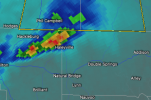
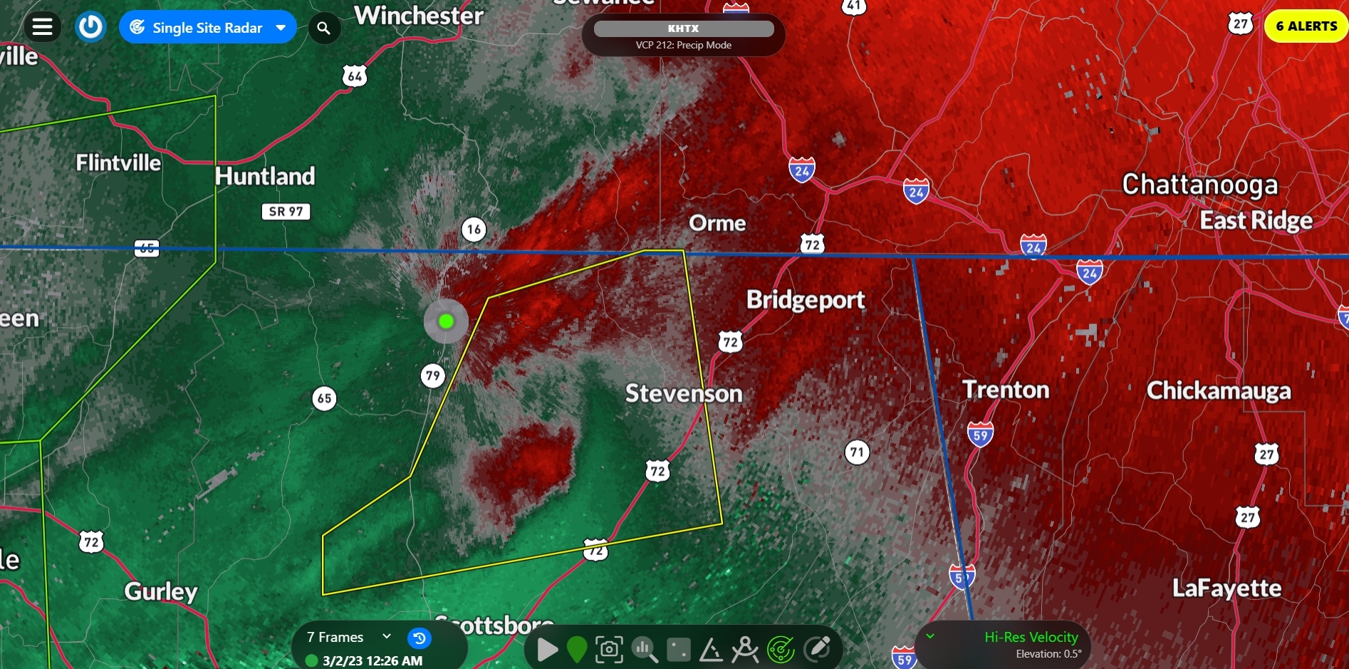
The storm has a tornado warning now.
Last edited:
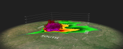
There was a brief TDS with that one.
Timhsv
Member
Anyone know where these specific SPC graphics are located with the regions zoomed in and the cities?
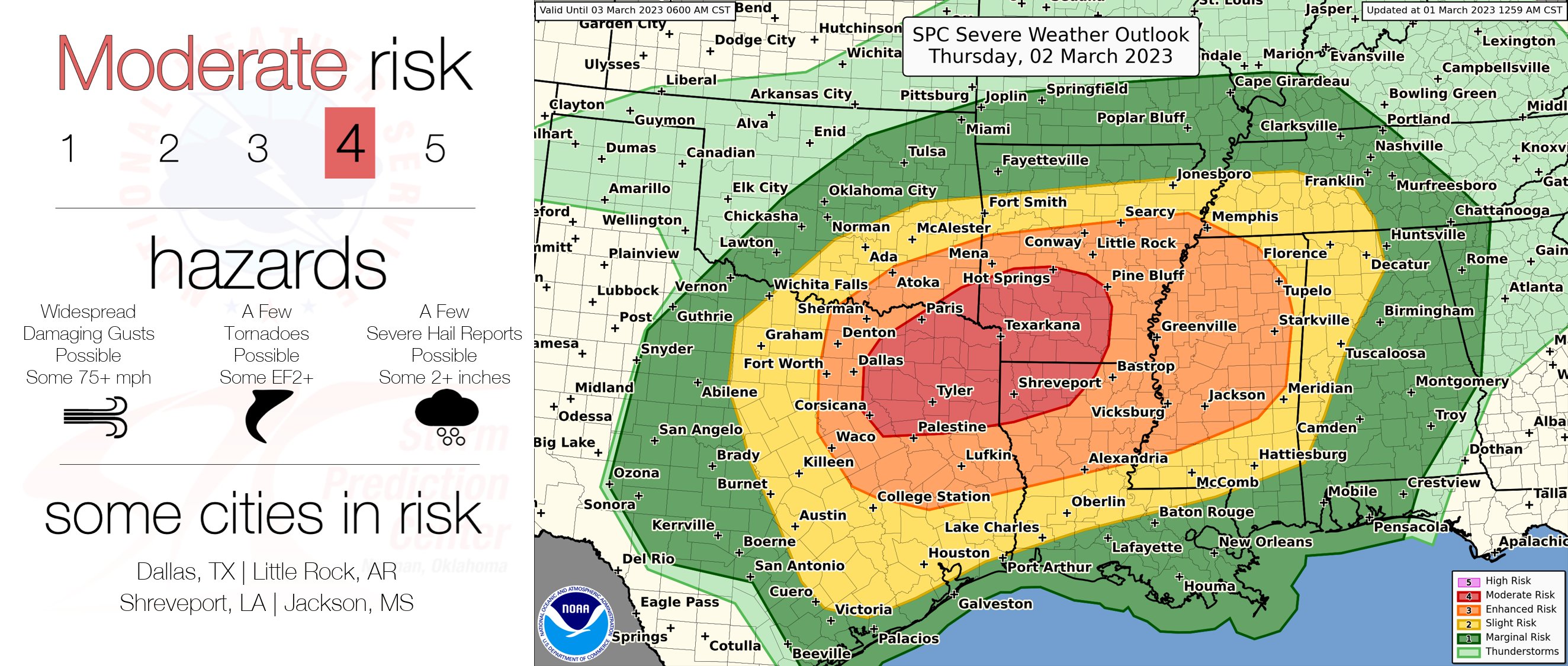
Not exactly like that but check out https://www.spc.noaa.gov/partners/outlooks/Anyone know where these specific SPC graphics are located with the regions zoomed in and the cities?