

Navigation
Install the app
How to install the app on iOS
Follow along with the video below to see how to install our site as a web app on your home screen.
Note: This feature may not be available in some browsers.
More options
-
Welcome to TalkWeather! We see you lurking around TalkWeather! Take the extra step and join us today to view attachments, see less ads and maybe even join the discussion. CLICK TO JOIN TALKWEATHER
You are using an out of date browser. It may not display this or other websites correctly.
You should upgrade or use an alternative browser.
You should upgrade or use an alternative browser.
Severe Weather Threat - October 25/26th, 2025
- Thread starter WeathermanLeprechaun
- Start date

Cyclonic Paracosm
Member
upgraded to an observed tornado warning for Lake Charles

joshoctober16
Member
chaser in lake charles
Kds86z
Member
Kds86z
Member
joshoctober16
Member
chaser in lake charles
power flashes on the stream , its now in downtown area.
Kds86z
Member
Kds86z
Member

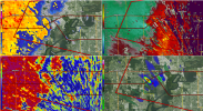
Kds86z
Member
Kds86z
Member
Kds86z
Member
- Thread starter
- #93

WeathermanLeprechaun
Member
I could've stayed up for the 3-4am stuff actually but decided not to.
POSTMORTEM:
Mischievous QLCS spinups on the TX/LA border AND a tornado that hit areas of Lake Charles.
Guess the 5% verified somewhat?
POSTMORTEM:
Mischievous QLCS spinups on the TX/LA border AND a tornado that hit areas of Lake Charles.
Guess the 5% verified somewhat?
- Thread starter
- #94
WeathermanLeprechaun
Member
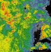
- Thread starter
- #95
WeathermanLeprechaun
Member
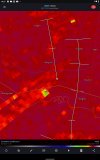
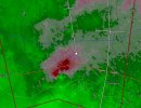
- Thread starter
- #96
WeathermanLeprechaun
Member
Currently monitoring a camera as this tornado passes by it!
Briefly condensed cone with brief vortices at the Pasacagoula River Bridge! Best camera catch I've ever had, couldn't get a screenshot in time though :/
Briefly condensed cone with brief vortices at the Pasacagoula River Bridge! Best camera catch I've ever had, couldn't get a screenshot in time though :/
Kds86z
Member
Kds86z
Member
- Thread starter
- #99
WeathermanLeprechaun
Member
Was a pretty intense moment for me! I was actually in slight shock even seeing it, first time I've managed to get one myself looking thru traffic cams.
Kds86z
Member
Dang