
Navigation
Install the app
How to install the app on iOS
Follow along with the video below to see how to install our site as a web app on your home screen.
Note: This feature may not be available in some browsers.
More options
-
Welcome to TalkWeather! We see you lurking around TalkWeather! Take the extra step and join us today to view attachments, see less ads and maybe even join the discussion. CLICK TO JOIN TALKWEATHER
You are using an out of date browser. It may not display this or other websites correctly.
You should upgrade or use an alternative browser.
You should upgrade or use an alternative browser.
Severe Weather Threat May 7-10, 2024
- Thread starter MichelleH
- Start date
Of course! It absolutely provides peace of mind when you can know what you're looking at.Ok. I think those are the ones I’m using as well. Thanks! I was pleasantly surprised last night to spot some rotation in Tennesse that was affirmed by someone else on this board. It makes me feel safer knowing I might be able to spot trouble in a local area by myself.
cincywx
Member

Recovery already well underway behind the current line of storms, which should be east of me in the next 2-2.5 hours.
FFC suggesting an almost summertime MCS threat with upcoming disturbances; uncertainties remain regarding placement & intensity. Also, it's so hot today; just went out to get the mail and it feels like hades out there.
.LONG TERM...
(Wednesday night through Monday)
Issued at 336 AM EDT Tue May 7 2024
An ongoing potentially active weather period will characterize the
start of the long term forecast Wednesday night into Thursday
morning. Convection, some likely severe, will be in progress
somewhere across the Tennessee Valley in the form of one or multiple
MCSs Wednesday night. This activity should gradually progress east-
southeastward in the well in advance of the surface cold front
through Thursday morning. Models tend to struggle in this type of
environment regarding the placement/timing of convection, so a
significant degree of uncertainty does remain. With that said, in
general PoPs will be on the increase across north Georgia from
late Wednesday night into Thursday morning with some associated
severe potential also increasing through this time. Given 0-6 km
bulk shear values of 40-50+ knots, damaging wind gusts would be
the primary concern with any convective complex that could enter
north Georgia with large hail and perhaps an embedded brief spin-
up tornado threat as well. To highlight this potential, SPC has
maintained a Slight Risk for far north Georgia and a Marginal Risk
down to roughly I-20 for the late Day 2 period from late
Wednesday night into early Thursday morning.
As we head later in the day on Thursday, the surface cold front will
begin to approach and push into the area. The front will get its
most sustained push into the area by Thursday afternoon as the upper
trough deepens across the Great Lakes. Additional convection will
likely develop in advance of the front by Thursday afternoon, though
coverage and degree of additional severe potential will to some
degree depend on the evolution of morning convection and any
lingering boundaries/cold pool. If forecast instability is
realized, a resurgent severe threat would be likely by Thursday
afternoon/evening. Amid still-favorable deep layer shear and 6-7
C/km lapse rates, damaging wind gusts and large hail could be
expected. A Day 3 Slight Risk thus envelopes most of the area
generally along and south of the I-85 corridor to account for this
risk. Lastly, models continue to highlight a potential eastward-
moving MCS that would track along/north of the Gulf coast late
Thursday into Thursday night that could possibly skirt southern
portions of the area and perhaps pose an additional severe risk.
notsoencrypted
Member
The leading edge of the line went through at about 7:30 CDT here (the difference in darkness from when I woke up to when it moved over was amazing), and now at 11:30 the sun is trying to peek out. I know we're not in anything more than a marginal risk, but I'll be intrigued to see what we get.
CheeselandSkies
Member
The leading edge of the line went through at about 7:30 CDT here (the difference in darkness from when I woke up to when it moved over was amazing), and now at 11:30 the sun is trying to peek out. I know we're not in anything more than a marginal risk, but I'll be intrigued to see what we get.
Interesting that Nadocast has the 5% tornado probability extending northwest across southern WI, while SPC stuck with 2% at 1630Z (and actually trimmed it back a bit, roughly to where Nadocast's 5% is). Some HRRR runs occasionally show a stronger supercell moving through southern Wisconsin sometime this afternoon/evening, but the location/timing has bounced around a lot from run to run and the modeled environment isn't particularly impressive. Not planning to chase at this time but will monitor things this afternoon.
Last edited:
Aaron Rider
Member
When WAS Michigan's last violent tornado anyway? If memory serves me right, no F4s in Michigan in at least 3 decades. Not sure about 3sIf I were Indiana I’d be asking what Illinois and Michigan are doing to avoid strong tornadoes
atrainguy
Member
I believe 1977, when there were 2 F4s near Battle Creek. Last EF3 was 2022 in Gaylord. Kinda makes me nervous, seems like we're long overdue, and I live in one of the tornado alleys of Michigan (Genesee County).When WAS Michigan's last violent tornado anyway? If memory serves me right, no F4s in Michigan in at least 3 decades. Not sure about 3s
Aaron Rider
Member
Tell me about it. A good friend is in Hillsdale, a definite historic alley.I believe 1977, when there were 2 F4s near Battle Creek. Last EF3 was 2022 in Gaylord. Kinda makes me nervous, seems like we're long overdue, and I live in one of the tornado alleys of Michigan (Genesee County).
atrainguy
Member
Ahh yeah, that's one of the areas hit by the two back to back F4s on Palm Sunday '65 isn't it?Tell me about it. A good friend is in Hillsdale, a definite historic alley.
CheeselandSkies
Member
Storm Prediction Center Mesoscale Discussion 676
Severe weather, tornado, thunderstorm, fire weather, storm report, tornado watch, severe thunderstorm watch, mesoscale discussion, convective outlook products from the Storm Prediction Center.
www.spc.noaa.gov
Tornado watch forthcoming for portions of northeast/east-central IL into western IN. Although the text notes that they expect the greater tornado threat to be primarily in IN.

tennessee storm chaser
Member
- Messages
- 1,877
- Reaction score
- 4,283
- Location
- jackson tennessee
- Special Affiliations
- SKYWARN® Volunteer
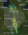
Little south more alsoD2 now has expanded the Slight eastwards.
View attachment 26672
tennessee storm chaser
Member
- Messages
- 1,877
- Reaction score
- 4,283
- Location
- jackson tennessee
- Special Affiliations
- SKYWARN® Volunteer
They also thought bout upgrade . But decided wait see
That's a chonker of an Enhanced/Slight areaD2 now has expanded the Slight eastwards.
View attachment 26672
atrainguy
Member
CheeselandSkies
Member
Although not warned at the moment, some supercell characteristics are apparent with the cell moving through the Rockford, IL vicinity, northeast toward Walworth County, WI. However, any peeks of sunshine here in Madison late this morning/early this afternoon have been pretty brief/muted.
James Sm.
Member
The cell just east of Janesville looks to be shaping up as wellAlthough not warned at the moment, some supercell characteristics are apparent with the cell moving through the Rockford, IL vicinity, northeast toward Walworth County, WI. However, any peeks of sunshine here in Madison late this morning/early this afternoon have been pretty brief/muted.
Tanner
Member
Tornado watch is out. 70/40 probs for tornadoes. That's pretty high.
