• Welcome to TalkWeather!
    We see you lurking around TalkWeather! Take the extra step and join us today to view attachments, see less ads and maybe even join the discussion.
    CLICK TO JOIN TALKWEATHER

Severe Weather Threat May 17-19, 2025

Perfect example of the inconsistency among different WFO’s and the application of the EF-scale.

Friday May 16–great use of contextual evidence to upgrade, and adequately captures the true violence of the tornado

Sunday May 18–complete ignorance of the contextual evidence, and thus a tornado that will go down as much weaker than it was

So sad. I like consistency
 
Earlier this morning I went and photographed some incredible damage to vegetation along this road 3 miles south of Grinnell, Kansas. The tornado left virtually not a blade of grass standing in the ditch on either side of the road, and in some locations scoured the ground to where there was just dirt behind. The centerline of the tornado was made remarkably visible as well in the soil as it crossed the road. I also noticed an old corn field to the south had essentially all dead corn stalks removed and several sizeable gouges in the soil from intense vortices. Some of these cornstalks were speared into the side of the ditch like lawndarts. This was the most intense scouring I was able to find along the path.
View attachment 42798View attachment 42799View attachment 42800View attachment 42801View attachment 42802View attachment 42804View attachment 42803View attachment 42807View attachment 42806View attachment 42805
Just out of curiosity, have you surveyed the first two tors near Greensburg yet? I saw almost zero info about these two, the only damage I can get likely from this post.
 
The most violent tornado of the day was no doubt the Plevna tornado, that thing was high end without a doubt. Whether it produced damage further W of Plevna to prove it, I'm not sure yet.
 
Earlier this morning I went and photographed some incredible damage to vegetation along this road 3 miles south of Grinnell, Kansas. The tornado left virtually not a blade of grass standing in the ditch on either side of the road, and in some locations scoured the ground to where there was just dirt behind. The centerline of the tornado was made remarkably visible as well in the soil as it crossed the road. I also noticed an old corn field to the south had essentially all dead corn stalks removed and several sizeable gouges in the soil from intense vortices. Some of these cornstalks were speared into the side of the ditch like lawndarts. This was the most intense scouring I was able to find along the path.
View attachment 42798View attachment 42799View attachment 42800View attachment 42801View attachment 42802View attachment 42804View attachment 42803View attachment 42807View attachment 42806View attachment 42805
This is some of the more impressive ground scouring I’ve seen photographed.
 
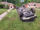
One of the most confusing DIs of this whole outbreak sequence has to be the cars in Bloomington, IN. Looks like they got tossed and demolished, but most of the nearby houses only suffered minor roof damage. The worst roof damage is next to the worst damaged cars though. So the tornado must've been razor thin in this location.

1747815829314.jpeg1747815842449.jpeg1747815865538.jpeg1747815877722.jpeg

The most controversial aspect of this EF2 rating isn't even the cars. Toward the end of the tornadoes path as it entered some foothills and valleys it rapidly intensified. It absolutely mangled trees, scoured the ground, and swept away a home. The home was described in the DAT as "All walls collapsed, but there was poor anchoring and debris loading".

1747816005298.jpeg1747816155946.jpeg1747816096122.jpeg1747816118269.jpeg1747816129055.jpeg

If there's one thing I HATE most about current survey practices, it's the use of incorrect DIs to access lower wind speeds. If you have to use the lower bound, that's absolutely fine, but don't log inaccurate, falsified data on purpose! As poorly built/anchored as that home may have been, it's GONE. And the contextual damage surrounding it is very impressive. "All walls collapsed" doesn't even remotely describe the actual damage that occurred here. Meanwhile, even mobile homes that are tossed fair distances are classified as EF3 DIs. Yet, this was rated EF2.
 
Last edited:
Another EF3 in Morganville, Kentucky uprooted corn crops and scoured the ground at the beginning and end of its path. In the middle it basically completely slabbed two homes. Both were once again classified as "all walls collapsed".

1747817579101.jpeg1747817589638.jpeg
1747817666538.jpeg1747817724302.jpeg

In my opinion the contextual tree damage justifies an upgrade to EF4
 
Back
Top