
Kds86z
Member
lol. chill down Reed.
Follow along with the video below to see how to install our site as a web app on your home screen.
Note: This feature may not be available in some browsers.


It really is an impressive mini supercell, especially for a storm west of the Rockies.Thats what I thought lol.
View attachment 52879
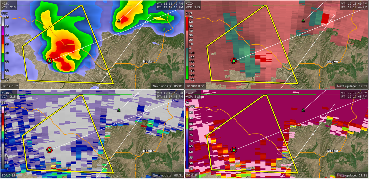
Was just about to post that.Tornado Warning for Meeker, CO.


There's now a tornado warning on the line:There's a line of storms just north of the Nebraska-South Dakota border, and it looks like it'll be traversing the northern end of the 15% tornado risk area fairly soon. I wonder what that will do to the risk in that area?

So WeathermanLeprechaun gets banned for harsh but very fair criticism of how this site is run, but crap like this faces no punishment whatsoever??Instead of crying to mods like a little b*tch why don't you address me like a man? Or do you need to be dominated too?

I have a legitamate question. You’re a bright guy judging by some of your posts, and then you veer into this bizarre sh*tposting territory mixed with eroticism for men. Absolutely no judgement if that’s real, but I think you just do it as some sort of joke. Do you just find that kind of shock humor funny?i'm starting my own weather forum, a better more functional alternative to this place. it's invite-only though, and you're not exactly showing me that you are getting an invite.