Kds86z
Member
Gosh, I forgot to mention this. Shortest track eF5 someone on X said.Amazing also that Enderlin was not a long-tracker. It’s path was less than 15 miles and down only about 20 minutes.
Follow along with the video below to see how to install our site as a web app on your home screen.
Note: This feature may not be available in some browsers.
Gosh, I forgot to mention this. Shortest track eF5 someone on X said.Amazing also that Enderlin was not a long-tracker. It’s path was less than 15 miles and down only about 20 minutes.
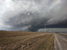
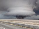
Yeah on top of that, does anybody know how it became a wedge in that short time frame? I know wedges can form from a multi vortex structure but I haven’t really seen any documentation if it was a large cone that descended or a large multi vortex.Amazing also that Enderlin was not a long-tracker. It’s path was less than 15 miles and down only about 20 minutes.
Yeah on top of that, does anybody know how it became a wedge in that short time frame? I know wedges can form from a multi vortex structure but I haven’t really seen any documentation if it was a large cone that descended or a large multi vortex.


Yeah, I know they do tend to form very quickly in some cases, Elmer 2015 formed rapidly into a wedge. 2016 Sulphur did the same thing. And that shot you got still amazes me. I just didn’t see any documentation of its formation. Most if not all videos or pictures show it as the mile-wide wedge.Tornadoes can "wedge out" very quickly. Per one of the few clear videos that exists of it, Joplin went from wispy multiple vortices to churning black wedge in less than a minute.
I've even seen it myself. Per the timestamps on the pictures in my phone; Keota went from this (white nub above the dust cloud just behind the tree line, with the original Ottumwa EF3 behind it):
View attachment 46968
...to this in less than four minutes:
View attachment 46969
Great photos @CheeselandSkies!Tornadoes can "wedge out" very quickly. Per one of the few clear videos that exists of it, Joplin went from wispy multiple vortices to churning black wedge in less than a minute.
I've even seen it myself. Per the timestamps on the pictures in my phone; Keota went from this (white nub above the dust cloud just behind the tree line, with the original Ottumwa EF3 behind it):
View attachment 46968
...to this in less than four minutes:
View attachment 46969
Not a very deep moist layer as well. It was very iffy on whether we'd get cells out ahead of the derecho, especially since temp dew spreads were forecasted to be a bit wider than they actually verified.Interestingly, not a whole lot (45 j/kg) of 0-3KM CAPE on that sounding. Perhaps it verified locally higher where the tornado occurred, or maybe the monster SRH just made up for it.
Not a very deep moist layer as well. It was very iffy on whether we'd get cells out ahead of the derecho, especially since temp dew spreads were forecasted to be a bit wider than they actually verified.
That’s something I learned this season. I always thought “more moisture = better”, but as we saw on 3/15, over saturation can actually damper an event.Eh, in my experience a moist layer that goes up to about ~800-750 MB before sharply drying out is actually the sweet spot for significant tornadoes, especially photogenic ones. Shallower than 850mb, or still close to saturated at or above 700mb is when you can start to have problems either with mixing out, with lapse rate issues causing problems for updraft maintenance, or at least with grungy storms and tornadoes that look like spinning fog banks.
Correct, I remember Trey from CC saying this on his forecast discussions at different times or in some past setups that did not go nuclear and had this caveat.That’s something I learned this season. I always thought “more moisture = better”, but as we saw on 3/15, over saturation can actually damper an event.
The second I saw the PNS link on Discord my heart rate shot up for some reason and it took several hours to come back down when I realized it hadn't been hacked. Almost passed out on my way to algebra class (I'm not joking, I legitimately started getting light-headed). Still don't know why that happened; probably just autism.I mean. Yeaaa? When an artificial statistical anomaly of this calibre lasting so long, is finally broken. It's gonna break the internet.
I had a similar reaction.
Sorry to hear that @Central Ohio Wx. That you passed out.The second I saw the PNS link on Discord my heart rate shot up for some reason and it took several hours to come back down when I realized it hadn't been hacked. Almost passed out on my way to algebra class (I'm not joking, I legitimately started getting light-headed). Still don't know why that happened; probably just autism.
Says he almost passed out, not that he did.Sorry to hear that @Central Ohio Wx. That you passed out.be safe
