KevinH
Member
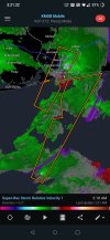
Shocker… clearly they do not know how Dixie behaves SMH.The Twitter kiddos are already bustposting on birdsite, even though MOB didn't expect much activity until after midnight CST.
Tomorrow, you should reply to one of their posts. You know, as a “follow up” LOL!!!