• Welcome to TalkWeather!
    We see you lurking around TalkWeather! Take the extra step and join us today to view attachments, see less ads and maybe even join the discussion.
    CLICK TO JOIN TALKWEATHER

Severe Weather Threat - Jan 11-12th, 2024

The system moves super fast though (which maybe a silver lining) so it may not have time to pull it up further that's one thing that may help mitigate the threat for some areas and why the higher instability doesn't move north fast enough. But idk bares watching, I just finally started looking at this one now that today's event has passed by.
yes, that is how it looks NOW.

Watch, the system is going to slow down… just bc it’s Dixie who likes to flip us off.
 
More concerned than you were about todays system?
Yes and especially concerned that SPC explicitly mentions environmental conducive for discrete supercell development.

"Increased inhibition and weaker mid/upper support might actually be
more conducive to discrete supercell development in the presence of
intense wind fields (including 50-80+ kts in the 850-700 mb layer)
and low-level shear. And models suggest that a dryline structure
might develop ahead of the cold front trailing the cyclone as it
progresses eastward."
 
It is very fortunate for AL and GA that this current system is going to limit moisture return for Friday's event, because that 500 mb setup is just about as classic as it gets for the SE and there is indeed a very strong signal for a pre-frontal trough (favoring discrete supercells) across guidance. Still, a significant event is possible closer to the Gulf Coast.

1704837936013.png
 
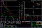
@andyhb, glad you finally decided to chime in here. Any thoughts on why the forecast hodographs on the GFS/NAM have just not been as dramatic across the board with the Friday event as they were for today's; despite an equally impressive trough and surface response?

I noted earlier in the thread that even pretty far out the GFS picked up on the extreme SRH values eventually observed (>900 m2/s2 0-3km at LIX last night, 895 m2/s2 on a KLTX VWP from this afternoon, for example). While the raw SRH numbers on the forecast soundings I'm cherry picking are certainly substantial, the wind barbs look pretty unidirectional from the surface up to around 700mb, with even a little bit of backing there, too.

Seems for some reason the models are just not picking up on a similar sort of firehose LLJ that took the sfc-1KM winds up to the 70-80kt range last night and today, despite another bombing surface low.

nam_2024010918_075_31.5--84.34.png
 
@CheeselandSkies come on down to the deep south and get some more good tornado pics friday ;).

If this threat comes up my way in Birmingham I'm heading to West Jefferson county and waiting for the typical Jefferson county tornadic cell to get a good pic
Ooooh yeah, come on down to Dixie where if you travel north by 20 miles it's 45 F and raining and if you travel 20 miles south you run head first into a wedge on a clogged highway. /s
 
Ooooh yeah, come on down to Dixie where if you travel north by 20 miles it's 45 F and raining and if you travel 20 miles south you run head first into a wedge on a clogged highway. /s
Sounds like ideal conditions! Hahaha

Told my buddy at work to get his drone ready that's the only way we are going to see a tornado with all these dang trees around here lol
 
Ooooh yeah, come on down to Dixie where if you travel north by 20 miles it's 45 F and raining and if you travel 20 miles south you run head first into a wedge on a clogged highway. /s
@Clancy DRIVE SOUTH! Remember that. LOL!
 
It is very fortunate for AL and GA that this current system is going to limit moisture return for Friday's event, because that 500 mb setup is just about as classic as it gets for the SE and there is indeed a very strong signal for a pre-frontal trough (favoring discrete supercells) across guidance. Still, a significant event is possible closer to the Gulf Coast.

View attachment 23193
Shhhhh… Don’t say that too loud. Dixie heard you and will probably do something to increase the moisture now…
 
Last edited:
I'm glad I looked at that closely. Almost had to do a doubletake as I thought you said it sure do be a hooker. LOL! I'm tired.
Oh man, that would've been an interesting way to put it haha.
 
Back
Top