Severe WX Severe Weather Threat - December 8th-10th, 2023

Ark Delta roads are good. MS/LA Delta is baaaaddd
I guess that's not surprising given the low population density but obviously not ideal for chasing purposes unless you wanna end up driving down Bob's Road. That's really the only area where it looks like you're gonna have decent CAPE with appreciable shear but the SRH values still aren't anything special.
 
Sounding off the 3km NAM near the Monroe County, MS and Alabama line.
Sounding off the NAM in western Calhoun County. NAM I notice is slower than the 3km NAM.
 

Attachments

  • 2023120712_NAM_060_33.97,-89.47_severe_sfc.png (Calhoun County).png
    2023120712_NAM_060_33.97,-89.47_severe_sfc.png (Calhoun County).png
    73.6 KB · Views: 0
  • 2023120712_NAMNST_060_33.93,-88.34_severe_sfc.png
    2023120712_NAMNST_060_33.93,-88.34_severe_sfc.png
    75.6 KB · Views: 0
All I was trying to say for the get-go, was don't let your guard down because models weren't showing this as a significant threat. Somehow, it got all blown up over nothing.  I have been doing this for almost 20 years. I think I know how these systems could change on the dime especially here in North MS. Moving on...
 
Updated JAN Discussion
Friday night into Saturday: Main focus for the forecast period is
on severe weather potential late Saturday. Southerly low level
flow will begin strengthening Friday night ahead of a deepening
longwave mid/upper trough. Isolated to scattered warm advection
showers will be possible Friday night, with greater coverage
possible toward Saturday morning as a weak leading shortwave
passes across the Mid South. Given strong deep layer shear and
sufficient elevated instability, a few storms are also possible.

More robust activity won't arrive until stronger forcing does via
upper level height falls and a cold front approaching later in
the day Saturday. Storms are expected to develop along the front
west of the area during the afternoon and begin reaching the
ArkLaMiss/Delta area closer to the late afternoon/early evening
time frame. Initial development may be more cellular, with strong
deep layer shear, moderate instability, and somewhat steep mid
level lapse rates providing potential for damaging wind gusts and
large hail. The strongest low level SRH currently looks to stay
out of phase with the stronger convection, so though we can't rule
tornadoes out, the threat looks relatively low. As storms advance
eastward, mode will quickly become more linear and eventually
begin to lose steam by late evening with the loss of instability.
A strengthening low level jet across north MS may help to offset
this limitation somewhat and maintain greater severe potential at
least over the northern half of the area. More of a lagging line
and lesser low level flow may help to limit severe potential more
over the southern half of the area. Convection will exit the area
during the late overnight/early Sunday morning hours. Overall,
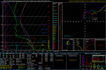
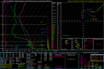
there are no major changes to previous severe outlook graphic, so
it will be maintained.
 
If the GFS model is correct, you're gonna have to make another thread in the middle of December. And it does not look good at all.
Tell Pulp Fiction GIF
 
I'm impressed by the 21z rap.

Id like to see more shear though.
Guess we gotta rely on the nocturnal jet... Sigh ..
 
If the GFS model is correct, you're gonna have to make another thread in the middle of December. And it does not look good at all.
I've been telling James Bishop for quite some time now that this feels like December 2015....and I would not be surprised to see a more potent severe system mid December.
 
I've been telling James Bishop for quite some time now that this feels like December 2015....and I would not be surprised to see a more potent severe system mid December.
I too have had the 2015 vibe. Definitely not a Super El Nino by any means, but we did get flooded pretty bad Christmas Day that year.
 
Back
Top