
- Moderator
- #1
The active pattern continues into the weekend.
Follow along with the video below to see how to install our site as a web app on your home screen.
Note: This feature may not be available in some browsers.
Looks like we are in line for some hail and heavy rain in south central Texas.The active pattern continues into the weekend.
Heavy wind and rain here. Storms are starting to rotate as they move north and east of our area where the enhanced risk area begins.
Two warnings out currently.
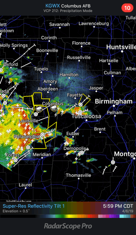
A bit of flooding!!It’s dumping in Tuscaloosa.
This city floods in the smallest shower.A bit of flooding!!