• Welcome to TalkWeather!
    We see you lurking around TalkWeather! Take the extra step and join us today to view attachments, see less ads and maybe even join the discussion.
    CLICK TO JOIN TALKWEATHER

Severe WX Severe Weather Threat 4/5/17-4/6/17

Are models still


Ok is there a model that initialized correctly that you could show? Are the models still showing supercell development east of 65 in TN?

They're all showing it but even the NMMB that had initialized well at 0z was crap.
 
I will be surprised if Birmingham/Tuscaloosa have another Tornado Watch issued. There is absolutely nothing forming over Mississippi or western Alabama. One last storm moving through Shelby County and that should be a wrap for the Birmingham area. Threat continues for a couple more hours over the eastern counties... but even there... I'm not so sure we see a whole lot. Definitely looks like a GA/SC event.
 
I will be surprised if Birmingham/Tuscaloosa have another Tornado Watch issued. There is absolutely nothing forming over Mississippi or western Alabama. One last storm moving through Shelby County and that should be a wrap for the Birmingham area. Threat continues for a couple more hours over the eastern counties... but even there... I'm not so sure we see a whole lot. Definitely looks like a GA/SC event.

So TN looks like it's clear then?
 
Alabama Law Enforement twitter account reports a tornado touched down in northern Henry County at White Oak and Sunset Acres in the Calhoun Drive area; damage has been reported
 
Anyone notice that Dew points that were rising in Northern Alabama are now falling?
 
I will be surprised if Birmingham/Tuscaloosa have another Tornado Watch issued. There is absolutely nothing forming over Mississippi or western Alabama. One last storm moving through Shelby County and that should be a wrap for the Birmingham area. Threat continues for a couple more hours over the eastern counties... but even there... I'm not so sure we see a whole lot. Definitely looks like a GA/SC event.

You've more or less posted this multiple times now. The threat is far from over for the Birmingham area.
 
RAP is the only model not initializing like garbage afaik, shows the northern cells popping over W AL and Central TN within a couple hours.
 
304f0bf7035a415a2800e2a6df884f0a.jpg


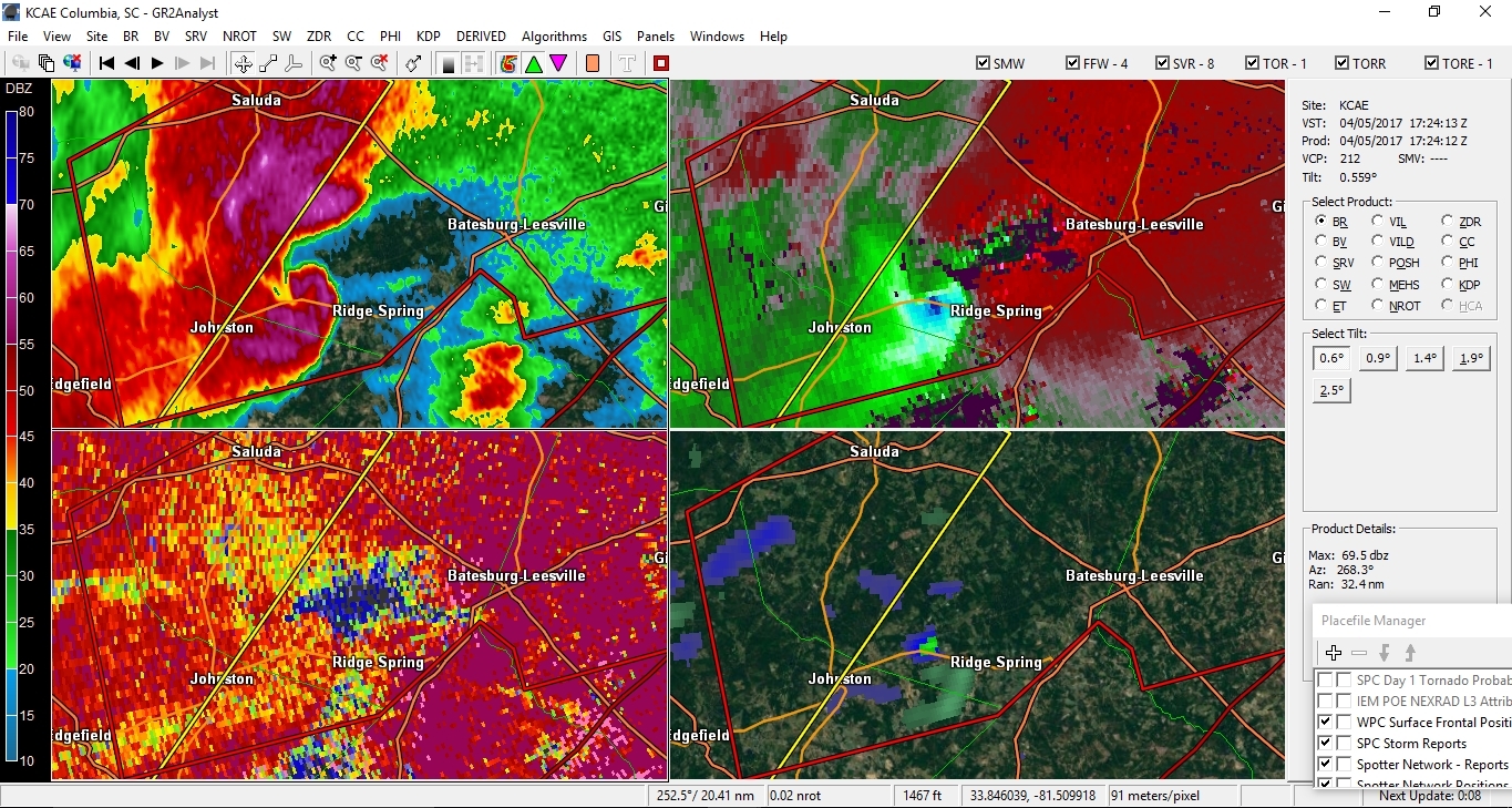
well that's a pretty cool looking hook. wraps all the way around. probably looking at a significant tornado dropping on this one within the next few minutes.
 
If KFFC gets hit by a tornado and also goes down for the day, we're utterly screwed.

I am not just saying this to be controversial, but KEOX and KMXX being down is absolutely criminal. Congress, the last admin, the current admin, etc should all be ashamed of themselves for not properly funding the maintenance, technicians, and parts necessary to make sure any NEXRAD that is down during a critical period can be repaired ASAP. Considering the potential property damage and risk to lives, it enrages me to know that our country with billions of dollars cannot adequately fund and maintain the WSR-88D network. There is simply no excuse. With proper funding the right amount of spare/surplus parts and technicians could be made available.
 
BMX has pulled their moderate risk to the east.

17757535_1335956989777047_470243906784129_n.png


12:25pm WEATHER FORECAST UPDATE from NWS Birmingham:

Here is the latest severe weather threat graphic for later on this afternoon through this evening across Central Alabama. We have adjusted the severe threat areas based on the latest data. A good portion of Central Alabama remains under a significant threat of severe storms, with all types of severe weather possible. Strong tornadoes remain possible across eastern and northeastern portions of Central Alabama, where the best wind shear remains in place. Once again, don't let your guard down, as we're going to likely see more severe storms developing from 2pm through this evening.
 
Back
Top