• Welcome to TalkWeather!
    We see you lurking around TalkWeather! Take the extra step and join us today to view attachments, see less ads and maybe even join the discussion.
    CLICK TO JOIN TALKWEATHER

Severe WX Severe Weather Threat 3/14-3/16

I know this is somewhat of a long shot, but if wild fires are as bad as expected tomorrow, could we have an issue where smoke increases the strength of the EML? I remember that being an issue during the 2019 Oklahoma high risk Forecasted Convective Amplification Deficiency.
When SPC mentions a "possible wildfire outbreak" with "near historic conditions" it's definitely something to consider. Will be quite an interesting scenario to be honest, if that were to occur. Unsure as to what effect it would have.
 
In terms of West/Middle TN, I am thinking the greatest threat is Saturday AM and that there is going to be too much precipitation to take advantage of the other uptrending dynamics (which are of course not as impressive as MS/AL) on Saturday evening. Probably a strong wind threat- which can be destructive in its own right- but a much lower tornado threat.

I would love to hear what the experts (and maybe even you self-proclaimed experts) think on this.
 
Doubtful...cause wildfires aren't a guarantee
I mean, yeah, but neither are tornadoes on either day. The fire risk is absolutely more strongly worded than the severe risk is, and that's saying something because the severe risk is very strongly worded.

However, i did say if the fires were to occur. Doesn't mean it will happen, but widespread smoke seems to be a very real possibility here. Now, I am not smart enough to know if oklahoma/texas/kansas/missouri caught on fire, would the smoke advect into the warm sector or not, and if so, what the impact of it could be.
 
When SPC mentions a "possible wildfire outbreak" with "near historic conditions" it's definitely something to consider. Will be quite an interesting scenario to be honest, if that were to occur. Unsure as to what effect it would have.
At least for Saturday, the mid-level air from the MS/AL/TN warm sector isn't coming from Oklahoma. It's coming from the northern Mexican plateau. But an EML is needed for a significant tornado event, and a slightly stronger cap than what is face value modeled in the CAMs at the current moment. They are trending in the direction they need to, however.
 
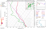
Iowa now showing the highest CAPE in the country tomorrow afternoon. It's crazy how primed the atmosphere is if there was more moisture to work with. Can anyone pull a more detailed sounding or give some insight about what i'm seeing here?


1741901142964.png

1741901549034.png
 
I know this is somewhat of a long shot, but if wild fires are as bad as expected tomorrow, could we have an issue where smoke increases the strength of the EML? I remember that being an issue during the 2019 Oklahoma high risk Forecasted Convective Amplification Deficiency.
There were a lot more issues with 5/20/2019 than the wildfires. I’d recommend watching Trey’s video on it. There was a major wildfire in Mexico during the 4/27/11 outbreak as well. I’m not saying that the wildfires had zero impact, but there was more wrong with that set up than that. You also have to remember, Caps can be so stout in the plains because of their proximity to the EML source region.
 
Also, I'm not necessarily convinced the wildfire smoke itself would have the same effect in warming the mid-levels over a wide area that you get from an actual EML source region. Still though, with the strongest 850mb winds advecting any smoke right into the first initiation points around IA/MO ~21z, and in a case where there may be some capping issues, perhaps it could put things on slightly the wrong side of marginal and delay initiation for a little while. Still, with the strength of the synoptic scale forcing I would be surprised if that had a major impact. Nevertheless, it will still be interesting to see unfold and might make for some pretty insane satellite imagery. Hopefully fires are limited for the sake of those in OK and TX.

1741902209773.png
 
Nam now showing increased energy BEHIND the first line of storms. The first few runs showed the storms clearing all the CAPE out, but now it's acting like they're actually going to amplify it.

1741901968562.png
 

Attachments

  • 1741901914845.png
    1741901914845.png
    261.8 KB · Views: 0
Was just reading Spann's afternoon disco and what just struck me was the abscense of the mention "Will this be like 4/27/11....no that was a generational outbreak" He has always included that in past systems since 2011. Just thought that was interesting since there has been then discussion of how deliberate he is with his messaging and wording.

KEY MESSAGES


*Our goal for any severe weather event in Alabama is no loss of life, and no serious injuries. It takes us all working together to make that happen. Everyone must have a reliable way of hearing warnings. Never, ever an outdoor siren. Never. A NOAA Weather Radio should be in every Alabama home and business. On your phone, have WEA (Wireless Emergency Alerts) enabled (look under notifications and be sure “emergency alerts” are active), and have the 33/40 weather app installed.


*In your safe place, have helmets for everyone, including adults. Most serious injuries in tornadoes involve blunt force trauma above the shoulders. Wearing hard shoes is also a good idea. Have a portable air horn for everyone; they can alert first responders to your location if you are injured.


*If you live in a mobile home, know the location of the nearest shelter, or business open 24/7 that can serve as a shelter. Have transportation arranged so you can get there quickly. You cannot stay in a mobile home if you are in a tornado warning polygon.


*If you are reading this, you pay attention to weather. Understand many people don’t keep up with the weather, so you can be a hero during the severe weather event. Let them know this is a high end threat. During the event, if you have a friend or loved one in a tornado warning polygon, call or text them to let them know of the immediate danger. You can play a huge role in saving lives.


*Subscribe to the James Spann and ABC 33/40 YouTube channels so you can watch our live coverage. We are thankful for the out of state YouTubers who do long form severe weather coverage, but to be truly successful in reaching people and communicating warnings in high end severe weather events like this, you have to understand the people, culture, geography, and microclimate of the region impacted.


*We don’t share any of this to scare people. But strong wording is necessary on occasion, and this is one of those times. Get the warnings, have a good plan, and we get through this together.
Him sharing the STP this morning felt like a subtle and intentional callback to 2011. That was my initial thought at least.
 
Nam now showing increased energy BEHIND the first line of storms. The first few runs showed the storms clearing all the CAPE out, but now it's acting like they're actually going to amplify it.

View attachment 35360

Here's a side by side *synchronized* comparison of CAPE and Precip

1741902514372.gif1741902563891.gif

@jiharris0220 any thoughts on this?
 
Last edited:
There were a lot more issues with 5/20/2019 than the wildfires. I’d recommend watching Trey’s video on it. There was a major wildfire in Mexico during the 4/27/11 outbreak as well. I’m not saying that the wildfires had zero impact, but there was more wrong with that set up than that. You also have to remember, Caps can be so stout in the plains because of their proximity to the EML source region.
Not denying that there were more issues than wildfires that day, just curious if anyone had any thoughts on any possible impacts to the severe threat this week.
 
Was just reading Spann's afternoon disco and what just struck me was the abscense of the mention "Will this be like 4/27/11....no that was a generational outbreak" He has always included that in past systems since 2011. Just thought that was interesting since there has been then discussion of how deliberate he is with his messaging and wording.

KEY MESSAGES


*Our goal for any severe weather event in Alabama is no loss of life, and no serious injuries. It takes us all working together to make that happen. Everyone must have a reliable way of hearing warnings. Never, ever an outdoor siren. Never. A NOAA Weather Radio should be in every Alabama home and business. On your phone, have WEA (Wireless Emergency Alerts) enabled (look under notifications and be sure “emergency alerts” are active), and have the 33/40 weather app installed.


*In your safe place, have helmets for everyone, including adults. Most serious injuries in tornadoes involve blunt force trauma above the shoulders. Wearing hard shoes is also a good idea. Have a portable air horn for everyone; they can alert first responders to your location if you are injured.


*If you live in a mobile home, know the location of the nearest shelter, or business open 24/7 that can serve as a shelter. Have transportation arranged so you can get there quickly. You cannot stay in a mobile home if you are in a tornado warning polygon.


*If you are reading this, you pay attention to weather. Understand many people don’t keep up with the weather, so you can be a hero during the severe weather event. Let them know this is a high end threat. During the event, if you have a friend or loved one in a tornado warning polygon, call or text them to let them know of the immediate danger. You can play a huge role in saving lives.


*Subscribe to the James Spann and ABC 33/40 YouTube channels so you can watch our live coverage. We are thankful for the out of state YouTubers who do long form severe weather coverage, but to be truly successful in reaching people and communicating warnings in high end severe weather events like this, you have to understand the people, culture, geography, and microclimate of the region impacted.


*We don’t share any of this to scare people. But strong wording is necessary on occasion, and this is one of those times. Get the warnings, have a good plan, and we get through this together.
You make an interesting point, but regardless of it was intentional or not, he's about to find out if every school visit, every safe place reminder, mattered, because we're about to see if Alabamians have listened.
 
Back
Top