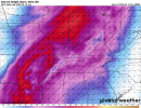
CorrectSo that only goes through about 10 am central tomorrow?
Navigation
Install the app
How to install the app on iOS
Follow along with the video below to see how to install our site as a web app on your home screen.
Note: This feature may not be available in some browsers.
More options
-
Welcome to TalkWeather! We see you lurking around TalkWeather! Take the extra step and join us today to view attachments, see less ads and maybe even join the discussion. CLICK TO JOIN TALKWEATHER
You are using an out of date browser. It may not display this or other websites correctly.
You should upgrade or use an alternative browser.
You should upgrade or use an alternative browser.
Severe WX Severe Weather Threat 3/14-3/16
- Thread starter Bulkshear
- Start date
Yes, that's 18 hours out. The HRRR does long range (48 hours) at 00z, 06z, 12z ,18z. 00z comes out in about 2-3 hours.So that only goes through about 10 am central tomorrow?
The Colonel
Member
Hi-21z HRRR run (uploaded 14z by accident just a second ago) View attachment 35610
I’ve posted off an and and lurked forever so don’t take this as a dumb question
But to me this looks very messy in the high risk area with most of the convection prog’d in N AL/MS & TN
Assuming the cells south of meridian MS would be what’s to cause the problems across C AL?
I just keep expecting to see a cleaner look on the sim radar but maybe that’s just overestimating on my end?
Bit of an aside from tonight's threat, but looking forward to tomorrow morning, the HRRR has a shortwave ridge over the northern half of the warm sector. Will induce slight subsidence which is likely to at least somewhat limit convective coverage in the warm sector. As has been the common theme with this sequence... not good.


Kds86z
Member
Ah yes , Trey mentioned this ridge also in his discussion.Bit of an aside from tonight's threat, but looking forward to tomorrow morning, the HRRR has a shortwave ridge over the northern half of the warm sector. Will induce slight subsidence which is likely to at least somewhat limit convective coverage in the warm sector. As has been the common theme with this sequence... not good.
View attachment 35613
TornadoFan
Member
New storm going up near Huntsville, Arkansas.
Jetstream
Member
Welp, the storm shelter has been cleaned out and prepped. Prayers lifted up for all, lets just hope for the best.
This run is for tonightHi-
I’ve posted off an and and lurked forever so don’t take this as a dumb question
But to me this looks very messy in the high risk area with most of the convection prog’d in N AL/MS & TN
Assuming the cells south of meridian MS would be what’s to cause the problems across C AL?
I just keep expecting to see a cleaner look on the sim radar but maybe that’s just overestimating on my end?
TornadoFan
Member
Even if tomorrow was somehow never in play, the combination of events that are either currently ongoing or are expected to happen later tonight could easily make tonight a memorable one by themselves. We've got (potentially) tornadic storms, dust storms, wildfires, etc.!
Just some food for thought...
Just some food for thought...
Keldeo
Member
Storm trying to go up around Mena Arkansas
lake.effect
Member
Tornado likely imminent near Nixa, MO - shear is stronger on each scan.
Muwx
Member
Its certainly organizing, but nothing to suggest its imminent yet.Tornado likely imminent near Nixa, MO - shear is stronger on each scan.
The rather large dewpoint spread in that area would likely put a crimp on the tornado threat from that cell, at least for some time anyway (knock on wood!).Tornado likely imminent near Nixa, MO - shear is stronger on each scan.
AJS
Member
treypops
Member
I don't see it. It's not juicy enough up there yet.Tornado likely imminent near Nixa, MO - shear is stronger on each scan.
UpperLevelLOL
Member
Possible TDS around Ute, IA
I've been watching the storms in Lousianna, usually you see a uptick in lighting with the strengthening mesocyclone/updraft nothing yet, few rumbles here and there but not drastic increase. it's got a anvil on both storms though.


