- Thread starter
- #101
Kory
Member
This is pretty much toast as a higher end event....
Follow along with the video below to see how to install our site as a web app on your home screen.
Note: This feature may not be available in some browsers.
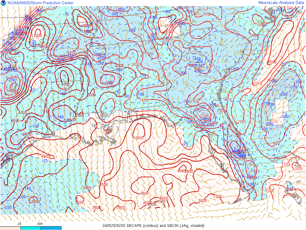
Yep, totally out of AL and MS now. Just yesterday, both states had areas in the moderate risk.Looks like the Enhanced Risk has been trimmed back quite significantly.
Richard, looking at what is developing now, what do you think regarding the rain to the S and SW of Central Alabama at the moment?After looking at radar tonight and new models, I am beginning to believe there isn't going to be much in Alabama. Could be wrong, but looking at radar right now, I could see how the line could disrupt the flow and/or reduce CAPE across the state.
I feel this is a fitting tune to our progression from forecasting to nowcasting with this system.Suns out in Hillsboro
Sent from my iPhone using TalkWeather
Suns out in Hillsboro
Sent from my iPhone using TalkWeather
HRRR seemed to have a good handle on things this morning. It has consistently showed upscale growth of the convective line as it moves out of LA into Southern MS and AL. Also, convection along the front (N MS) tries to get going later today. Some stronger, marginally severe, cores could develop in these areas. This solution seems reasonable to me, given the current disposition of the environment. And I'm beginning to think the SLGT may not verify.
If this doesn't do anything, I think a lot of people will start paying less attention to severe weather outlooks more than 24 hours out from the event. In my area, we've had several consecutive events forecast 2 days out to be fairly significant and turn out to be pretty much nothing. When that happens too many times in a row, people get real cynical.