• Welcome to TalkWeather!
    We see you lurking around TalkWeather! Take the extra step and join us today to view attachments, see less ads and maybe even join the discussion.
    CLICK TO JOIN TALKWEATHER

Severe Weather 2026

Mine would probably be the big Ice Storm across North MS. Monroe County got lucky as we stayed in the "warm sector" and got more rain. Had we not, it would have been far worse.
 
Let's see if they finally decide to issue a Freeze Warning or Hard Freeze Warning..... LOL! We see it's freezing outside, but since growing season has ended, we aren't going to alert you to bring your plants inside or protect your pipes.
 
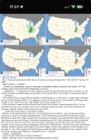
Figured since I did something similar last year around this time, what are the most memorable weather events of this year for ya'll?
Figured I'd mention mine.

1: June 11th, suprise prefrontal mayhem

Tornado of the day: Kouts, IN (EF-3 165 MPH) or Toluca, IL (EF-3 155 MPH)

2: April 23rd. Enid and Bramen storms

Tornado of the day (and year): Enid, OK (EF-4 180 MPH)

3: March 6th, Tornado outbreak from the great plains to the great lakes.

Tornado of the day: Union City, MI (EF- 3, 160 MPH)

4: June 21st, suprise tornado outbreak

Tornado of the day: Mount Vernon, IL (EF-3 140 MPH)
 
The problem isn't necessarily the moisture return itself. It's the speed of these storm systems that's been the main issue thus far with severe weather threats and will continue to be unless one of these systems slows down enabling better moisture return. I do see the 00z Euro and a few GFS runs that have what should be a significant severe threat around or just after 20th. That being said, there's been little consistency though thus far between GFS and Euro.
 
Back
Top