Navigation
Install the app
How to install the app on iOS
Follow along with the video below to see how to install our site as a web app on your home screen.
Note: This feature may not be available in some browsers.
More options
-
Welcome to TalkWeather! We see you lurking around TalkWeather! Take the extra step and join us today to view attachments, see less ads and maybe even join the discussion. CLICK TO JOIN TALKWEATHER
You are using an out of date browser. It may not display this or other websites correctly.
You should upgrade or use an alternative browser.
You should upgrade or use an alternative browser.
Severe Weather 2026
- Thread starter KevinH
- Start date

GXSC
Member
Nice, and in the week right before I move out of town.Welp
In 1-2 years I gotta get to Pennsylvania or smth so I stop being so stressed about the weather all the time.
Kds86z
Member
He isn’t quite sold. Good thoughts.
Last edited:

WeathermanLeprechaun
Member
He isn’t quite sold. Good thoughts.
He's essentially sprouting what Hunter Fowkes said regarding crapvection and the saturated mid levels. I sincerely think everyone is hyping this setup a bit too much on there and I think it's classic chaser fatigue

CheeselandSkies
Member
He's essentially sprouting what Hunter Fowkes said regarding crapvection and the saturated mid levels. I sincerely think everyone is hyping this setup a bit too much on there and I think it's classic chaser fatigue
IIRC Hunter is part of the Storm Chaser Coaching team, so they do work together.
WeathermanLeprechaun
Member
I meant this not on them but half the other chasers wishcasting or being like "don't sleep on this!!" they've examined the failmodes very well.IIRC Hunter is part of the Storm Chaser Coaching team, so they do work together.
Kds86z
Member
Latest day 2 from Bentley
30 TO 35 KNOTS OF
EFFECTIVE SHEAR DURING THE AFTERNOON. THIS WOULD SUPPORT A SUPERCELL
STORM MODE. IF THIS DISCRETE STORM MODE CAN BE MAINTAINED, A EF2+
TORNADO THREAT WILL EXIST GIVEN THE NEARLY PURELY STREAMWISE
VORTICITY IN THE LOWEST 2KM FROM RAP FORECAST SOUNDINGS IN THE
REGION. LIMITING FACTORS TO THIS SCENARIO ARE MULTIPLE STORMS
DEVELOPING ALONG THE FRONT AND QUICKLY GROWING UPSCALE AND A LACK OF
STRONG VENTING FLOW ALOFT WHICH MAY RESULT IN DISRUPTIVE DOWNBURSTS
BEFORE A MORE ORGANIZED, STRONG LOW-LEVEL MESOCYCLONE CAN DEVELOP.
30 TO 35 KNOTS OF
EFFECTIVE SHEAR DURING THE AFTERNOON. THIS WOULD SUPPORT A SUPERCELL
STORM MODE. IF THIS DISCRETE STORM MODE CAN BE MAINTAINED, A EF2+
TORNADO THREAT WILL EXIST GIVEN THE NEARLY PURELY STREAMWISE
VORTICITY IN THE LOWEST 2KM FROM RAP FORECAST SOUNDINGS IN THE
REGION. LIMITING FACTORS TO THIS SCENARIO ARE MULTIPLE STORMS
DEVELOPING ALONG THE FRONT AND QUICKLY GROWING UPSCALE AND A LACK OF
STRONG VENTING FLOW ALOFT WHICH MAY RESULT IN DISRUPTIVE DOWNBURSTS
BEFORE A MORE ORGANIZED, STRONG LOW-LEVEL MESOCYCLONE CAN DEVELOP.
Kds86z
Member
Gosh I love his discussions.Latest day 2 from Bentley
30 TO 35 KNOTS OF
EFFECTIVE SHEAR DURING THE AFTERNOON. THIS WOULD SUPPORT A SUPERCELL
STORM MODE. IF THIS DISCRETE STORM MODE CAN BE MAINTAINED, A EF2+
TORNADO THREAT WILL EXIST GIVEN THE NEARLY PURELY STREAMWISE
VORTICITY IN THE LOWEST 2KM FROM RAP FORECAST SOUNDINGS IN THE
REGION. LIMITING FACTORS TO THIS SCENARIO ARE MULTIPLE STORMS
DEVELOPING ALONG THE FRONT AND QUICKLY GROWING UPSCALE AND A LACK OF
STRONG VENTING FLOW ALOFT WHICH MAY RESULT IN DISRUPTIVE DOWNBURSTS
BEFORE A MORE ORGANIZED, STRONG LOW-LEVEL MESOCYCLONE CAN DEVELOP.
WeathermanLeprechaun
Member
Every chaser trying to sell tomorrow was gonna be like sniffing crack and it's actually McDonald's salt packets. The hype for this one was pretty unnecessary. Out of the blue analogy I know but just came off top of my head

No matter what happens tomorrow, I can virtually guarantee there will be a lot of people complaining about the forecasting. There are no words for how bad the models have performed for Iowa this year. There's basically a giant blind spot for 500 miles to the West. RRFS A actually did pretty well with the flash flooding event we had here last week. HRRR completely whiffed. Wish i still had my pivotal weather subscription!
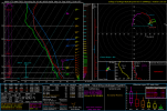
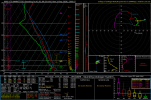
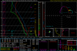
NAM thinks the CAP is going to break, and the RAP doesn't. These are pretty amazing environments across the board. Sounding profile is looking like photogenic supercells.

slenker
Member
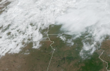
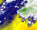
With how capped a lot of the soundings ended up being, I’m surprised at the continued development of morning convection behind the line that has been trudging through the risk area. Unsure what that entails.
GXSC
Member
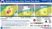
It means we're probably gonna get flooded againWith how capped a lot of the soundings ended up being, I’m surprised at the continued development of morning convection behind the line that has been trudging through the risk area. Unsure what that entails.

For how far away Iowa is to the ocean this place gets way too much torrential rain.
Kds86z
Member
Kds86z
Member
Kds86z
Member
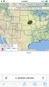
Latest day 1:
MOST GUIDANCE CONTINUES
TO SHOW A FAVORABLE CONDITIONAL ENVIRONMENT FOR TORNADOES ACROSS
EASTERN NEBRASKA/WESTERN IOWA AS THE SUPERCELLS/CLUSTERS SPREAD
QUICKLY EASTWARD THIS EVENING, WITH A 40-50 KT LOW-LEVEL JET AIDING
THE DEVELOPMENT OF AMPLE EFFECTIVE SRH. BUT, VARIOUS RAP FORECAST
SOUNDINGS ACROSS THIS REGION SHOW LINGERING LOW-LEVEL INHIBITION,
AND IT REMAINS UNCLEAR WHETHER CONVECTION WILL BE ABLE TO FULLY TAKE
ADVANTAGE OF THE STRONG LOW-LEVEL SHEAR. EVEN WITH THIS UNCERTAINTY,
A SUSTAINED SURFACE-BASED SUPERCELL IN THIS ENVIRONMENT WOULD
CONDITIONALLY BE CAPABLE OF PRODUCING A STRONG TORNADO.
MOST GUIDANCE CONTINUES
TO SHOW A FAVORABLE CONDITIONAL ENVIRONMENT FOR TORNADOES ACROSS
EASTERN NEBRASKA/WESTERN IOWA AS THE SUPERCELLS/CLUSTERS SPREAD
QUICKLY EASTWARD THIS EVENING, WITH A 40-50 KT LOW-LEVEL JET AIDING
THE DEVELOPMENT OF AMPLE EFFECTIVE SRH. BUT, VARIOUS RAP FORECAST
SOUNDINGS ACROSS THIS REGION SHOW LINGERING LOW-LEVEL INHIBITION,
AND IT REMAINS UNCLEAR WHETHER CONVECTION WILL BE ABLE TO FULLY TAKE
ADVANTAGE OF THE STRONG LOW-LEVEL SHEAR. EVEN WITH THIS UNCERTAINTY,
A SUSTAINED SURFACE-BASED SUPERCELL IN THIS ENVIRONMENT WOULD
CONDITIONALLY BE CAPABLE OF PRODUCING A STRONG TORNADO.
WeathermanLeprechaun
Member
I'm not convinced whatsoever. If today manages to prove me wrong, I'll be bamboozled. Don't do a June 17th on me, Mother Nature

I told somebody that there's a 90% chance nothing happens, but I think even that's too low for today.I'm not convinced whatsoever. If today manages to prove me wrong, I'll be bamboozled. Don't do a June 17th on me, Mother Nature
Kds86z
Member
Don’t sleep on 2026 SPC 5% hatched days. Ha. Last time we had an ef2 in new York. I’m 50/50. lolI told somebody that there's a 90% chance nothing happens, but I think even that's too low for today.
I'm not convinced whatsoever. If today manages to prove me wrong, I'll be bamboozled. Don't do a June 17th on me, Mother Nature
I'm telling you, there's just really not enough reliable data to make a good prediction right now. Short range models have all been abysmal in this region. It's really going to come down to how big this clearing gets and how long it lasts, I think.