• Welcome to TalkWeather!
    We see you lurking around TalkWeather! Take the extra step and join us today to view attachments, see less ads and maybe even join the discussion.
    CLICK TO JOIN TALKWEATHER

Severe Weather 2026


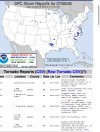
IL/IN/IA/MO just crushing everybody else. Surprisingly the latter two states managing to do it without being affected by any really high-end outbreaks like 4/26/24 or 3/14/25.

WI's count of 39 is considerably above the 1981-2010 30-year normal of 23, but still well below our annual record of 62 set in 2005, when our daily record-setting outbreak of 27 tornadoes occurred on August 18, of all days (when the Stoughton F3 almost hit me).
 
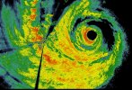
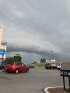
Minnesota had some tornadoes last evening. The pictured one here is not the PDS one which unfortunately caused 2 injuries.


* AT 801 PM CDT, A CONFIRMED LARGE AND EXTREMELY DANGEROUS TORNADO
WAS LOCATED OVER ROCHERT, OR NEAR DETROIT LAKES, MOVING EAST AT 40
MPH.

THIS IS A PARTICULARLY DANGEROUS SITUATION. TAKE COVER NOW!

HAZARD...DAMAGING TORNADO.

SOURCE...WEATHER SPOTTERS CONFIRMED TORNADO.


Attachments

  • IMG_0970.jpeg
    IMG_0970.jpeg
    211.9 KB · Views: 31
so, quick writeup on the tornado potential the next few days.

Today still appears to be focused within that boundary in NE SD but I do expect rapid upscale. Sloshy windbag and brief tornadoes a possibility. Wouldn't rule out one in NE Montana conditionally either.

TOMORROW
Mini supercells in Central MN could drop a isolated tornado. No other area of interest.


THURSDAY
MCV potential in N IL, albeit high uncertainty on placement and etc, models have consistently picked up on this disturbance. I expect a tornado threat somewhere in this vicinity. Conditional window for initiation in N SD, but globals aren't optimistic. If storm development uptrends, a isolated all hazards threat will exist with any supercell.

FRIDAY
W Alberta could see a isolated supercell or two with low end tornado potential. Moisture quality is the question and how much instability. A very sneaky threat here and the only one at that

SATURDAY
Globals are very confident in a potentially robust window for severe weather, including all hazards in Central Alberta here. 65+ effective shear may lead to long lived supercells, capable of a tornado threat and large hail. Watching this day closely given the area it's in.
 
so, quick writeup on the tornado potential the next few days.

Today still appears to be focused within that boundary in NE SD but I do expect rapid upscale. Sloshy windbag and brief tornadoes a possibility. Wouldn't rule out one in NE Montana conditionally either.

TOMORROW
Mini supercells in Central MN could drop a isolated tornado. No other area of interest.


THURSDAY
MCV potential in N IL, albeit high uncertainty on placement and etc, models have consistently picked up on this disturbance. I expect a tornado threat somewhere in this vicinity. Conditional window for initiation in N SD, but globals aren't optimistic. If storm development uptrends, a isolated all hazards threat will exist with any supercell.

FRIDAY
W Alberta could see a isolated supercell or two with low end tornado potential. Moisture quality is the question and how much instability. A very sneaky threat here and the only one at that

SATURDAY
Globals are very confident in a potentially robust window for severe weather, including all hazards in Central Alberta here. 65+ effective shear may lead to long lived supercells, capable of a tornado threat and large hail. Watching this day closely given the area it's in.
great analysis lep, totally agree with everything said here.
 
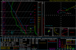
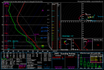
A localised, conditional window for a strong tornado may exist in NW Quebec on Monday. Given nearly 380+ 0-1km SRH and enough CAPE aloft a leftover inversion, should shear overcome the inversion and SE moving storm mode cooperate, a isolated strong tornado may be possible.
 

Attachments

  • 2026070818_GFS_126_49.78,-76.34_severe_ml.png
    2026070818_GFS_126_49.78,-76.34_severe_ml.png
    97.8 KB · Views: 11
Tomorrow seems like the better sneaky MCV tornado risk tbh, i can see a brief tor or two in E KS stretching to.... Take a guess... Southern Illinois. Sporadic supercell regime it seems

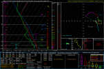
On the other hand, seems like central Saskatchewan is in for a potentially interesting severe weather outbreak on Saturday. Impressive parameter space.
 

Attachments

  • gfs_2026070912_060_52.75--105.25.png
    gfs_2026070912_060_52.75--105.25.png
    258.4 KB · Views: 1
Back
Top