Here's what I finally found with the TNI:
It has the total by month. Which is probably better in a way
It has the total by month. Which is probably better in a way
Follow along with the video below to see how to install our site as a web app on your home screen.
Note: This feature may not be available in some browsers.


Severe weather is for sure making a return but once again, there is plenty of uncertainty. Even the period beyond the 15th has signals for severe but the deterministic is either spitting out lackluster setups or high end fantasy setups due to the lack of good resources to work with. Mid-late Feb may favor severe weather is all I've got to say. That 00z GFS taken verbatim would be a closely packed, semi discrete arc of supercells similar to 5/21/24 making their way through Iowa. That took me by surprise.
Absolutely agree, it really took me by surprise seeing such a robust setup that far north. The GFS hasn't pulled such a robust fantasy run like that so far this year so I'll just save it for laughing sakeWon't happen of course (if for no other reason than I'm scheduled to have that day and the next off so I actually would be able to chase it) but the 0Z GFS depiction for Thursday the 19th is pretty wild for February. Strong instability up into the upper Midwest ahead of a potent trough and surface low.
After events like February 8th two years ago and 2/28/17, I think I've finally learned never say never even when it's still winter up around here.
I am not sure how much I like this look

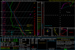
POST pics please!!! lol. Graphics are always helpful00z euro run is impressive for the southeast...nasty look.
Yeah this looks kind of nasty. What date is this for?
Exactly! Dixie does what it wants, when it wants and doesn’t follow “the rules”.Won't happen of course (if for no other reason than I'm scheduled to have that day and the next off so I actually would be able to chase it) but the 0Z GFS depiction for Thursday the 19th is pretty wild for February. Strong instability up into the upper Midwest ahead of a potent trough and surface low.
After events like February 8th two years ago and 2/28/17, I think I've finally learned never say never even when it's still winter up around here.
I was planning on pulling the trigger on a thread tonight lol depending on how both the Euro and GFS looks on the runs tonight.What do you want to bet that we have that 15% by tomorrow or Wednesday?
...DISCUSSION...
Increasing thunderstorm potential may develop across portions of TX
to the Lower MS Valley and Southeast Days 5-7/Fri-Sun. During this
period, an upper trough will move across the southern Plains and
Southeast U.S. Medium range forecast guidance varies with regard to
timing of eastward progression, and how far north 60s F dewpoints
will develop ahead of the upper trough and attendant surface low.
Notably, the GFS keeps appreciable instability mostly offshore the
Gulf Coast, while ECMWF destabilizes further north into the Gulf
Coast states during the weekend. Meanwhile, SPC GEFS and other ML
guidance depicts only minor severe probability areas. Given the
current forecast strength and track of the associated surface
cyclone across the Lower MS Valley/Southeast, at least some low-end
potential for severe thunderstorms seems possible. Nevertheless, the
aforementioned uncertainties, and expected modest thermodynamic
environment even if Gulf moisture spreads further inland, precludes
15 percent severe delineation at this time.
Love it… I wouldn’t be surprised if there is some model flip flopping thoughI was planning on pulling the trigger on a thread tonight lol depending on how both the Euro and GFS looks on the runs tonight.
It's a little to early now. But both the GFS and euro show severe weather of some kind. With the euro being the most volatile. I'm not sure how the ensembles look. But I think that there's a good chance for severe weather.Love it… I wouldn’t be surprised if there is some model flip flopping though
My notifications are ready for when you pull the trigger. hahahhahahaha