• Welcome to TalkWeather!
    We see you lurking around TalkWeather! Take the extra step and join us today to view attachments, see less ads and maybe even join the discussion.
    CLICK TO JOIN TALKWEATHER

Severe Weather 2025

oh okay gotcha but hope you stay safe when the qlcs gets near to you good ole spinups
1753467730295.png
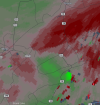
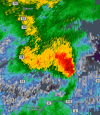
the QLCS seem to have sorta died , the rotation area is from a supercell that is strugling with outflow , however the cell has suddenly made a left turn , rotation seems to be picking up , the backwards hook look that you tend to see in outflow supercells is now gone , keeping a eye on it for it to get a regular inflow hook again.
 
View attachment 45447
the QLCS seem to have sorta died , the rotation area is from a supercell that is strugling with outflow , however the cell has suddenly made a left turn , rotation seems to be picking up , the backwards hook look that you tend to see in outflow supercells is now gone , keeping a eye on it for it to get a regular inflow hook again.
oh okay i see
 
full picture of the risk of heavy precipitation
image0.jpg
 
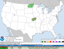
NAM is suggestive that we could see some action in the upper Midwest in the tomorrow-Tuesday timeframe, although a lot of uncertainty remains as to ceiling, timing and location of strongest convection hence SPC's reluctance to introduce greater than marginal risk probabilities, although they did add a 15% (slight risk) wind contour over parts of MN/northern WI for tomorrow.
 
Back
Top