
Navigation
Install the app
How to install the app on iOS
Follow along with the video below to see how to install our site as a web app on your home screen.
Note: This feature may not be available in some browsers.
More options
-
Welcome to TalkWeather! We see you lurking around TalkWeather! Take the extra step and join us today to view attachments, see less ads and maybe even join the discussion. CLICK TO JOIN TALKWEATHER
You are using an out of date browser. It may not display this or other websites correctly.
You should upgrade or use an alternative browser.
You should upgrade or use an alternative browser.
Severe Weather 2025
- Thread starter KevinH
- Start date
Kds86z
Member

Ledian
Member
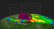
There's the tornado warning. Taking dead aim at the radar site too
Tornado warned now.

Ledian
Member
Near Paris, MS could be a problem for me soon.
Overall regional convective presentation is really interesting. It's like a mini-supercell outbreak and a hot, steamy summer day's spotty afternoon thunderstorms mushed together. Area to watch ultimately will be northern MS, where best overlap of strong instability and helicity are.


slenker
Member
I know it's likely soon to go linear, but today has really impressed me with its discreteness thus far. Didn't expect that.

TH2002
Member
- Messages
- 4,973
- Reaction score
- 11,113
- Location
- California, United States
- Special Affiliations
- SKYWARN® Volunteer
@JPWX, have you checked to make sure that the JPWX Tornado Magnet™ has been switched off today?
I have not. Let me do some checking and see if it's off@JPWX, have you checked to make sure that the JPWX Tornado Magnet™ has been switched off today?
18Z GFS decided to play ball with a tornado outbreak next Sunday.
18Z GFS decided to play ball with a tornado outbreak next Sunday.


Well, I'm glad I didn't pre register for the severe storm symposium in Starkvegas next weekend. Can't say I'm surprised.18Z GFS decided to play ball with a tornado outbreak next Sunday.
View attachment 37090View attachment 37091View attachment 37092View attachment 37093
Ledian
Member
Coming up to two years after the scariest weather experience i've ever had...lovely.18Z GFS decided to play ball with a tornado outbreak next Sunday.
