• Welcome to TalkWeather!
    We see you lurking around TalkWeather! Take the extra step and join us today to view attachments, see less ads and maybe even join the discussion.
    CLICK TO JOIN TALKWEATHER

Severe Weather 2025

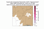
So I've started to use the SPC tornado probabilities in my forecasts. Have for a good while now. In effort to make the communication easier for people to understand what this probability means, I've added my own wording to describe each TOR probability and add the within 25 miles etc. I plan to use this same type of formula with the damaging winds and hail categories.
Very Low Chance, 2%
Low Chance, 5%
Elevated Chance, 10%
Medium Chance, 15%
High Chance, 30%
Very High Chance, 45%
Extreme Chance, 60%
 
So in its first real test of power, I ran the WRF-ARW model I made to look ahead for the 29-30 threat. I did it at a 9 km resolution, so it's somewhat more refined than the current models out there at this timeframe. Let's see what it finds! (I haven't looked either yet.) I used the 06 GFS as initial conditions, and it ran for about 6 hours.

-------------------

It's showing not anything really on the 29th and most of the 30th...but here's what it does show. Maybe trying to resolve a few supercells? Not sure.

1742764358145.png
1742764412104.png


Here's the SBCAPE. It does show some potential for convective thunderstorms, but it's rather limited over parts of Mississippi mainly.

test124.gif

I'm still working on the composite indices (like SCP, STP, VTP, etc.), so take this with a huge grain of salt! But the approximate SCP shows some scattered supercell potential possible, again, especially over Mississippi and Arkansas (but the radar didn't pick up on any convection in Arkansas).


test125.gif


The surface Temps and humidity show the front, with about a 20-25 degree swing from KC to Birmingham.

1742765148704.png

1742765209524.png
 

Attachments

  • test125.gif
    test125.gif
    309 KB · Views: 0
Looking at the *real* models, the GFS is starting to come into some?? agreement with the Euro and others that an event is possible. I guess we'll see! It's getting into a climatologically rich season, and it's going to be an active year I feel. So definitely looking towards next weekend as a bigger threat than today.
 
So in its first real test of power, I ran the WRF-ARW model I made to look ahead for the 29-30 threat. I did it at a 9 km resolution, so it's somewhat more refined than the current models out there at this timeframe. Let's see what it finds! (I haven't looked either yet.) I used the 06 GFS as initial conditions, and it ran for about 6 hours.

-------------------

It's showing not anything really on the 29th and most of the 30th...but here's what it does show. Maybe trying to resolve a few supercells? Not sure.

View attachment 37068
View attachment 37069


Here's the SBCAPE. It does show some potential for convective thunderstorms, but it's rather limited over parts of Mississippi mainly.

View attachment 37070

I'm still working on the composite indices (like SCP, STP, VTP, etc.), so take this with a huge grain of salt! But the approximate SCP shows some scattered supercell potential possible, again, especially over Mississippi and Arkansas (but the radar didn't pick up on any convection in Arkansas).


View attachment 37072


The surface Temps and humidity show the front, with about a 20-25 degree swing from KC to Birmingham.

View attachment 37074

View attachment 37077
Huge Fan of this and the work you're continuing to do with this! Absolutely fantastic!
 
Huge Fan of this and the work you're continuing to do with this! Absolutely fantastic!
Thanks! It's been a lot more difficult than I expected (possibly because I'm on a MacBook, a lot of the infrastructure isn't optimized for it, so a lot had to be troubleshoot haha). But I love the flexibility it offers! Understandably, the main models like HRRR are restricted in time and resolution, but this has free rein only limited by my resources and time.

If anyone ever wants a specific run (over a certain area, at a certain resolution, with certain metrics, etc.) just post or pm me and I'll see what I can do. I know during hurricane season, I plan to use it in vortex-following mode (like the hurricane models do currently) to make my own version of HWRF basically. But yeah, I'm happy to run anything that is requested if it's feasible and possible.

The main limitation is time. I have 12 cores on my MacBook and 32 G of ram, so it's powerful for sure, but still takes a long time (hey, most of the real models are run on big computers haha). So I'll try to communicate any realism limitations with you when you request. But yeah, in general, happy to entertain requests within reason. Obviously I can't spend every waking moment doing these, but it's fun for now and I enjoy doing them!
 
Tornado Warning probably soon on that cell moving into Booneville
 

Attachments

  • Screenshot 2025-03-23 165217.png
    Screenshot 2025-03-23 165217.png
    1.1 MB · Views: 0
Back
Top