Navigation
Install the app
How to install the app on iOS
Follow along with the video below to see how to install our site as a web app on your home screen.
Note: This feature may not be available in some browsers.
More options
-
Welcome to TalkWeather! We see you lurking around TalkWeather! Take the extra step and join us today to view attachments, see less ads and maybe even join the discussion. CLICK TO JOIN TALKWEATHER -
Current Tropical Systems Melissa
You are using an out of date browser. It may not display this or other websites correctly.
You should upgrade or use an alternative browser.
You should upgrade or use an alternative browser.
Severe Weather 2025
- Thread starter KevinH
- Start date
Parker Copeland
Member
wow
Heckin chonker
Parker Copeland
Member
so looks like gfs caught back up temp lmao
tennessee storm chaser
Member
- Messages
- 1,623
- Reaction score
- 3,058
- Location
- jackson tennessee
- Special Affiliations
- SKYWARN® Volunteer
J
jesus Christ ….
tennessee storm chaser
Member
- Messages
- 1,623
- Reaction score
- 3,058
- Location
- jackson tennessee
- Special Affiliations
- SKYWARN® Volunteer
Wonder if the trough is dipping to far south to rob moisture content ?
12z GFS run absolutely is affected by that lead wave being more amplified than the 06z run and thus suppressing moisture return more.
tennessee storm chaser
Member
- Messages
- 1,623
- Reaction score
- 3,058
- Location
- jackson tennessee
- Special Affiliations
- SKYWARN® Volunteer
What I was thinking12z GFS run absolutely is affected by that lead wave being more amplified than the 06z run and thus suppressing moisture return more.
With that said, the 15th, despite a rather iffy looking trough, looks impressive. Positive tilt can work and has worked a lot in the SE.
tennessee storm chaser
Member
- Messages
- 1,623
- Reaction score
- 3,058
- Location
- jackson tennessee
- Special Affiliations
- SKYWARN® Volunteer
We keep getting this amped up systems and these wicked looking troughs heading into April , Buckle up all I got say
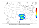
CIPS is still continuing to show a strong signal for severe centered on the Deep South. CSU's modelling also picking up on the beginnings of it at D8 range. SPC is watching the period closely, suggesting delineations may be required if confidence increases.


ZCZC SPCSWOD48 ALL
ACUS48 KWNS 070909
SPC AC 070909
Day 4-8 Convective Outlook
NWS Storm Prediction Center Norman OK
0309 AM CST Fri Mar 07 2025
Valid 101200Z - 151200Z
...DISCUSSION...
A progressive upper pattern is forecast during the Day 4-8 period.
An upper shortwave trough over the Southeast will move offshore the
Atlantic coast on Day 4/Mon. In its wake, low-amplitude upper
ridging is forecast from the southern Plains into the Southeast
through Day 5/Tue. Severe thunderstorm potential will be low during
this time as surface high pressure near the Gulf coast maintain a
dry continental airmass.
By Day 6/Wed, an upper trough over the southern Rockies and northern
Mexico will shift east across the southern Plains to the Sabine
Valley vicinity. Enhanced southwesterly deep-layer flow will develop
ahead of the trough across TX into the Lower MS Valley. Surface
cyclogenesis is currently forecast to remain modest, but southerly
low-level flow will transport Gulf moisture northward across the
south-central states. Higher-quality moisture is expected to remain
offshore or very near the TX/LA coast, with low 60s F dewpoints
possible across parts of east TX and LA ahead of an eastward
advancing cold front. Thunderstorm potential will accompany this
system, but moisture return will likely remain sub-optimal for a
greater severe risk.
By the end of the period, around Day 8/Fri, medium range guidance
develops a larger-scale, deepening trough ejecting into the Plains
and Upper Midwest vicinity. While some severe potential may increase
around the Friday time frame, large spread among guidance with
regards to timing and placement of the upper trough and key surface
features lends to low predictability. Trends will be monitored over
the coming days and outlook areas may become necessary if confidence
increases.
..Leitman.. 03/07/2025


- Thread starter
- #672
KevinH
Member
Freaking @Clancy man..CIPS is still continuing to show a strong signal for severe centered on the Deep South. CSU's modelling also picking up on the beginnings of it at D8 range. SPC is watching the period closely, suggesting delineations may be required if confidence increases.
View attachment 34702View attachment 34703View attachment 34704View attachment 34705View attachment 34706
Between you, @JPWX and @Fred Gossage I cant tell you how much I enjoy your (graphic) posts. They are truly valuable for visual people like myself.
(Even though you always INSIST on posting MD and WW a split second before I do ROFL!!!)
CheeselandSkies
Member
12z GFS run absolutely is affected by that lead wave being more amplified than the 06z run and thus suppressing moisture return more.
...and still gets mid-50s into Iowa with depth almost up to 700mb, where it's -16°C at 500mb.
Parker Copeland
Member
gfs can't do moisture return well...and still gets mid-50s into Iowa with depth almost up to 700mb, where it's -16°C at 500mb.
Parker Copeland
Member
oh crap12z Euro ensemble is very impressive for being 180 hours out. Moisture/CAPE probabilities improved as well.
View attachment 34707
View attachment 34708
View attachment 34709
tennessee storm chaser
Member
- Messages
- 1,623
- Reaction score
- 3,058
- Location
- jackson tennessee
- Special Affiliations
- SKYWARN® Volunteer
I was just going over 12z euro too, looks like first wave also not diving down far south as previous runs .12z Euro ensemble is very impressive for being 180 hours out. Moisture/CAPE probabilities improved as well.
View attachment 34707
View attachment 34708
View attachment 34709
Considering buying a drone (got a little money to blow so why not lol ) for viewing some of these supercells/storms that come through northern Jefferson county. Maybe if we see something next weekend I'll have one and be able to get a birds eye view of the north Jefferson county tornado magnet.
lake.effect
Member
Lots can change, but I think it we see two more model runs with the same signal we're looking at a legitimate big threat next week.
Telstar
Member
On a side note, are these systems going to hamper viewing of the blood moon next week?


