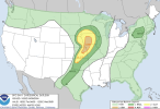
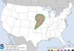
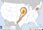
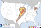
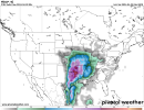
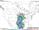
6z GEFS next weekend
Attachments
-
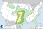
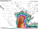 sbcape-prob0500.conus (2).png314.2 KB · Views: 0
 -
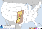
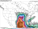 sbcape-prob0500.conus (3).png307.9 KB · Views: 0
 -
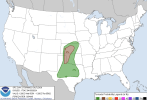
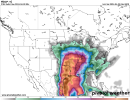 scp-prob01.conus (2).png317.3 KB · Views: 0
 -
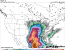 scp-prob01.conus (3).png309.3 KB · Views: 0
 -
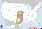
 scp-prob05.conus (2).png281.1 KB · Views: 0
 -
 scp-prob05.conus (3).png269.2 KB · Views: 0
 -
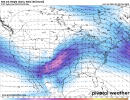 500wh-mean.conus.png575.3 KB · Views: 0