• Welcome to TalkWeather!
    We see you lurking around TalkWeather! Take the extra step and join us today to view attachments, see less ads and maybe even join the discussion.
    CLICK TO JOIN TALKWEATHER

Severe Threat May 15-16, 2025

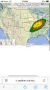
Found some analogs for tomorrow from my sounding collection. It seems a lot of the soundings we've been pulling a reminiscent of a classic Kansas outbreak.

May 4, 2003: Girard / Liberal / Stockton & Carl Junction & Pierce City Missouri
Numerous high-end, large, long track tornadoes. Out of an outbreak of 15 total tornadoes, 4 were rated F3 and one an F4. Some tracked for 20-80 miles.
View attachment 41521

June 9, 2005: Hill City, Kansas
Cyclic tornadic supercell (up to F2).
View attachment 41522

May 25, 2008: Parkersburg, Iowa
Long-tracked EF5 wedge tornado that killed 9 people.
View attachment 41523

May 25, 2012: La Crosse, Kansas
Particularly cyclic supercell that produced several tornadoes, up to EF2, in rapid succession.
View attachment 41524

April 28, 2014: Louisville, Mississippi
Long-tracked EF4 tornado that killed 10 people.
View attachment 41525

May 9, 2016: Katie / Wynnewood / Sulphur, Oklahoma
Two tornadoes, the first a particularly photogenic EF4, and the second an EF3 wedge tornado with winds measured by mobile radar to be over 200 mph.
View attachment 41527

May 21, 2016: Leoti, Kansas
Particularly photogenic, stationary supercell that produced a few brief tornadoes.
View attachment 41528

May 24, 2016: Minneola / Dodge City, Kansas
Prolific tornadic supercell producing 13 often-photogenic tornadoes (up to EF3), with three documented simultaneously, in a localized area. Often regarded as one of the greatest days of modern storm chasing.
View attachment 41531

May 4, 2019: Denver City, Texas
Particularly photogenic low-precipitation supercell.
View attachment 41534

June 23 2023 Granada–Holly CO / Johnson KS tornadoes, mothership
View attachment 41535
It is a very plains-esk setup with similar ingrediants that you would find out in Kansas. Not sure if we'll see tornadoes to this degree, but never say never.
 
It is a very plains-esk setup with similar ingrediants that you would find out in Kansas. Not sure if we'll see tornadoes to this degree, but never say never.
I'm not sure I'd say this is a "Plains" setup per say, this (Friday) is a relatively classic looking westerly flow setup that tends to yield significant severe events east of the Plains, especially in the Ohio Valley and SE. This type of trough/flow orientation would generally not work in the Plains because the low-level flow trajectories are out of the SW/WSW, which would advect in dry air off the Mexican Plateau/SW US if it was over the Plains.
 
I'm not sure I'd say this is a "Plains" setup per say, this (Friday) is a relatively classic looking westerly flow setup that tends to yield significant severe events east of the Plains, especially in the Ohio Valley and SE. This type of trough/flow orientation would generally not work in the Plains because the low-level flow trajectories are out of the SW/WSW, which would advect in dry air off the Mexican Plateau/SW US if it was over the Plains.
00z HRRR gets too warm (my main concern) with inverted-V thermodynamic profiles down south, which leads to an outflowy mess.
Gotcha! Good to know. I understand that you think tomorrow has a more likelihood of a "outflow" dominant (whoopee /s) outcome of storms around the southern risk area (assumption is northern IL/IN) due to the amount of the warm/dry air. Can I ask how you can detect the outflow potential of a severe weather event (or a more damaging wind threat vs tornado threat) on a sounding/skew-t chart vs just looking at reflectivity?
I understand that shear rates/SRH values come into play when forecasting tornadoes.
 
Some more soundings from Michigan that are eerily similar to what the NAM is showing in the state Thursday evening.

October 18, 2007: White Lake, Michigan
Particularly photogenic tornadic waterspout, part of a large-scale tornado outbreak.
1747278388523.png

May 20, 2022: Gaylord, Michigan
EF3 tornado
1747278145599.png

March 15, 2012: Dexter, Michigan
EF3 tornado that was largely unanticipated. (the hodograph is particularly analogous here)
1747278438420.png

Now here are two soundings I pulled from Western Michigan as the cells exit the Lake.
1747278488881.png1747278541196.png
 
Gotcha! Good to know. I understand that you think tomorrow has a more likelihood of a "outflow" dominant (whoopee /s) outcome of storms around the southern risk area (assumption is northern IL/IN) due to the amount of the warm/dry air. Can I ask how you can detect the outflow potential of a severe weather event (or a more damaging wind threat vs tornado threat) on a sounding/skew-t chart vs just looking at reflectivity?
I understand that shear rates/SRH values come into play when forecasting tornadoes.
Higher temperature/dewpoint spreads, especially when they started getting above 20 degrees F, with dry air aloft usually indicate more potential for outflow dominance in storms (stronger downdrafts).

This brief piece explains well: https://www.theweatherprediction.com/thermo/soundings/invertedv/
 
The fact that the bulk of the event won't get started until near and just after Sunset Friday doesn't help any either.
 
Getting caught up. Friday is looking like tornado outbreak central. If it is anything like models are showing. You are going to see intense to perhaps violent tornadoes. Those two supercells in Tennessee caught my eye immediately.
 
Watching this Broyles/Convective Chronicles vid, and one method they're covering is subtracting 700 mb temps from the STP. If the resulting number is positive then it's showing potential for a tornado event. If the STP is high enough, and 700 mb temp low enough it could indicate a tornado outbreak.

1747282099213.png

So here's the STP (12.7) and 700 mb temp (9 C) for Arkansas Friday afternoon. The result is positive 3.7.
1747281818770.png1747282162890.png

In Missouri the STP is 13.5 and the 700mb temp is 6 C. The result is positive 7.5.
1747282266862.png1747282360604.png

Illinois: STP 15.1 - 700mb temp 6 C = positive 9.1
1747282533821.png1747282596024.png

Indiana: STP 15.9 - 700mb 7 C = +8.9
1747282829496.png1747282870510.png


The value is Ohio is +7.9 and Kentucky is +3.4. Thursday evening, Wisconsin is -4.3 and Michigan is actually +1.
 
1747290448259.png1747290459311.png
...THERE IS AN ENHANCED RISK OF SEVERE THUNDERSTORMS FRIDAY
AFTERNOON INTO FRIDAY NIGHT ACROSS PARTS OF NORTHEASTERN
ARKANSAS...EAST CENTRAL AND SOUTHEASTERN MISSOURI...SOUTHERN
ILLINOIS...SOUTHERN INDIANA...SOUTHWESTERN OHIO...MUCH OF WESTERN
AND CENTRAL KY...WESTERN AND MIDDLE TENNESSEE...

...SUMMARY...
Severe thunderstorms appear likely to develop across parts of the
middle Mississippi through lower and middle Ohio Valleys Friday
afternoon into Friday night. During the late afternoon into
evening, this may include a few intense supercells posing a risk for
large hail and tornadoes. During the evening into the overnight
hours, this probably will include an upscale growing and organizing
cluster posing a risk for strong, damaging winds and perhaps a
continuing risk for tornadoes.

...Discussion...
Downstream of a prominent mid-level high over the southern mid- to
subtropical latitudes of the eastern Pacific, split flow will
persist across much of North America through this period. Within
this regime an initially deep and occluded surface cyclone, centered
over northern Minnesota at the outset of the period, is forecast to
weaken Friday through Friday night, as it migrates into the Upper
Great Lakes region in response to a short wave perturbation pivoting
around the southern periphery of the mid-level circulation center.
It appears that this perturbation will come in phase with another
short wave perturbation forecast to accelerate east-northeast of the
central Great Plains through much of the Ohio Valley by early
Saturday. Another vigorous short wave trough digging around the
northeastern periphery of the Pacific ridge may reach the northern
California coast by the end of the period, preceded by at least one
more modest perturbation migrating northeastward across the northern
Baja vicinity.

In lower levels, associated with the occluding cyclone, a
weak/weakening Pacific cold front/dry line appears likely to stall
across the lower Great Lakes through Ohio River vicinity, and across
the Ark-La-Tex into Rio Grande River by 12Z Friday. This may be
trailed by another weak front across the Upper Midwest through the
central Great Plains and Texas South Plains, which is forecast to be
overtaken by the primary cold front surging southeastward from the
upper Mississippi Valley/northern Great Plains. By late Friday
night, this cold front may reach the lower Ohio Valley and central
Great Plains.

Preceding the consolidating fronts, low-level moisture return and
moderate to strong destabilization is forecast across the middle
Mississippi and lower Ohio Valleys on strengthening south to
southwesterly flow. The potential northern extent of the moisture
return remains unclear, based on model output, and this could be
impacted by outflow associated with possible early period convective
development across the lower Ohio Valley into portions of the
Allegheny and Cumberland Plateaus. Depending on how these
uncertainties play out, it might not be out of the question that a
more substantive outbreak of severe thunderstorms could evolve than
currently depicted. It is possible areal coverage and probabilities
could be increased further in later outlooks for this period.


...Lower Great Lakes into northern Mid Atlantic...
Uncertainty lingers concerning the potential for severe weather.
However, the intersection of the initial weak surface cold
front/dryline and warm front could still be providing a focus for
strong to severe thunderstorm development at the outset of the
period across the lower Great Lakes/upper Ohio Valley vicinity.
Aided by continuing inflow from better potential instability across
the Ohio Valley, in the presence of moderate to strong vertical
shear, it is possible that this could continue into the day Friday,
perhaps evolving into an organizing cluster which should tend to
propagate southeastward and perhaps pose potential for strong to
severe surface gusts.

...Middle Mississippi into Ohio Valley...
There remains at least some signal that a modest short wave
perturbation, within the belt of westerlies emanating from the
subtropical eastern Pacific, may be contributing to vigorous
convective development at the outset of the period, or shortly
thereafter, across parts of the lower Ohio Valley. If this occurs,
it might not be out of the question that the boundary-layer
downstream, into the western slopes of the Appalachians, might
destabilize in time to support an upscale growing cluster with
potential to produce to produce severe wind and hail.

The impact of this possible early period convection might be the
primary contributor to at least some continuing model disparity
concerning upstream boundary-layer moistening and destabilization
(particularly the northern extent) across the middle Mississippi
into lower Ohio Valleys. However, it still appears most probable
that destabilization, as far north as the I-44 corridor of
central/eastern Missouri, will support the initiation of storms by
early afternoon, in response to forcing for ascent associated with
the mid-level perturbation emerging from the central Great Plains.

This is generally forecast to shift east-northeastward into the
lower Ohio Valley through late Friday afternoon, in an environment
that may support at least a window of opportunity for
sustained/long-lived supercells with potential to produce large to
giant hail and a couple of strong tornadoes
. Into Friday evening
and overnight, there remains a considerable signal in model output
that large-scale forcing for ascent will support a notable upscale
growing and organizing cluster, in the presence of seasonably strong
(and increasingly convectively augmented) westerly deep-layer mean
flow. This may support widespread severe surface gusts,
occasionally in excess of 65 kt, across a swath from southern
Indiana/western Kentucky and northern Tennessee toward the Allegheny
and Cumberland Plateaus.

Pretty crazy to see them mention giant hail as a possibility. Sounds like they're considering issuing a moderate and/or expanding the risk area in the afternoon. Confidence is still low for the ceiling of the event because models can't reach a consensus, and there's two or three cold fronts and three separate shortwave perturbations in play.
 
Last edited:
View attachment 41558View attachment 41559


Pretty crazy to see them mention giant hail as a possibility. Sounds like they're considering issuing a moderate and/or expanding the risk area in the afternoon. Confidence is still low for the ceiling of the event because models can't reach a consensus, and there's two or three cold fronts and three separate shortwave perturbations in play.
Always catches my attention when they mention the possibility of long lived supercells capable of producing strong tornadoes.
 
Always catches my attention when they mention the possibility of long lived supercells capable of producing strong tornadoes.
There's definitely a bit of recency bias with people's lower expectations for these events. We've had more high profile tornado events this year than bu$ts, and when the SPC uses messaging like this it usually comes to fruition. It's pretty rare for hatched risk areas to not produce at least one significant tornado.
 
Last edited:
There's definitely a bit of recency bias with people's expectations for these events. We've had more high profile tornado events this year than bu$ts, and when the SPC uses messaging like this it usually comes to fruition. It's pretty rare for hatched risk areas to not produce at least one significant tornado.
I know. Just always catches my attention because of the human life aspect. Hate seeing people have to go through dangerous severe weather.
 
Back
Top