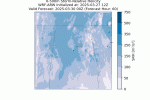
Well, you have open invitation to Monroe County, MS. I'm sure, like with this upcoming threat, we'll be in the bullseye for that one.Also am quite bummed that I won’t get to chase this weekend. I’ve got an open water tournament to attend so I won’t be able to chase this weekend.
However, the models continue to show a perhaps impressive outbreak around the 4th of April and if time allows, I may make the drive up to some of those states.
Navigation
Install the app
How to install the app on iOS
Follow along with the video below to see how to install our site as a web app on your home screen.
Note: This feature may not be available in some browsers.
More options
-
Welcome to TalkWeather! We see you lurking around TalkWeather! Take the extra step and join us today to view attachments, see less ads and maybe even join the discussion. CLICK TO JOIN TALKWEATHER -
Current Tropical Systems Melissa
You are using an out of date browser. It may not display this or other websites correctly.
You should upgrade or use an alternative browser.
You should upgrade or use an alternative browser.
Severe WX Severe threat 3/30-3/31
- Thread starter Bulkshear
- Start date
Would you trust the EURO at this range over the other globals and NAM?18z Euro is back to the 500 mb look that had me worried in my AFD Wednesday morning.
I'll say this. The Euro has been the most aggressive and consistent than the GFS regarding this weekend it seems.
- Moderator
- #344
The EURO, EURO AI, Japanese, China, Canadian, Icon were the fastest with the system Sunday, but trended slower towards the GFS, UK, and Australia models.
Probably. The NAM is usually horrible past 48 hours.Would you trust the EURO at this range over the other globals and NAM?
Sky_I565
Member
wx_guy
Member
- Messages
- 1,237
- Reaction score
- 4,443
- Location
- United States
- HAM Callsign
- KO4ZGH
- Special Affiliations
- SKYWARN® Volunteer
- ARRL Member
So with the recent curiosity about the N AL area (and I know quite a few of you live in the area), I ran the 12z WRF-ARW model centered on Birmingham, AL and a grid of about 300 miles square. I also did high resolution, with a 2 km resolution. Here's some of the highlights:
The Composite Radar shows a couple of rounds of cells coming through. It actually wants to make the early morning Monday round semi-linear, which is interesting.

The SBCAPE isn't all that impressive during the times it aligns with the convection. This may be a big limiting factor, but the model could just be misaligning the arrival of the CAPE also, so we'll see.

So for most of the event, there's modest (but sufficient) levels of SRH in the 0-500m level (the level most important for tornadoes), but as the front comes through, there is a significant boost in low-level SRH in the Birmingham metro area that is concerning.

The Vertically Integrated Graupel is designed to show storm cores (possibly of supercells) that have increased lightning/hail potential. Isolated storm cores exhibit deep VIG and probably signify very strong storm cores.

This algorithm (an enhancement of the BRN) is designed to show Storm Mode. While initially favoring Disorganize/Pulse storms earlier on Sunday, as the event progresses, a strong tendency towards (potentially tornado-producing) discrete supercells occurs, with a narrow corridor of multicellular activity along the front boundary.

The latest creation of mine is the Tornado Risk Index. It gives a score from 0 to 10 of the overall Tornado Risk in an area. It factors in STP (fixed layer version), SCP, SRH, EBWD shear, the LCL, and CIN (if present), and is normalized to go from 0 to 10. STP has the most weight. In cases where conditions are conducive to significant tornadoes (STP > 2, SRH > 200, EBWD > 25, and LCL < 1000, simultaneously), a hatch is applied to the plot.
The Tornado Risk looks largest Monday morning, probably in the predawn hours, and is maximized near the Birmingham metro area with around a 7 out of 10 on the scale, and a hatch.

Hopefully this high-res 2k zoom in on the Alabama area is helpful/useful! I still think the situation favors a discrete cell situation, and tornadoes I'd like to believe would be isolated, but those that do form could be strong. Interesting setup, especially coming in the early AM hours.
The Composite Radar shows a couple of rounds of cells coming through. It actually wants to make the early morning Monday round semi-linear, which is interesting.

The SBCAPE isn't all that impressive during the times it aligns with the convection. This may be a big limiting factor, but the model could just be misaligning the arrival of the CAPE also, so we'll see.

So for most of the event, there's modest (but sufficient) levels of SRH in the 0-500m level (the level most important for tornadoes), but as the front comes through, there is a significant boost in low-level SRH in the Birmingham metro area that is concerning.

The Vertically Integrated Graupel is designed to show storm cores (possibly of supercells) that have increased lightning/hail potential. Isolated storm cores exhibit deep VIG and probably signify very strong storm cores.

This algorithm (an enhancement of the BRN) is designed to show Storm Mode. While initially favoring Disorganize/Pulse storms earlier on Sunday, as the event progresses, a strong tendency towards (potentially tornado-producing) discrete supercells occurs, with a narrow corridor of multicellular activity along the front boundary.

The latest creation of mine is the Tornado Risk Index. It gives a score from 0 to 10 of the overall Tornado Risk in an area. It factors in STP (fixed layer version), SCP, SRH, EBWD shear, the LCL, and CIN (if present), and is normalized to go from 0 to 10. STP has the most weight. In cases where conditions are conducive to significant tornadoes (STP > 2, SRH > 200, EBWD > 25, and LCL < 1000, simultaneously), a hatch is applied to the plot.
The Tornado Risk looks largest Monday morning, probably in the predawn hours, and is maximized near the Birmingham metro area with around a 7 out of 10 on the scale, and a hatch.

Hopefully this high-res 2k zoom in on the Alabama area is helpful/useful! I still think the situation favors a discrete cell situation, and tornadoes I'd like to believe would be isolated, but those that do form could be strong. Interesting setup, especially coming in the early AM hours.
- Thread starter
- #348
Bulkshear
Member
Wow. Strong long-track tornadoes possible . That took a full 180.Hang on to your butts….Strong wording on the day 3. I would fully expect this to go moderate at some point.
tennessee storm chaser
Member
- Messages
- 1,623
- Reaction score
- 3,058
- Location
- jackson tennessee
- Special Affiliations
- SKYWARN® Volunteer
That is a very large day 3. 30 percent risk I seen long time
tennessee storm chaser
Member
- Messages
- 1,623
- Reaction score
- 3,058
- Location
- jackson tennessee
- Special Affiliations
- SKYWARN® Volunteer
Actually used likely wording. Read it carefully . That caught my attentionWow. Strong long-track tornadoes possible . That took a full 180.
Probably will be dragged southeast some in the coming days.Hang on to your butts….Strong wording on the day 3. I would fully expect this to go moderate at some point.
AJS
Member
Holy excrement at those models for next week.
We’re going to have a couple of days of wild weather it seems.
We’re going to have a couple of days of wild weather it seems.
cg9450
Member
Let’s get this thread ready for 1,000 pages.
CheeselandSkies
Member
It's really annoying how the NAM keeps flip-flopping on the northern extent of the threat in Illinois and also the timing. Current 06Z run is too fast and too far south for a good chase opportunity for me. Previous (00Z) run had looked better.
CheeselandSkies
Member
Let’s get this thread ready for 1,000 pages.
This only covers Saturday-Sunday's event and we're only at 18, so I don't think this one's going to make it.
AJS
Member
I will say, that is some pretty strong wording on the SPCs outlook for Sunday. I do believe a moderate risk may be issued in the coming day or two.
OhOkayThen
Member
tennessee storm chaser
Member
- Messages
- 1,623
- Reaction score
- 3,058
- Location
- jackson tennessee
- Special Affiliations
- SKYWARN® Volunteer
Someone direct me to the April 2. / 3 system. Can’t find it some reason on my end lol


