• Welcome to TalkWeather!
    We see you lurking around TalkWeather! Take the extra step and join us today to view attachments, see less ads and maybe even join the discussion.
    CLICK TO JOIN TALKWEATHER
  • April 2024 Weather Video of the Month
    Post your nominations now!

Severe WX Severe Threat 17-18 March 2021

MattW

Member
Messages
325
Reaction score
228
Location
Decatur, GA
HAM Callsign
KG4GUF
Special Affiliations
  1. SKYWARN® Volunteer
Uh so this is what the NAM is saying for 10 miles NE of Tuscaloosa at 01:00 CDT Thursday morning...
 

Attachments

  • nam_2021031506_069_33.31--87.42.png
    nam_2021031506_069_33.31--87.42.png
    236.2 KB · Views: 0

Equus

Member
Messages
3,346
Reaction score
3,532
Location
Jasper, AL
Special Affiliations
  1. SKYWARN® Volunteer
And there's our uptrend after the three-day-out downtrend. Buckets of yikes. Gonna be paying very close attention to this one.
 
Messages
2,914
Reaction score
4,841
Location
Madison, WI
Uh so this is what the NAM is saying for 10 miles NE of Tuscaloosa at 01:00 CDT Thursday morning...

...and that's not even close to the most impressive hodograph available on forecast soundings across the region.

* Also valid time of 03Z is 10:00 PM CDT.
 

warneagle

Member
Messages
4,021
Reaction score
3,999
Location
Arlington, VA
Special Affiliations
  1. SKYWARN® Volunteer
The most impressive hodographs I've seen are over central Alabama in the 10 pm to 1 am timeframe, which is not great! Even if the NAM is overcooking the instability (the GFS is in the 650-750 J/kg range while the NAM is double that in some places) there would be sigtor potential well into the overnight hours.
 

Clancy

Member
Messages
3,162
Reaction score
5,942
Location
Macland, Georgia
The most impressive hodographs I've seen are over central Alabama in the 10 pm to 1 am timeframe, which is not great! Even if the NAM is overcooking the instability there would be sigtor potential well into the overnight hours.
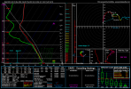
SPC's D3 discussion also suggests tornado threat would definitely persist past dusk.
1615817775233.png
 

Fred Gossage

Member
PerryW Project Supporter
Meteorologist
Messages
730
Reaction score
3,193
Location
Florence, AL
The most impressive hodographs I've seen are over central Alabama in the 10 pm to 1 am timeframe, which is not great! Even if the NAM is overcooking the instability (the GFS is in the 650-750 J/kg range while the NAM is double that in some places) there would be sigtor potential well into the overnight hours.
The GFS is decoupling the boundary layer, magically, at sunset. It's done this since before it was called the GFS. We have mid/upper 60 dewpoints, skies will be mostly cloudy or becoming overcast by then, and strengthening boundary layer winds. It goes against this planet's physics to do that.
 

Equus

Member
Messages
3,346
Reaction score
3,532
Location
Jasper, AL
Special Affiliations
  1. SKYWARN® Volunteer
The HRW CAMs will come into range later today, will be interesting to see.
 

KevinH

Member
Messages
1,888
Reaction score
3,069
Location
West Central GA
The SPC put the D3 MOD risk JUST outside of the west of me, in Columbus, GA. I know not to get too caught up in the categories, but I am hoping things to not trend worse for West Central GA.

Thoughts anyone?
 

Fred Gossage

Member
PerryW Project Supporter
Meteorologist
Messages
730
Reaction score
3,193
Location
Florence, AL
The SPC put the D3 MOD risk JUST outside of the west of me, in Columbus, GA. I know not to get too caught up in the categories, but I am hoping things to not trend worse for West Central GA.

Thoughts anyone?
Not correcting to be a jerk, but to make sure you know it's not currently higher than what it is... but *ENH.

You need to be vigilantly watching this one. The low-level winds overnight are still trending stronger, and the magnitude of this whole ordeal is still in flux (but while in flux, not backing off). I still think the worst is west/northwest of you, but you need to be vigilant.
 

KevinH

Member
Messages
1,888
Reaction score
3,069
Location
West Central GA
Not correcting to be a jerk, but to make sure you know it's not currently higher than what it is... but *ENH.

You need to be vigilantly watching this one. The low-level winds overnight are still trending stronger, and the magnitude of this whole ordeal is still in flux (but while in flux, not backing off). I still think the worst is west/northwest of you, but you need to be vigilant.
Oops! Yes, EHN sorry.

Hopefully things STAY at the ENH level, but even ENH is still something to watch.... CLOSELY.

And I will be up all night Wednesday watching this with my Wx radios charged, RadarScope on my phone, Twitter on my iPad, and my laptop on several weather pages (including IEMBot).

Thanks again Fred!
 

Richardjacks

Member
Meteorologist
Messages
1,161
Reaction score
1,331
Location
Atop Red Mountain Birmingham, Al
There are many reasons to be concerned but the one thing that stands out to me besides the instability is the shear, more importantly the low level turning and how the low level winds are backed over a large space, and the amount of time they are backed...all under very strong low level jet. Those soundings are very impressive.
 

Fred Gossage

Member
PerryW Project Supporter
Meteorologist
Messages
730
Reaction score
3,193
Location
Florence, AL
There are many reasons to be concerned but the one thing that stands out to me besides the instability is the shear, more importantly the low level turning and how the low level winds are backed over a large space, and the amount of time they are backed. Those soundings are very impressive.
Without worry of advecting in a more stable air mass while being as backed as they are.
 

warneagle

Member
Messages
4,021
Reaction score
3,999
Location
Arlington, VA
Special Affiliations
  1. SKYWARN® Volunteer
I've noticed that 05/04/03 is popping up as an analog on a lot of the NAM soundings...
 
Top