
Navigation
Install the app
How to install the app on iOS
Follow along with the video below to see how to install our site as a web app on your home screen.
Note: This feature may not be available in some browsers.
More options
-
Welcome to TalkWeather! We see you lurking around TalkWeather! Take the extra step and join us today to view attachments, see less ads and maybe even join the discussion. CLICK TO JOIN TALKWEATHER
You are using an out of date browser. It may not display this or other websites correctly.
You should upgrade or use an alternative browser.
You should upgrade or use an alternative browser.
Severe Thread: 5/13-17
- Thread starter DetectiveWX
- Start date
MMWX
Member
- Messages
- 751
- Reaction score
- 2,465
- Location
- Mississippi State University
- Special Affiliations
- SKYWARN® Volunteer
Is there any consensus on where the main risk is yet? The SPC has south MS/LA in the D3, someone else mentioned (might have been you) to watch out for the TN valley, and now we have 45 contours over North-Central MS. This isn't me being critical, it's a genuine question: Is it really that hard to get an accurate idea of where the main threat will be 3 days in advance? Those are three pretty different areas.Not a 45 contour showing up across North-Central MS on Friday.
Well, the biggest issue is MCS potential across the Gulf Coast region that is a question as to how fast it moves out, which in turn, would lead to a greater severe potential for areas this far north. That's why SPC hasn't drawn a bigger Level 2 risk yet. You have plenty of shear and instability to work with. It's just that pesky MCS potential is the biggest question mark at this time. SPC, NWS Jackson, Birmingham, and Huntsville all mention severe weather potentialIs there any consensus on where the main risk is yet? The SPC has south MS/LA in the D3, someone else mentioned (might have been you) to watch out for the TN valley, and now we have 45 contours over North-Central MS. This isn't me being critical, it's a genuine question: Is it really that hard to get an accurate idea of where the main threat will be 3 days in advance? Those are three pretty different areas.
The wind profiles are just yikes. Randomly picked sounding off the 00Z NAM in west GA. Models still disagreeing on a quite a few details, but a lot of the large-scale things are there. HRRR is perhaps most bearish with convection down south choking off instability. Hoping that's what verifies, because if not, could be a potent setup for the Southeast Friday.

KevinH
Member
aaaaaaand now the thread has my attention lolNo bueno if this type of solution verifies for the Deep South. Sounding from western ATL metro.
View attachment 27159View attachment 27160
KevinH
Member
West GA? Not me typing in those coordinates lolThe wind profiles are just yikes. Randomly picked sounding off the 00Z NAM in west GA. Models still disagreeing on a quite a few details, but a lot of the large-scale things are there. HRRR is perhaps most bearish with convection down south choking off instability. Hoping that's what verifies, because if not, could be a potent setup for the Southeast Friday.
View attachment 27163
UPDATE: If I input those coordinates right, that is in Buchanan, GA, directly west of Atlanta.. and north of me.
I guess it’s time to turn on notifications for this thread.
Yeah that should be about right. NAM had PDS soundings all across W GA and E AL.West GA? Not me typing in those coordinates lol
UPDATE: If I input those coordinates right, that is in Buchanan, GA, directly west of Atlanta.. and north of me.
I guess it’s time to turn on notifications for this thread.
KevinH
Member
Something to watch … even though the SPC hasn’t “pulled any triggers”Yeah that should be about right. NAM had PDS soundings all across W GA and E AL.
Lots of questions regarding Friday and Saturday, mostly revolving around convective evolution. 2 solutions offered by CAMs, 1) coastal MCS cuts off convection up north, as suggested by WRF-NSSL and HRRR, and 2) lack of coastal activity allows for discrete development in a highly sheared warm sector, as modelled by NAM and WRF-ARW. Also possible threat again on Saturday, but that would depend heavily on how Friday pans out. Wind fields also a lot more unidirectional by that time. Will have to wait and see.
KevinH
Member
So in other words…????Lots of questions regarding Friday and Saturday, mostly revolving around convective evolution. 2 solutions offered by CAMs, 1) coastal MCS cuts off convection up north, as suggested by WRF-NSSL and HRRR, and 2) lack of coastal activity allows for discrete development in a highly sheared warm sector, as modelled by NAM and WRF-ARW. Also possible threat again on Saturday, but that would depend heavily on how Friday pans out. Wind fields also a lot more unidirectional by that time. Will have to wait and see.
Well, as of 12Z most of the CAMs have come in with the solution that I reckon is most likely to verify. Heavy rain will blanket most of northern AL and GA Friday afternoon, which spares the northern halves of both states from severe weather. However, areas south of there (Columbus included, sounding from nearby) would still be under threat thanks to strong instability and fairly favorable wind fields. Modelling also shows a potential 2nd threat on Saturday for the central and northern portions of MS/AL/GA, but at that point it'd be mostly a lower-end wind and hail threat. Of course, by this evening models will probably look completely different, but it aligns with how setups like these often pan out.So in other words…????


KevinH
Member
D2 in a couple hours may be interesting.Well, as of 12Z most of the CAMs have come in with the solution that I reckon is most likely to verify. Heavy rain will blanket most of northern AL and GA Friday afternoon, which spares the northern halves of both states from severe weather. However, areas south of there (Columbus included, sounding from nearby) would still be under threat thanks to strong instability and fairly favorable wind fields. Modelling also shows a potential 2nd threat on Saturday for the central and northern portions of MS/AL/GA, but at that point it'd be mostly a lower-end wind and hail threat. Of course, by this evening models will probably look completely different, but it aligns with how setups like these often pan out.
View attachment 27164View attachment 27165
View attachment 27166
KevinH
Member
Nothing to write home about for now but….
Day 2 really shrunk from what I had expected. That MCS potential is the biggest question mark for the severe weather risk for northern zones of the Southeast
warneagle
Member
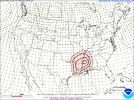
Potentially a major flash flooding event setting up across TX/LA. WPC issued a high risk.
warneagle
Member
Yeah that morning MCS is just gonna work the environment over, you’re not gonna get enough recovery outside of the immediate Gulf Coast for an appreciable severe threat.Day 2 really shrunk from what I had expected. That MCS potential is the biggest question mark for the severe weather risk for northern zones of the Southeast
This is why we don't trust the NAM beyond 36-48 hours (if at all), everyone.Yeah that morning MCS is just gonna work the environment over, you’re not gonna get enough recovery outside of the immediate Gulf Coast for an appreciable severe threat.
KevinH
Member
Can we ever trust the NAM though?!This is why we don't trust the NAM beyond 36-48 hours (if at all), everyone.
Jk jk
")
atrainguy
Member
Kolle
Member
90-100mph gusts entering downtown Houston.
