
So question about Tallahassee power outage. Was it mainly caused from the tornado or a combination of both straight line winds/tornado?
Navigation
Install the app
How to install the app on iOS
Follow along with the video below to see how to install our site as a web app on your home screen.
Note: This feature may not be available in some browsers.
More options
-
Welcome to TalkWeather! We see you lurking around TalkWeather! Take the extra step and join us today to view attachments, see less ads and maybe even join the discussion. CLICK TO JOIN TALKWEATHER
You are using an out of date browser. It may not display this or other websites correctly.
You should upgrade or use an alternative browser.
You should upgrade or use an alternative browser.
Severe Thread: 5/13-17
- Thread starter DetectiveWX
- Start date
wx_guy
Member
- Messages
- 1,237
- Reaction score
- 4,443
- Location
- United States
- HAM Callsign
- KO4ZGH
- Special Affiliations
- SKYWARN® Volunteer
- ARRL Member
Both. There were 2 EF-2 Tornadoes that hit the city simultaneously, also coinciding with straight-line winds the NWS says were "at least 100 mph".So question about Tallahassee power outage. Was it mainly caused from the tornado or a combination of both straight line winds/tornado?
Dang!!!!Both. There were 2 EF-2 Tornadoes that hit the city simultaneously, also coinciding with straight-line winds the NWS says were "at least 100 mph".
wx_guy
Member
- Messages
- 1,237
- Reaction score
- 4,443
- Location
- United States
- HAM Callsign
- KO4ZGH
- Special Affiliations
- SKYWARN® Volunteer
- ARRL Member
The 18z HRRR and NAM both shows favorable conditions for waves of severe weather across the FL Panhandle/Big Bend through sometime Wednesday. So there could be waves and scattered strong storms for quite a while. Super fun.
Going to be significant damage in Lake Charles. They just got raked by multiple tornadoes (including one going right through downtown) and destructive straight line winds associated with an embedded mesovortex.
wx_guy
Member
- Messages
- 1,237
- Reaction score
- 4,443
- Location
- United States
- HAM Callsign
- KO4ZGH
- Special Affiliations
- SKYWARN® Volunteer
- ARRL Member
Sounds like a running theme the past few days...yuck!Going to be significant damage in Lake Charles. They just got raked by multiple tornadoes (including one going right through downtown) and destructive straight line winds associated with an embedded mesovortex.
Looked like a near repeat of Tallahassee last week…which ended up with tornado #1 two blocks south of my daughter’s place.Going to be significant damage in Lake Charles. They just got raked by multiple tornadoes (including one going right through downtown) and destructive straight line winds associated with an embedded mesovortex.
CheeselandSkies
Member
Going to be significant damage in Lake Charles. They just got raked by multiple tornadoes (including one going right through downtown) and destructive straight line winds associated with an embedded mesovortex.
I've seen storms get a TORR for less...
Attachments
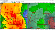
Yeah. I was curious as to why it wasn't at least a reported tornado warned storm, but I'm not NWS.I've seen storms get a TORR for less...
TH2002
Member
- Messages
- 4,974
- Reaction score
- 11,116
- Location
- California, United States
- Special Affiliations
- SKYWARN® Volunteer
You are a meteorologist though, aren't you? Therefore, your input is valid unlike that "NWS FORECASTS R GARBAG" guy.Yeah. I was curious as to why it wasn't at least a reported tornado warned storm, but I'm not NWS.
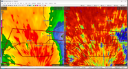
I am. That storm did have a tight rotation couplet when it was nearing the radar site. Though no debris couplet or signature from what I could tell.You are a meteorologist though, aren't you? Therefore, your input is valid unlike that "NWS FORECASTS R GARBAG" guy.
And I do appreciate that.
wx_guy
Member
- Messages
- 1,237
- Reaction score
- 4,443
- Location
- United States
- HAM Callsign
- KO4ZGH
- Special Affiliations
- SKYWARN® Volunteer
- ARRL Member
The cell(s) that develops around midnight off the cost of Louisiana, according to the last several runs of the HRRR, grows into a strong bowing segment that crosses the Big Bend in the early Tuesday morning hours (between 5 AM and 7 AM). The key will be how far north it develops, assuming it does.

SmokeEater
Member
Baton Rouge now warned to 80mph.
So not directly related to the storm system in the SE, but today was quite a bust up in SE Idaho by the SPC. Not even a marginal outlook on any of the day 1 outlooks, and there’s over a dozen wind reports including one of 80MPH. There’s been warnings as a line/cluster marched east across the state.
Severe threat bullseyed on southern GA tomorrow afternoon-early evening. At least some severe threat for most of AL, GA and northern half of FL. Along the southern areas of the threat, biggest question will be how early-day convection interacts with later development. Across the northern extent, convective coverage remains somewhat uncertain. Regardless, another weird setup for the South that could pan out 1,000 different ways.


jiharris0220
Member
We have a state named Idaho?So not directly related to the storm system in the SE, but today was quite a bust up in SE Idaho by the SPC. Not even a marginal outlook on any of the day 1 outlooks, and there’s over a dozen wind reports including one of 80MPH. There’s been warnings as a line/cluster marched east across the state.
atrainguy
Member
It must be a troll post, everyone knows Idaho doesn't exist (just like "wyoming").We have a state named Idaho?
TH2002
Member
- Messages
- 4,974
- Reaction score
- 11,116
- Location
- California, United States
- Special Affiliations
- SKYWARN® Volunteer
We do, allegedly. El Dorado also exists, but instead of being made of gold, all I saw there were tornadoes, wheat fields and a sign pointing to Wichita.We have a state named Idaho?
wx_guy
Member
- Messages
- 1,237
- Reaction score
- 4,443
- Location
- United States
- HAM Callsign
- KO4ZGH
- Special Affiliations
- SKYWARN® Volunteer
- ARRL Member
The latest HazCast (another will run overnight) gives VERY high severe wind probabilities across the areas Clancy mentioned. Tornado and hail threats are extant as well, but much lower.

Lower-end severe threat persists on modelling, which continues to stick with a bimodal distribution - MCS activity along the coast and possible activity across the northern halves of AL/GA. Cloud cover may limit threats further north, where hail and damaging winds are the main concern.

From FFC's AFD
From FFC's AFD
An upper level trough moving at a snails pace through the Tennessee
Valley will be the primary player in our weather over the next 36
hours. Southerly flow ahead of the trough will continue to advect
moisture northward, allowing low clouds, haze and light rain showers
to continue in the region this morning. Later this afternoon it will
draw a warm front northward into central Georgia. This front should
serve as a focal point for thunderstorms between 4 PM and 10 PM.
Though additional elevated thunderstorms may form north of the warm
front in northern Georgia. Diurnal heating and rising surface
dewpoints (peaking near 70 degrees) behind the warm front should
allow SBCAPE values to peak in the 1000 to 2000 J/kg range this
afternoon. This instability should be coupled with adequate shear
values (0 to 6 km values between 25 and 40 kt) for isolated
supercell development near the warm front. Note the mean STP values
in the 1 to 3 range in the 00Z HREF guidance. Mid level lapse rates
have also improved in the CAM guidance compared to what was
projected yesterday (mean values are now in the 6.0 to 7.0 C/km
range). Given these considerations today`s Marginal Risk (Level 1 of
5) appears to be a higher end Marginal. This is especially true
along a line from Columbus to Macon to Augusta, where proximity to
the warm front will elevate the severe potential. Along this line
damaging winds are the main concern, but large hail or a brief
tornado are possible. Further north the elevated nature of the
storms should lead to a lower potential for damaging winds or hail.