• Welcome to TalkWeather!
    We see you lurking around TalkWeather! Take the extra step and join us today to view attachments, see less ads and maybe even join the discussion.
    CLICK TO JOIN TALKWEATHER

'Ruskin Heights' tornado (1957)

There’s no doubt in my mind that the parent storm was a classic supercell for most of the tornado’s life. All the pictures of it show a clearly visible funnel (of varying size) and some, especially the ones from the Ottawa Airport, show that very well developed, sculpted wall cloud and inflow tail reminiscent of the Cordova tornado as others have mentioned.


This was a very powerful trough for late May, perhaps one of the strongest documented in the climatology. There were several other strong tornadoes this day, including a massive, long-tracked wedge near Concordia, KS that was rated F4, but was probably F5. The same system produced another significant tornado event the next day over the Northern Ozarks and Mid MS Valley, where Fremont, MO was devastated by an F4.

1600612867165.jpeg
 
Last edited:
I was going to wait for the anniversary, but this might help @locomusic01 with his article on this outbreak.
Awesome, thanks! I had copies of most of these but the scans were so bad I just put them in my junk folder lol.

The Davis family's story is so sad. I talked to a woman who was there immediately after the tornado as a young kid and she described hearing someone yelling something along the lines of "Help me, I'm in the water!" over and over. Turned out it was Isam Davis, who'd landed at the edge of a small pond and was clinging to life, but he died before he could be transported to the hospital. The rest of the family was scattered across the field hundreds of yards apart.

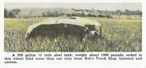
The vehicle damage around Spring Hill (and everywhere else tbh) was pretty wild.

b6VWVgk.jpeg


tuuN9vI.jpeg
 
I also wonder if this funnel was the actual Ruskin Heights tornado or one of the 1-2 funnel clouds seen around the main tornado in the Hickman Mills, Martin City, Ruskin Heights area. The damage path's width in those areas doesn't match this tornado's narrow width.

The_Los_Angeles_Times_Tue__May_21__1957_.jpg


I wonder if the Ruskin Heights tornado is the dark area on the far left of the photo. You know, before people knew about wedge tornadoes, they might not have known what they were looking at, and just quickly got a pic of what was a more stereotypical-looking funnel. Not sure.
 
I also wonder if this funnel was the actual Ruskin Heights tornado or one of the 1-2 funnel clouds seen around the main tornado in the Hickman Mills, Martin City, Ruskin Heights area. The damage path's width in those areas doesn't match this tornado's narrow width.

View attachment 41437


I wonder if the Ruskin Heights tornado is the dark area on the far left of the photo. You know, before people knew about wedge tornadoes, they might not have known what they were looking at, and just quickly got a pic of what was a more stereotypical-looking funnel. Not sure.
It was taken near State Line Rd & 130th St (now Blue Ridge Blvd) right around the time the tornado crossed into Missouri, which is one of a few areas where the path briefly narrowed to 200-300 yards. The newspaper print also makes the funnel look smaller than in the original photo:

0Uphybg.jpeg


There were definitely a lot of reports of people seeing multiple funnels in that area though (and at various points throughout the path), including possibly multiple tornadoes on the ground. Some survivors also talked about a second intense burst of wind + audible roar following shortly after the main tornado, but it's tough to reconstruct exactly what happened.
 
It was taken near State Line Rd & 130th St (now Blue Ridge Blvd) right around the time the tornado crossed into Missouri, which is one of a few areas where the path briefly narrowed to 200-300 yards. The newspaper print also makes the funnel look smaller than in the original photo:

There were definitely a lot of reports of people seeing multiple funnels in that area though (and at various points throughout the path), including possibly multiple tornadoes on the ground. Some survivors also talked about a second intense burst of wind + audible roar following shortly after the main tornado, but it's tough to reconstruct exactly what happened.

The OP posted another photograph taken from a built up area that shows a narrow funnel as well. It does seem to contradict other descriptions of the tornado, and it somewhat surprises me that most of the photographs we do have are from rural areas.

There was a manager of a car dealership at the then corner of 117th street and highway 71 who claims to have actually been inside a calm centre of the tornado. Like most such stories, it somewhat stretches credulity.
 
Much like Amber-Bridge Creek-Moore 1999, this tornado took various shapes and sizes during its 70+ mile track. It is disappointing that we don't have more photos of it in the Kansas City area, but I know people were probably trying to save their lives rather than grab a camera.

It could have taken on an appearance similar to Pampa, TX, 1995, during the Hickman Mills-Ruskin Heights track: narrow funnel but wide debris field. It looks very much like that tornado southwest of Ottawa, Kansas.
From eyewitness accounts, it does seem to have been quite a shapeshifter, and a lot of people describe it rapidly growing and shrinking in size visually. The width of the damage path also seems to reflect that in some places, although I'm still working on refining that. I've also mapped out the locations where all the tornado photos I have were taken (going back through this thread I see you did something similar); I gotta run now but I'll post it later.

I've also been told by several people that there are photos of the tornado taken in and around Ruskin itself, but if there are and they still exist, I have a feeling the only way to dig them up will be in person. I'm hoping one or more of the people I've made contact with there will be willing to help since a 1,200 mile drive isn't really feasible right now lol
 
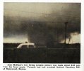
Okay, so locations of the photos I currently have - starting with Jack McClure's shot from just northeast of Homewood.

ySDomMp.jpeg


This was taken from his porch (purple camera icon on the map, obviously), I believe facing generally NW or WNW-ish. The tornado was expanding steadily at this point and was a little over a third of a mile wide, remaining fairly steady as it passed south of Ottawa..

OwTekrs.png


..which is where the next series of photos was taken by Chuck LeMaster at Ottawa Municipal Airport:

H6D7oAD.png


uXGx3La.jpeg


n2Z894R.png


The view is roughly due north from this location and the tornado was starting to contract fairly quickly, going from ~0.4 mile (750 yards) to 300-400 yards around the time it claimed its first victims. It actually continued to shrink from there and may or may not have briefly cycled just to the NE (still working on that):

lvBSLPe.png


Next shot was by O.D. Garrett taken from his yard looking NW just below Hwy 68 about 7.75 miles E of Ottawa. If it was indeed one continuous tornado, it was basically at its narrowest point right around here:

hK72qDX.jpeg


Photo location:

5evC3i6.png


Next is the famous shot in Spring Hill taken by Rev. Robert Alexander from the parsonage of the Spring Hill United Methodist Church; the path here was generally about half a mile wide, though it was gradually narrowing as it went through town.

uQVs00J.jpeg


Location:

v1CaQVX.png
 
Next is William Straeter's photo looking S or SSE from near Blue Ridge Blvd & State Line Rd right along the KS/MO border:

87PjfTa.jpeg


The path narrowed pretty rapidly here from a little over a third of a mile to 250-300 yards around the time the photo was taken:

VWweSJZ.png


Poor quality shot taken by Lawrence Henson from his home at 12525 Grandview Rd:

WTE2OGz.jpeg


This is roughly halfway between Martin City and Hickman Mills and Henson was facing basically due W, so he likely got the shot just before the tornado started rapidly expanding and intensifying again (not that it had lost much strength anyway):

utr5DoU.png


Last one was labeled as being taken from the neighborhood of Gregory Heights in Raytown, but that doesn't seem to match up. I'm assuming it was in that general area but further SE. Haven't looked much into this one yet tbh.

WNUeKJc.jpeg


SaYydNF.png
 
Back
Top