• Welcome to TalkWeather!
    We see you lurking around TalkWeather! Take the extra step and join us today to view attachments, see less ads and maybe even join the discussion.
    CLICK TO JOIN TALKWEATHER

Potential Tropical Cyclone Nine and Hurricane Humberto

View attachment 46634


Gabrielle still an intense hurricane, and now CODE RED on the two areas moving into the western Atlantic! 1) I wonder how close the western one will get to CONUS and 2) I wonder if they're close enough for Fujiwara action!
AAAAH! The models ARE honing in on Fujiwara action! I just looked for the first time in days, and I'm excited! This could be a very rare Fujiwara interaction actually near land. That greatly complicates path forecast.

EDIT: Please someone post some of these model runs. I'm too excited too, but I'll just say they look BEAUTIFUL! Hurricanes spiraling around each other right off the East Coast.
 
Gabrielle still an intense hurricane, and now CODE RED on the two areas moving into the western Atlantic! 1) I wonder how close the western one will get to CONUS and 2) I wonder if they're close enough for Fujiwara action!
I have a few questions for anyone more knowledgeable about this:

1. Do the weaker storm(s) have a greater potential to be slingshotted in Fujiwhara situations? And, if so, doesn’t that make the storm to the east a very dangerous driver for the storm to the west, assuming it develops more quickly?

2. How well do models tend to do with Fujiwhara interactions? I feel like I’ve never seen it before, or, if I have, it’s always in voodoo land for the models.

3. Does a Fujiwhara interaction have any implications on the intensity of these storms?

4. Is a merger possible in Fujiwhara situations?

Sorry for the plethora of questions, but you simply don’t see this very often and this has completely piqued my interest.
I'm NOT a meteorologist, so take my answers with a grain of salt! @JPWX maybe you can weigh in?

When I've seen it happen, it's usually in the Pacific Ocean and the interactions can be extremely complex. That being said, I'm not sure about a slingshot effect, but it seems plausible.

Models have, in my limited experience, a HARD time with interactions like these because they have to get within a certain radius of each other before they start to dance around each other, and the interactions are dependent on the strengths of the storms, so since the path + intensity play into effect, it's really a wild Wild West for the models.

Yes, the interaction can drastically affect the intensity of these storms. Typically, the larger more powerful storm "eats" the smaller one after a half or full rotation around each other, but more complex outcomes are possible.

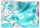
The GFS, Euro, Euro-AI, and others are all showing some interaction possible, and at hurricane strength for each of them look to be possible. Two hurricanes spinning around each other that close to the U.S. is 1) dangerous and 2) as far as I can recall, unprecedented. Like I said, most of the time, this happens in the open Pacific.
 
I have a few questions for anyone more knowledgeable about this:

1. Do the weaker storm(s) have a greater potential to be slingshotted in Fujiwhara situations? And, if so, doesn’t that make the storm to the east a very dangerous driver for the storm to the west, assuming it develops more quickly?

2. How well do models tend to do with Fujiwhara interactions? I feel like I’ve never seen it before, or, if I have, it’s always in voodoo land for the models.

3. Does a Fujiwhara interaction have any implications on the intensity of these storms?

4. Is a merger possible in Fujiwhara situations?

Sorry for the plethora of questions, but you simply don’t see this very often and this has completely piqued my interest.
The stronger storm can pull in the weaker storm, if both storms are similar in intensity, they can merge together into one powerful storm, or they can dance around each other until one decides to separate and move out.
 
Euro is getting too close for comfort. Say goodbye to more beach houses on the outer banks from erosion, at the least.
1758720453049.png
 
06Z ECMWF - the eastern storm absorbs the western storm earlier off the Florida coast and then keeps the eastern storm off the eastern seaboard as well. These are going to be hard to predict thanks to the Fujiwara - I expect we'll see the models put out a lot of different scenarios between now and next week as they try to get a handle on a very complex interaction. Hopefully these stay off the coast and it's just something for weather junkies like us to ooh and ahh over.

1758732579589.png
 
Last edited:
12zGFS never forms the eastern storm and fishes the western one, though it looks like a big tough fish.
 
Looks like we will realize Tropical Storm Humberto at 5 pm from Invest 93L

AL, 93, 2025092418, , BEST, 0, 198N, 545W, 35, 1008, LO, 34,
IMG_8100.jpeg
 
Looks like we will realize Tropical Storm Humberto at 5 pm from Invest 93L

AL, 93, 2025092418, , BEST, 0, 198N, 545W, 35, 1008, LO, 34,
View attachment 46642
Models also want Humberto to continue its hurricane streak:

Humberto was a Category 2 in 1995:
IMG_8101.jpeg

Humberto was a Category 2 in 2001:
IMG_8102.jpeg

Humberto was a Category 1 in 2007:
IMG_8103.jpeg
Humberto was a Category 1 in 2013:
IMG_8104.jpeg


Humberto’s most recent occurrence before 93L likely becomes Humberto was as a major hurricane for the first time after four previous seasons iterations failed to do so. Humberto 2019 became a Category 3:

IMG_8105.jpeg

It appears our so-to-be Humberto could also have major hurricane potential as well. If 93L (future Humberto) becomes a hurricane, Humberto’s hurricane streak will extend to six hurricanes in a row.
 

Attachments

  • IMG_8101.jpeg
    IMG_8101.jpeg
    894.1 KB · Views: 0
  • IMG_8102.jpeg
    IMG_8102.jpeg
    913.4 KB · Views: 0
Welcome to TalkWeather
well.
it happened i guess.
(also hi; first post.)
Yep, it happened. And Humberto is forecast to continue its hurricane streak.
 
94L doesn't look far behind. No shortage of convection, at least - not sure how much spin it's got.

View attachment 46654
A person on Storm2K said that the NWS radar in Puerto Rico showed some spin, and that they didn’t think that 94L was too far behind Humberto in getting a name (Next name is Imelda)
 
Here's my usual plug for using Mimic TPW for seeing expected tropical system formation. You can see both taking shape - Huberto being more well formed for now.

Welcome dessertdoom. I've been following hurricanes for about 30 years. I know a little and have a lot of web links to folks who know a whole lot.
Definitely starting to see 94L getting going with more moisture at the end of the loop.

I feel like it could be a sneaky system that will somehow find a backdoor to hit us, but it’s probably just me though.
 
Definitely starting to see 94L getting going with more moisture at the end of the loop.

I feel like it could be a sneaky system that will somehow find a backdoor to hit us, but it’s probably just me though.
I don't like that the interaction is going to be so complex and so close to land at the same time. This one has me spooked a bit, because fujiwaras are unpredictable. I'd prefer one absorbs the other pretty quickly.
 
12Z ECMWF is a trip. Humberto pulls future Imelda away from Florida, then Humberto gets ripped to bits by a high and Imelda strengthens and heads west to slam into NY a week later. Not kidding - bizarre stuff.
https://weather.cod.edu/forecast/ (ECMWF, then Atlantic Ocean)
 
I don't like that the interaction is going to be so complex and so close to land at the same time. This one has me spooked a bit, because fujiwaras are unpredictable. I'd prefer one absorbs the other pretty quickly.
It’s hard for the models to resolve such a thing. Heck, in my 5 years watching the basin I don’t think I’ve see such a complex fujiwara issue.
 
It’s hard for the models to resolve such a thing. Heck, in my 5 years watching the basin I don’t think I’ve see such a complex fujiwara issue.
I think the only fujiwara I’ve seen in the basin was between Philippe and Rina in 2023, and that was not too complicated of a setup, but it was still difficult to resolve.
 
Back
Top